Skip to content

Saturdaty Update: Front Range Forecast: Warm and windy again

In Brief:

Very warm and windy conditions return.

Saturday Update:

Very warm (70F today!) weather returns and the winds pick up again creating fire weather danger. We return to seasonable temperatures with low precipitation chances until we get to Thursday. The week-end storm looks fairly warm and not particularly wet, but I'll keep an eye on it here.  Go out and play - it is beautiful out there!

figure2u_03022024
Figure 1 update: the 10 day graphical forecast for Longmont from weatherunderground.com

End Saturday update.

The Forecast Discussion:

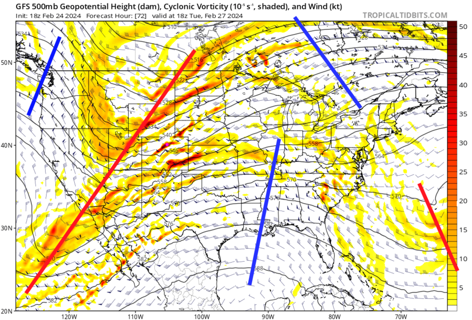
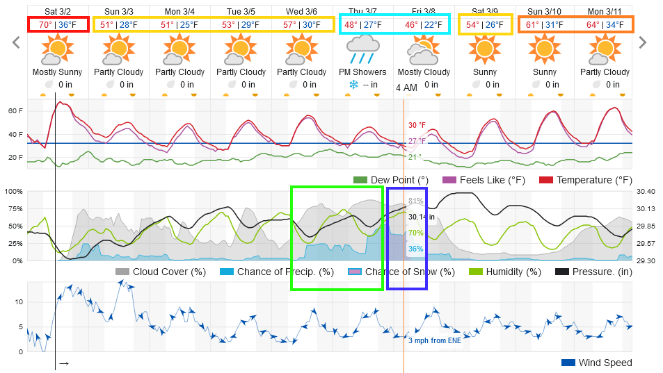
We have a few days of unusual warmth and wind creating red flag fire warning conditions (Figure 1).  A strong, but fast moving, cold front hits Monday night.  (See the Longer Range forecast below for more).

figure1_02242024
Figure 1: the 10 day graphical forecast for Longmont from weatherunderground.com

The Longer Range Forecast:

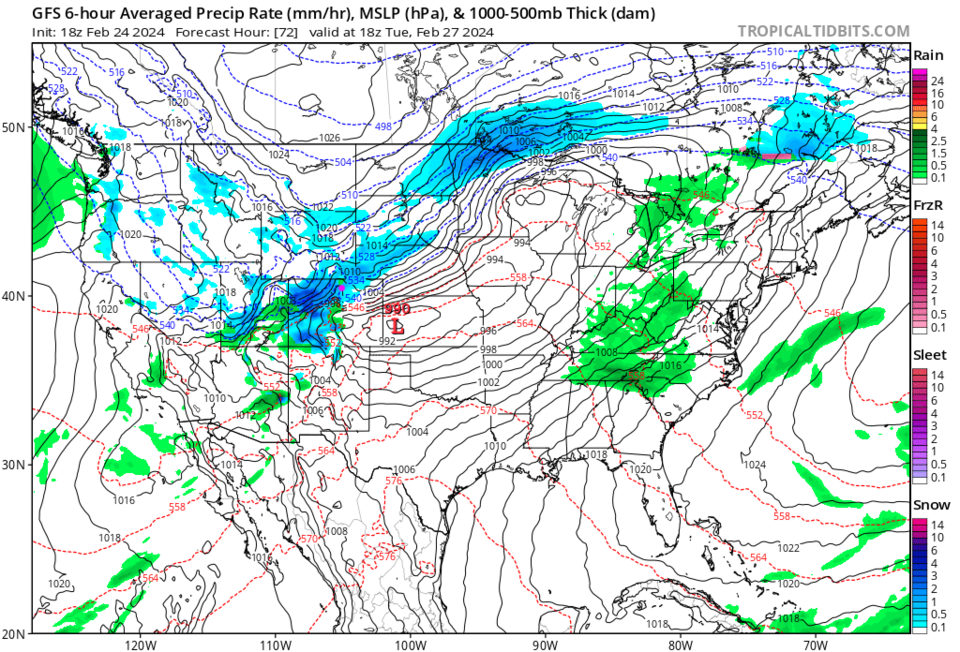
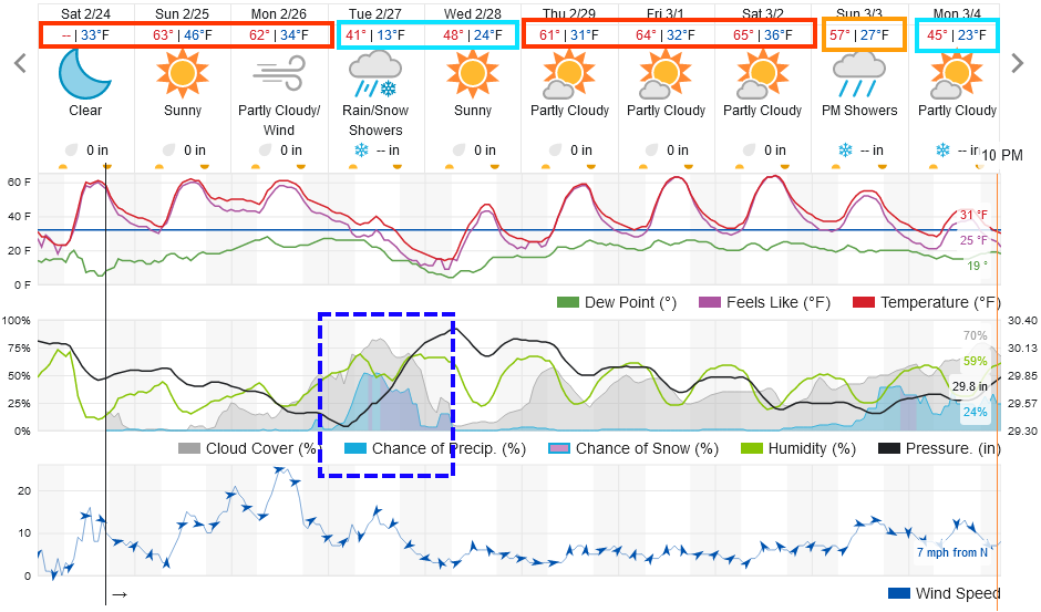
The approaching upper air trough stretches from Canada down into the Pacific (Figure 2).  If this could have arrived as a cut-off low (as the models showed a week ago) - we could have had significant state-wide snowfall.  But, it will move through rather quickly. The peak snowfall for the storm appears to center on lunchtime Tuesday (high sun angle will make sticking snow difficult to achieve - Figure 3).

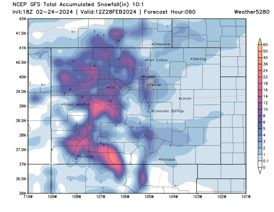
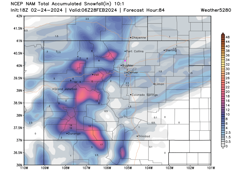
Currently, the GFS (Figure 4) gives Longmont 2-4 inches.  The NAM (Figure 5) gives us 1-3 inches with more quickly piling up closer to the mountains.

More later!

After that passes, it looks like we return to the 60's very quickly.


figure2_02242024
Figure 2: the 500mb upper air forecast map from the GFS and tropicaltidbits.com
figure3_02242024
Figure 3: the surface conditions forecast map from the GFS and tropicaltidbits.com
figure4_02242024
Figure 4: the 10:1 snowfall forecast from the GFS and weather5280.com through Wednesday.
figure5_02242024
Figure 5: the 10:1 snowfall forecast from the NAM and weather5280.com through Wednesday.


About the Author: John Ensworth

John Ensworth used to work from Longmont as the PI for the NASA through the IGES (The Institute for Global Environmental Strategies). He now teaches technology, algebra, astronomy, meteorology, film school, and Lego robotics to middle/high school.
Read more


Comments


Current Weather

Clear

Clear

51°F

UV Index
0 Low
Pressure
29.96 Rising
Visibility
8 miles
Dewpoint
34 °F
Humidity
51%
Wind
NW 2.7 mph
Gust
6.1 mph
Wind Chill
51 °F

Hourly Forecast

Today
6 AM
48°F
Mostly sunny
Today
7 AM
51°F
Mostly sunny
Today
8 AM
57°F
Mostly sunny
Today
9 AM
62°F
Mostly sunny
Today
10 AM
66°F
Mostly sunny
Today
11 AM
70°F
Mostly sunny
Today
12 PM
72°F
Mostly sunny
Today
1 PM
75°F
Mostly sunny
Today
2 PM
77°F
Mostly sunny
Today
3 PM
79°F
Mostly sunny
Today
4 PM
77°F
Mostly sunny
Today
5 PM
74°F
Partly sunny w/ t-storms

7 Day Forecast

Partly sunny w/ t-storms

Saturday

79 °F

Mostly sunny and not as warm, becoming breezy with a thunderstorm in spots this afternoon


Partly cloudy w/ t-storms

Saturday Night

49 °F

A thunderstorm in spots early this evening; otherwise, partly cloudy


Mostly sunny

Sunday

83 °F

Sunshine and patchy clouds; breezy in the afternoon


Mostly clear

Sunday Night

51 °F

Mainly clear


Intermittent clouds

Monday

70 °F

Cooler with times of sun and clouds; a thunderstorm in spots in the afternoon


Thunderstorms

Monday Night

46 °F

Cloudy; evening thundershowers followed by a couple of showers late


Mostly cloudy

Tuesday

60 °F

Mostly cloudy and cooler


Intermittent clouds

Tuesday Night

37 °F

Partly cloudy


Intermittent clouds

Wednesday

70 °F

Pleasant and warmer with intervals of clouds and sun


Mostly clear

Wednesday Night

40 °F

Mainly clear


Sunrise and Sunset

Sunrise
5:41 AM
Sunset
8:13 PM

Based on AccuWeather data