In Brief:
Abnormally warm dry weather with smoke increasing at times will continue through Monday followed by a slight cooling and small chances of rain.
Forecast Discussion:
The smoke is back. Most of what you see, and smell at times, is smoke from the West Coast (Figure 1 - black arrows).
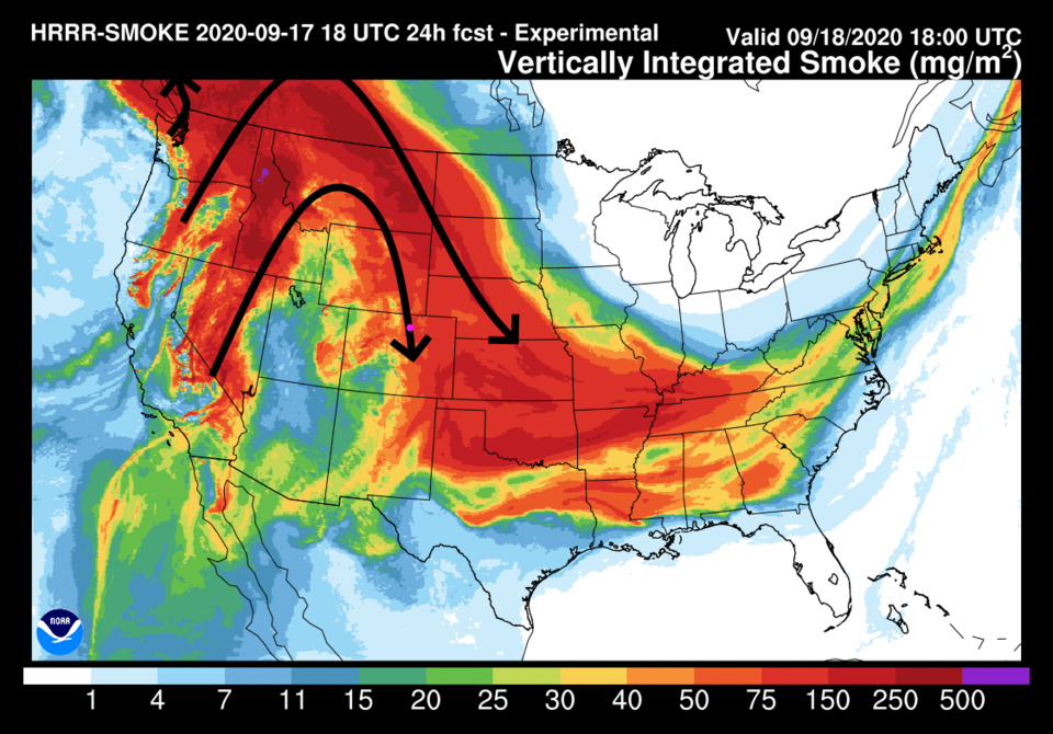 Figure 1: the HRRR smoke at all levels forecast map for noon Friday from NOAA.
Six hours after (Figure 2) the map in Figure 1, you can see the Colorado fires, like the highlighted Cameron Peak fire, are beginning to add to the overall smoke load in the atmosphere.
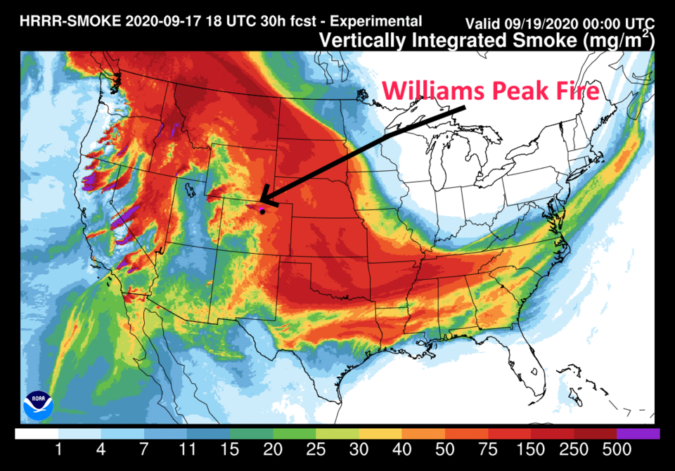 Figure 2: the HRRR smoke at all levels forecast map for Friday evening from NOAA.
The wind pattern, bringing in the smoke is the same pattern associated with the high-pressure ridge that has one circulation center off the U.S.-Mexico border and a new center forming around the Four Corners region (Figure 3). We are under the ridge again, which means above-normal temperatures are here to stay for a few days.
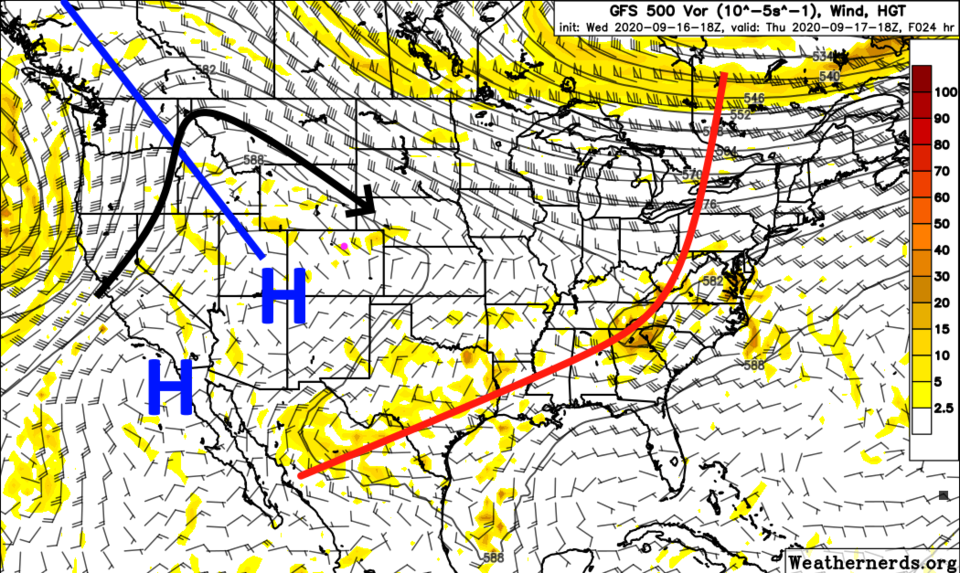 Figure 3: the 500mb forecast upper air map for Thursday noon from Weathernerds at www.weathernerds.org
We warm, with high temperatures rising each day to almost the 90-degree mark over the weekend into Monday with bone dry conditions (Figure 4).
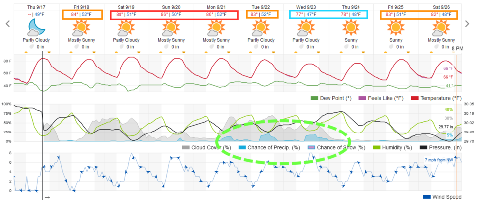 Figure 4: the 10 day graphical forecast for Longmont CO from weatherunderground.com
The longer-range forecast:
A cool-down begins Tuesday and 70-degree high temperatures are back midweek along with a small chance of showers (Figure 4 again).
The next trough is going to create an unusual weather pattern. It is over on the West Coast (colored blue, Figure 5). At first, the flow from the smoke-producing regions will be coming more directly into Colorado (black arrows).
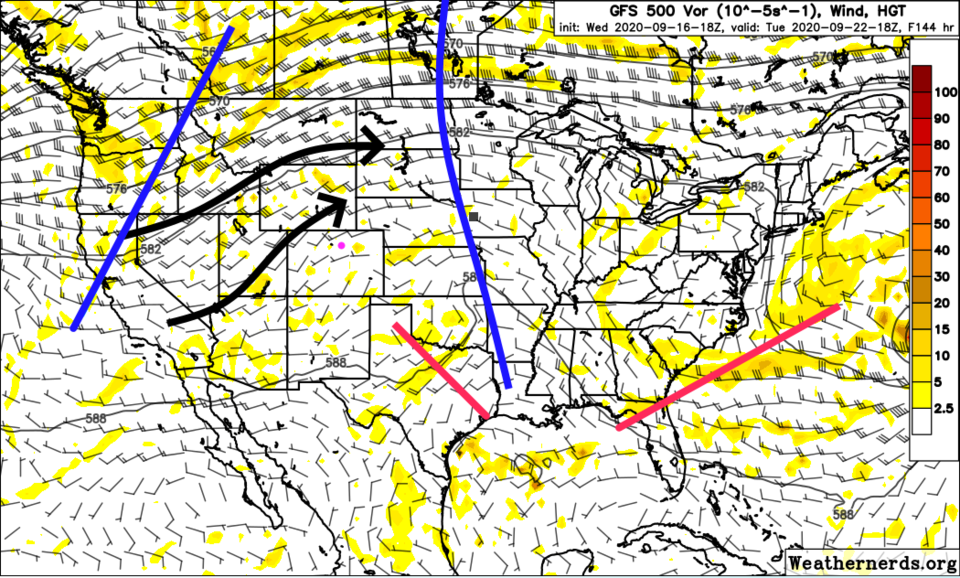 Figure 5: the 500mb forecast upper air map for Tuesday noon from Weathernerds at www.weathernerds.org
Then, with a highly twisted ridge stretching from North Dakota to Los Angeles, we'll see a low deepen to our south (Figure 6) bringing air in from the east (light blue arrow).
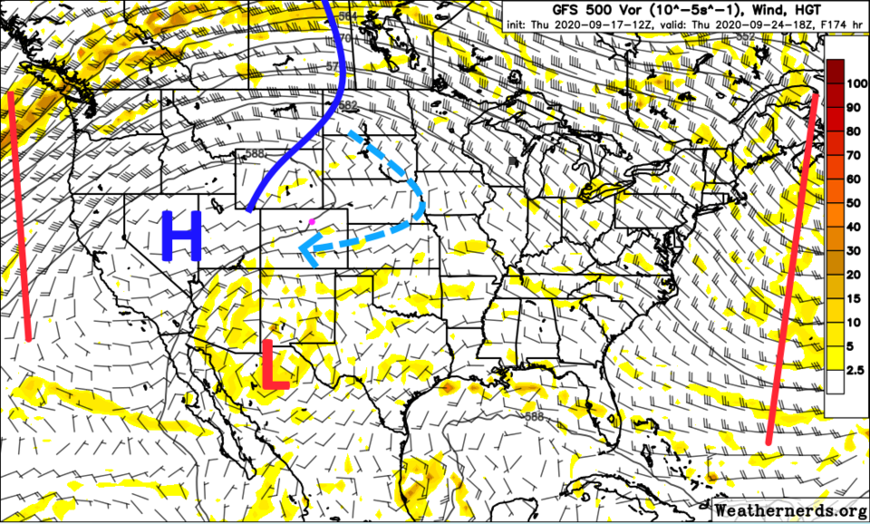 Figure 6: the 500mb forecast upper air map for NEXT Thursday noon from Weathernerds at www.weathernerds.org
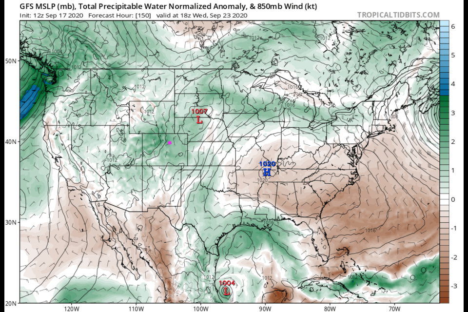
The precipitable water anomaly map (Figure 7) shows a fair amount of moisture returning with that cooling trough. Add upslope flow and we will have small rain chances return the middle of next week. It is trying to become fall.
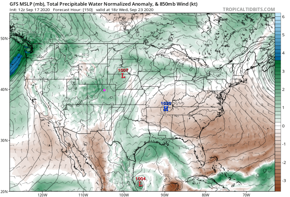 Figure 7: the precipitatable water anomaly for Wednesday noon from tropicaltidbit.com


