Skip to content

Next Storm/Next Snow Forecast Discussion from the Cherrywood Observatory – February 9, 2019

This content was originally published by the Longmont Observer and is licensed under a Creative Commons license.

Forecast Discussion:

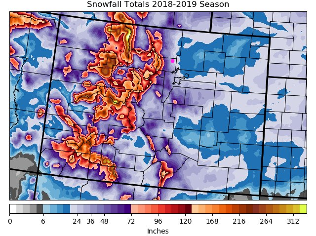
Before we look at our very small chance of snow Saturday night, let's look at the season snowfall to date (Figure 1). My home, in NE Longmont, has received 45.2 inches of snow since September (that is amazing to me too). That matches the purple shade for Longmont in this figure. Places in the mountains have received tremendous amounts of snow. Overall, the state is at 111% of normal as snow fall goes. Good news.

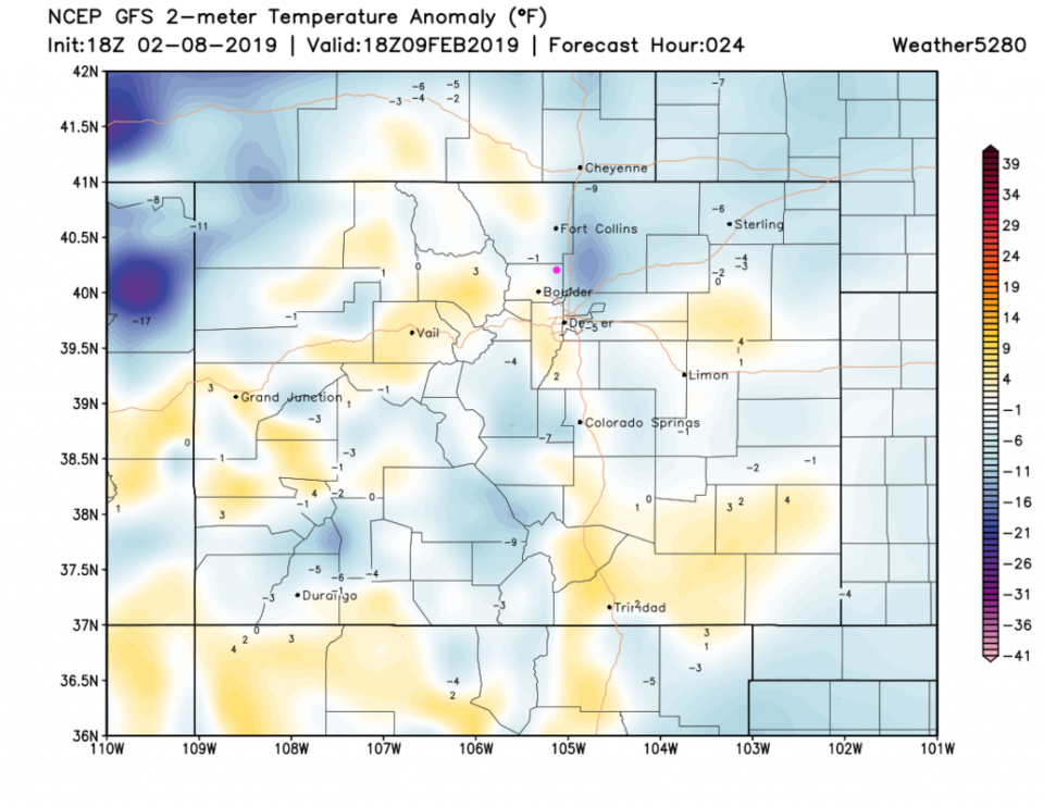
Today (Saturday) temperatures return to just somewhat below normal for the date - Figure 2 (about 48°F for today). The cool front passes around 3 pm.

The longer range forecast:

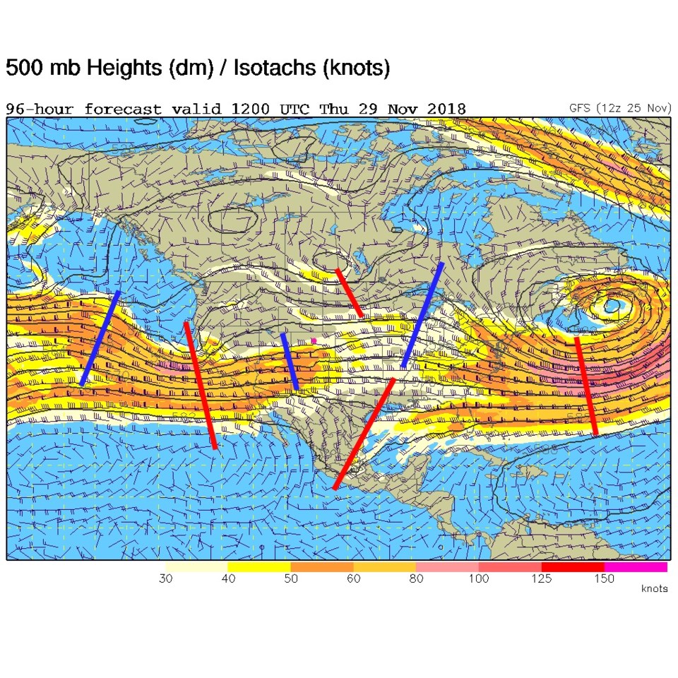
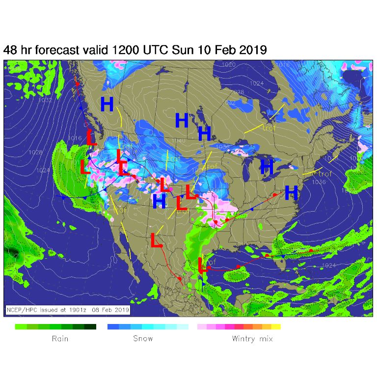
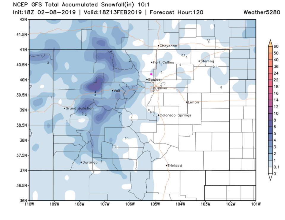
Figure 3 is the upper-air pattern for Sunday showing a trough passing and a deeper one approaching from the west. The problem is there is little moisture expected to be available to the system east of the Rockies. The mountains will keep getting shot after shot of new snow. The surface map for Sunday am (Figure 4) shows precipitation remaining over the western slopes and higher mountains and northern Colorado Rockies. We 'may' see some snow sneak off, but it won't be much. Figure 5 is the GFS take on snowfall over the next 5 days. We have a coating to 1 inch touching the eastern side of the town and just down the road in Boulder.

After this weekend, we bounce around in the 30's F and 40's F with our next chance of snow coming Thursday. More on that later!

Figure 1: Snowfall totals posted on Twitter by Matt Makins.
Figure 2: The forecast temperature departure from normal map from the GFS and weather5280.com for Colorado, Saturday noon.
Figure 3: The 500mb forecast upper air analysis for Sunday AM. Pink dot is Longmont. Red lines are troughs, blue lines are ridges.
Figure 4: The forecast surface map for Sunday AM. From NCEP.
Figure 5: the forecast accumulated snow map from the GFS and weather5280.com for Colorado, through Wednesday (5 days out).

Current Weather

Sunny

Sunny

58°F

UV Index
8 Very High
Pressure
30.17 Steady
Visibility
8 miles
Dewpoint
27 °F
Humidity
30%
Wind
ESE 3.3 mph
Gust
6.4 mph
Wind Chill
58 °F

Hourly Forecast

Today
12 PM
59°F
Intermittent clouds
Today
1 PM
60°F
Intermittent clouds
Today
2 PM
61°F
Mostly cloudy
Today
3 PM
62°F
Cloudy
Today
4 PM
60°F
Showers
Today
5 PM
59°F
Cloudy
Today
6 PM
57°F
Cloudy
Today
7 PM
54°F
Cloudy
Today
8 PM
52°F
Intermittent clouds
Today
9 PM
50°F
Mostly cloudy w/ t-storms
Today
10 PM
47°F
Intermittent clouds
Today
11 PM
46°F
Intermittent clouds

7 Day Forecast

Mostly cloudy w/ showers

Tuesday

62 °F

Cooler with some sun, then turning cloudy; a couple of afternoon showers


Partly cloudy w/ t-storms

Tuesday Night

39 °F

An evening thundershower; otherwise, partly cloudy


Mostly sunny

Wednesday

76 °F

Pleasant and warmer with sunshine and patchy clouds


Partly cloudy

Wednesday Night

41 °F

Patchy clouds


Mostly cloudy

Thursday

75 °F

Turning cloudy, warm; breezy, a thunderstorm around in the afternoon


Cloudy

Thursday Night

48 °F

Considerable cloudiness


Showers

Friday

69 °F

Mostly cloudy with a couple of showers


Thunderstorms

Friday Night

46 °F

Cloudy; thundershowers in the evening followed by periods of rain late


Showers

Saturday

53 °F

Cloudy and cooler with a couple of showers


Showers

Saturday Night

39 °F

Cloudy with occasional rain and drizzle late


Sunrise and Sunset

Sunrise
6:10 AM
Sunset
7:48 PM

Based on AccuWeather data