Skip to content

Next Storm/Next Snow Forecast Discussion from the Cherrywood Observatory – December 10-11, 2019

This content was originally published by the Longmont Observer and is licensed under a Creative Commons license.

In Brief:

After 15 snow flakes fell in town this afternoon (Monday) we enter a very normal, dry (boring) stretch of weather. The models are in a lot of disagreement over what will come next; the weatherunderground and GEM models drop good snow on Longmont Saturday into Sunday. The GFS and NAM do not.

Forecast Discussion:

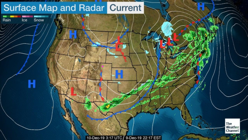
All is quiet on the western front - well the front that is fading out to our west (Figure 1). High pressure will dominate the weather story for the week. I did see flakes falling between me and my cell phone at lunchtime, but the clouds were thin and the sun was shining. The radar didn't show precipitation falling. Tuesday is very close to seasonably cool with just a few clouds now and then.

The Longer Range Forecast:

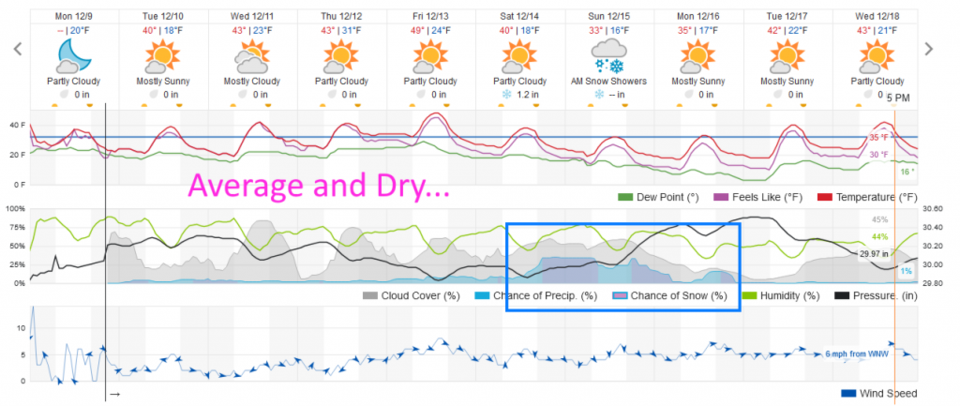
The rest of the week is that same story - mild and cool (Figure 2). The **slow** melt will continue. I finally got the last chunks of ice of my driveway proper, but the street out front is still an icy lumpy mess.

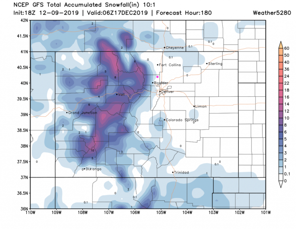
Looking at next weekend the GEM and weatherunderground models - they are sniffing out at least a few, to a number of inches of snow (Figure 2). Still, the GFS says nothing significant will fall in town (Figure 3). It puts all the action up in the mountains.

The Fantasy Far-Out Christmas Forecast:

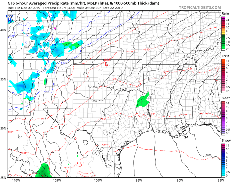
I'm always rooting for White Christmas. Just looking quickly at the GFS; it has some snow falling in places around the state overnight Saturday into Sunday December 21-22 (Figure 4). It has us locked under a strong (cold) high pressure center for Christmas Eve and Day (not shown). This could certainly change a LOT between now and then. It is good news that there is some type of storm in the area within a few days of Christmas showing up in the models. That hints that a large ridge won't be ruling the roost entirely by the end of the month. More later!

Figure 1: the current surface analysis map from Monday PM and the weather channel.
Figure 2: the graphical forecast for the next 10 days for Longmont, CO from weatherunderground.com
Figure 3: 10:1 (snow to liquid) snowfall totals through through NEXT Tuesday midnight/morning from the GFS and weather5280com for Colorado made Monday noon.
Figure 4: The 6 hour precipitation type forecast for midnight/morning Sunday Dec 22 from the GFS.

Current Weather

Cloudy

Cloudy

32°F

UV Index
0 Low
Pressure
30.36 Steady
Visibility
6 miles
Dewpoint
30 °F
Humidity
94%
Wind
ENE 1.1 mph
Gust
2.8 mph
Wind Chill
32 °F

Hourly Forecast

Today
2 AM
33°F
Cloudy
Today
3 AM
33°F
Cloudy
Today
4 AM
33°F
Snow
Today
5 AM
33°F
Snow
Today
6 AM
33°F
Snow
Today
7 AM
33°F
Cloudy
Today
8 AM
33°F
Flurries
Today
9 AM
34°F
Snow
Today
10 AM
35°F
Cloudy
Today
11 AM
36°F
Cloudy
Today
12 PM
37°F
Cloudy
Today
1 PM
38°F
Cloudy

7 Day Forecast

Rain and snow

Friday

41 °F

Chilly; rain and snow showers in the morning with little or no accumulation followed by rain and drizzle in the afternoon


Snow

Friday Night

32 °F

Periods of wet snow, accumulating 1-3 inches; roads could be slippery


Flurries

Saturday

39 °F

A bit of morning snow with little or no accumulation; otherwise, cloudy and cold; storm total snowfall 1-3 inches


Intermittent clouds

Saturday Night

30 °F

A shower in places this evening; otherwise, partly cloudy


Partly sunny

Sunday

64 °F

Partly sunny and warmer


Mostly clear

Sunday Night

41 °F

Mainly clear


Intermittent clouds

Monday

79 °F

Warmer with a blend of sun and clouds


Partly cloudy

Monday Night

40 °F

Partly cloudy


Mostly cloudy

Tuesday

66 °F

Mostly cloudy and not as warm


Mostly cloudy

Tuesday Night

40 °F

Mostly cloudy


Sunrise and Sunset

Sunrise
6:15 AM
Sunset
7:44 PM

Based on AccuWeather data