Colorado’s Continental Divide offers some of the most scenic and rugged landscapes in the Rocky Mountains. With dozens of access points across the state, visitors can hike, drive, or simply stop to take in the views. From mountain passes to high-alpine trails, the Continental Divide Colorado is a top destination for nature lovers and road trippers alike.
What is the Continental Divide?
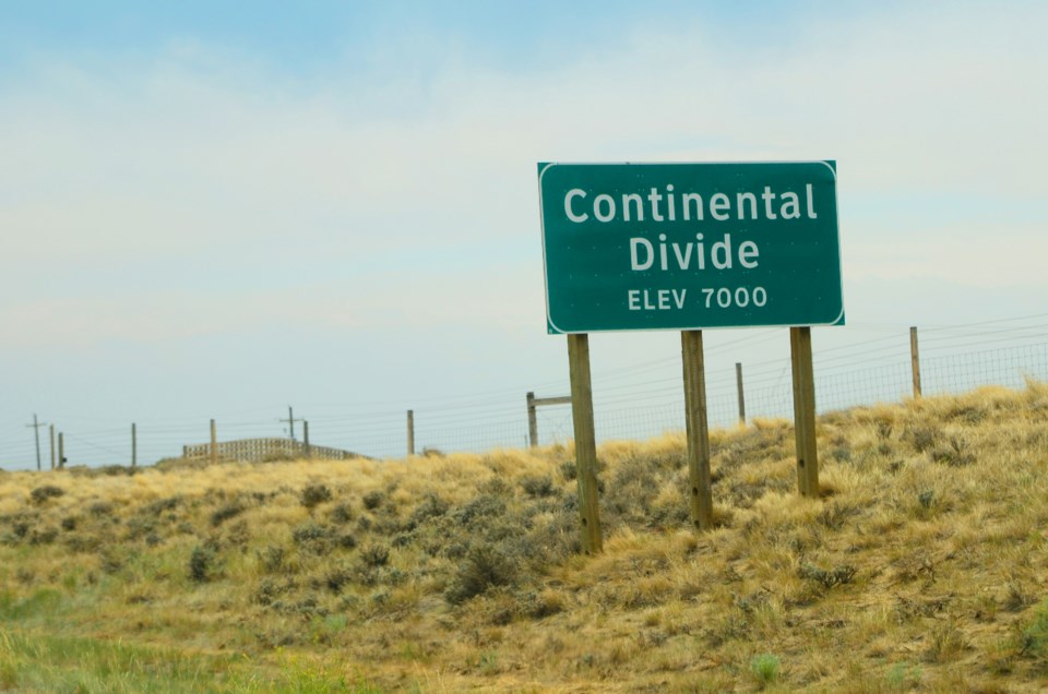
The Continental Divide is a natural ridge that runs from Alaska through the Rocky Mountains and down to South America. In North America, it separates river systems that drain into the Pacific Ocean from those flowing toward the Atlantic and Gulf of Mexico. In Colorado, this line cuts through the center of the state, shaping much of its geography and weather.
This divide is more than just a line on a map. It plays a key role in managing Colorado’s water systems and impacts everything from snowmelt to river flow. Many of the state’s highest peaks and scenic routes sit directly on or near the divide, making it a popular spot for outdoor activities year-round.
Continental Divide Trail in Colorado
Colorado covers 740 miles of the Continental Divide Trail, offering routes through high peaks, remote forests, and scenic mountain passes. Each section provides different hiking experiences, from short loops to multi-day treks.
San Juan Mountains & Cataract Lake
Southern Colorado’s San Juan Mountains are among the most rugged and scenic on the trail. In the Weminuche Wilderness, the CDT stays above 11,000 feet for 70 miles. A 13-mile loop at Cataract Lake shows off the divide’s westernmost turn and offers sweeping views of the Rio Grande headwaters.
South San Juan Mountains & The Knife Edge
The CDT runs for 42 miles through the South San Juan Wilderness, home to sharp ridges and fast-flowing rivers. Pagosa Springs serves as a base for exploring this stretch, including the dramatic Knife Edge loop. This 25-mile route includes a narrow ledge carved into a shale cliff. It's best accessed from the Williams Creek Trailhead and offers an unforgettable backcountry challenge.
Mount Zirkel Wilderness & Buffalo Pass
The Mount Zirkel Wilderness in northern Colorado spans over 160,000 acres and includes 36 miles of the CDT. Hikers can explore alpine lakes, meadows, and 15 peaks rising above 12,000 feet. A notable section is the 21-mile hike from North Lake to Buffalo Pass, ending at 10,180 feet. It offers a mix of quiet forest trails and wide mountain views.
Rabbit Ears Range & Rabbit Ears Pass
Located near Steamboat Springs, the Rabbit Ears Range is known for its volcanic rock formations and moderate hiking routes. One popular CDT section runs 15 miles from Rabbit Ears Pass to Buffalo Pass. For a shorter trip, the stretch between Fishhook and Lost Lakes is ideal for day hikers. The area is also part of a designated CDT Gateway Community.
Vasquez-Gore Range: Silverthorne to Copper Mountain
This section winds through the Vasquez Peak, Ptarmigan Peak, and Eagles Nest wilderness areas. A 15-mile out-and-back trail starting at Vasquez Peak Trailhead climbs up to the divide with rewarding views. The area blends forested paths with open ridgelines and is close to Silverthorne for easier access.
Sawatch Range: Twin Lakes & Hope Pass
The Sawatch Range holds Colorado’s tallest peaks, including Mt. Elbert. Near Twin Lakes, the CDT and Colorado Trail merge for a scenic stretch past Turquoise Lake and Interlaken. A popular 4-mile loop offers easier access and great fishing spots. The full route continues over Hope Pass, climbing steeply above the treeline.
Cochetopa Hills & Marshall Pass
Between Gunnison and Saguache, the Cochetopa Hills offer a quieter section of the CDT. The 22-mile Summit Trail follows Lujan Creek and passes Windy Peak before reaching Marshall Pass. It’s a good area for solitude, with fewer hikers and more wildlife. Trail improvements are planned to make this area more accessible.
Never Summer Range & Bowen Gulch Loop
This lesser-known range in northwest Colorado includes 21,000 acres of rugged beauty. The CDT runs through gulches and over two high mountain passes. The 19-mile loop from Baker Gulch to Bowen Gulch offers moose sightings, wildflower fields, and alpine lakes. At the top, hikers can see peaks like Mt. Cumulus and Nimbus.
Front Range: Devil’s Thumb & Grays Peak
The Front Range hosts some of Colorado’s most visited peaks, including Grays Peak at 14,270 feet—the highest point on the CDT. Devil’s Thumb Loop near Nederland is a challenging hike with views of granite spires and elk-inhabited meadows. Another standout is the 22-mile route from Herman’s Gulch to Berthoud Pass, which stays above treeline for the final stretch.
Scenic Drives Across the Continental Divide
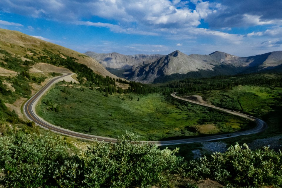
You don’t have to hike miles to see the Continental Divide in Colorado. Several mountain passes and roads offer direct access to the divide—many of which are drivable year-round or seasonally. Here are some of the most accessible and scenic options.
Monarch Pass
At 11,312 feet, Monarch Pass is a high crossing at the southern end of the Sawatch Range. Visitors can take in sweeping views from the Monarch Crest Scenic Tramway, which reaches over 12,000 feet. It’s also a known stop for CDT hikers who mail supplies here. The pass remains open most of the year, weather permitting.
Cottonwood Pass
Reaching 12,119 feet, Cottonwood Pass is the highest paved crossing of the Continental Divide in Colorado. Found near Buena Vista, this south-central route is fully paved and accessible in warmer months. Parking areas allow visitors to stop, walk, and enjoy the ridge views. The pass typically closes for winter in late fall.
Trail Ridge Road (Milner Pass)
Trail Ridge Road, between Estes Park and Grand Lake, is the highest continuous paved road in the U.S. It crosses the divide at Milner Pass (10,759 feet) inside Rocky Mountain National Park. While the full stretch closes in winter, parts remain open near both towns. The drive offers some of the best mountain views in the state.
Wolf Creek Pass
Located in southwestern Colorado, Wolf Creek Pass climbs to 10,857 feet and crosses the divide near the San Juan Mountains. It’s open year-round but can be hazardous in winter. Nearby, the Lobo Overlook at 11,760 feet provides dramatic views. For a longer trek, hike 8 miles roundtrip to Rock Lake from this spot.
Loveland Pass
Loveland Pass reaches 11,900 feet and provides an alternative to I-70 between Denver and Summit County. Though winding and steep, it stays open most of the year and has spots to park and walk along the ridge. It’s one of the easiest ways to access the divide for a quick visit or short hike.
Independence Pass
At 12,095 feet, Independence Pass is the second-highest paved crossing of the Continental Divide. It connects Leadville and Aspen and passes through stunning alpine terrain. There’s also a ghost town on the Aspen side. The road closes seasonally, usually in late October.
Other Notable Crossings and Tunnels
Additional mountain passes like Boreas, Hoosier, and Buffalo offer alternative ways to cross the divide. Many are gravel or seasonal, requiring 4WD. Tunnels also play a role: the Eisenhower Tunnel (for vehicles) and Moffat Tunnel (for trains) both cut through the divide underground.
Final Thoughts on the Continental Divide in Colorado
Whether you’re hiking high-alpine trails or driving scenic mountain roads, the Continental Divide in Colorado offers endless ways to enjoy its natural beauty. With so many access points and diverse landscapes, it remains one of the state’s most iconic and rewarding features.

