Activity on the CalWood and Lefthand Canyon fires was minimal overnight Sunday and there was no measurable fire growth, according to the Boulder County Office of Emergency Management.
The CalWood fire as of 10 a.m. Monday was burning 8,788 acres and was 15% contained. As of Sunday night, 26 homes had been destroyed by the fire, according to officials.
Nearly 3,000 people have been forced to evacuate the area because of the fire that was first reported Saturday afternoon.
The Lefthand Canyon fire was burning 320 acres as of Monday morning and was 4% contained, according to information posted to a new Facebook page dedicated to fire updates. The fire, which was reported on Sunday, forced the town of Ward to evacuate.
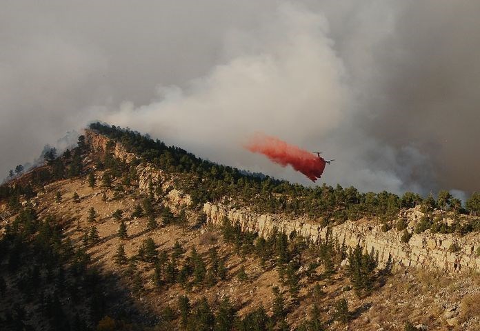
Because of the weather on Sunday, aircraft use on the CalWood fire was limited through the day, according to the OEM, and “crews worked extensively constructing a fire line close to the fire’s edge. Control lines were built between the fire and structures on the west and southwest sides of the fire.”
On Monday crews will continue line construction to protect structures and gain further containment and aircraft will be used to support those efforts, according to the OEM.
Aircraft were able to work extensively Sunday on the Lefthand Canyon fire, and firefighters built containment lines Sunday and continue doing so Monday, according to the OEM. Crews also are working to minimize fire spread and patrol for spot fires.
A federal Type II incident management team took over coordination of the CalWood and Lefthand Canyon fires on Monday morning.
“Local Boulder County emergency management staff are working closely with the federal team, and will coordinate local impacts to the community outside of the fire footprint, such as road closures, evacuations, sheltering options for people and animals, damage assessments, and fire investigation, etc.,” the OEM stated. “The federal team (is) managing firefighting operations, acreage and containment, etc.”
A number of closures remain in place because of the fires. Road closures can be viewed on the public information map at BoulderOEM.com.
Hall Ranch, Heil Valley Ranch, Lagerman Agricultural Preserve, Pella Crossing, Bald Mountain and the Anne U. White Trail are closed, according to Boulder County. Button Rock Preserve also will remain closed until further notice, the city of Longmont announced on Monday.
The CalWood fire burned significant forest acreage at Heil Valley Ranch, according to Boulder County Parks and Open Space.
Portions of the Roosevelt National Forest also are closed. A map of the closed area is available here.

