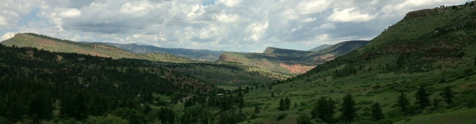
There are 101,000 acres of public land in Colorado considered corner locked, according to a new report on access to public lands published by onX.
The recently released report provides a detailed analysis of “corner-locked” public lands throughout the West. A parcel of public land is considered corner locked when it is surrounded by private land but touches another parcel of public land at one or more corners.
More than 8.3 million acres of land are considered corner-locked in the West, totalling 27,120 of these controversial corners, according to the onX report. The report found that 70% of the public lands considered corner locked belong to the Bureau of Land Management, while another 26% is state and 4% is other federal agencies.
In Colorado, 668,000 acres of public land — roughly 2.5 times the size of Rocky Mountain National Park — are considered “landlocked” or not accessible by public roads or trails, according to onX. About 15% of that land is corner-locked behind 489 property corners, which are shared with 527 unique landowners, onX said.
The issue with this type of public land is that accessing it falls into a legal gray area, with no laws expressly forbidding or permitting corner crossings. While a public land user may be able to step from one corner of public land to another without physically stepping on private land, because their bodies pass over the air space of private land, the question is whether that action is considered trespassing.
This issue recently came to fruition in Wyoming last October, when four hunters were charged with criminal trespass after corner crossing public land in Carbon County, Wyoming. The hunters were acquitted in April of criminal charges, but a pending civil case in federal courts could have a ripple effect on law and land access debates.
Oftentimes, the land ownership boundaries are invisible on the landscape. The report explained that much of the land in the western United States were mapped and platted based on 640-acre squares through the Public Land Survey System, and the many land sales, exchanges and actions of the federal government throughout the past two centuries have led to this phenomenon.
In 2018 and 2019, onX and the Theodore Roosevelt Conservation Partnership worked together to quantify the 15.8 million acres of landlocked state and federal land throughout the west that public citizens cannot access since there are no public trails or roads to them. More than half of that land is corner locked, while the remaining is considered “isolated” — think islands in a sea of private land.
The private lands surrounding these corner blocked parcels belong to 11,000 unique private landowners with about a fifth of those owners being oil, gas, energy, timber and mining companies, the report found.
The issue highlights a complex intersection between private property rights and access to public lands. While state governments in the West have proposed bills both permitting and banning corner-crossing, none have made it into law.
The onX report did highlight some mutually beneficial solutions, like land exchanges with private property owners, temporary access agreements during hunting seasons and corner easements. While some of these solutions can be expensive, onX pointed to the Land and Water Conservation Fund that was fully and permanently funded through the Great American Outdoors Act in 2020.
The federal fund is required to receive at least $15 million annually for projects that improve recreational access, and it received $67.5 million in funding in 2021.


