In Brief:
A ridge overhead means hot weather through the weekend - only briefly broken by thunderstorms Saturday PM.
6/13 12pm Update:
Unless too many clouds form in the mountains in the early afternoon (that would slide east and cool us down, stabilizing the atmosphere) we will see a chance of severe weather over much of the state this afternoon. The primary thread is for hail, high winds, and lightning. Take care. See Figure 1 update.
End 6/13 12pm update.
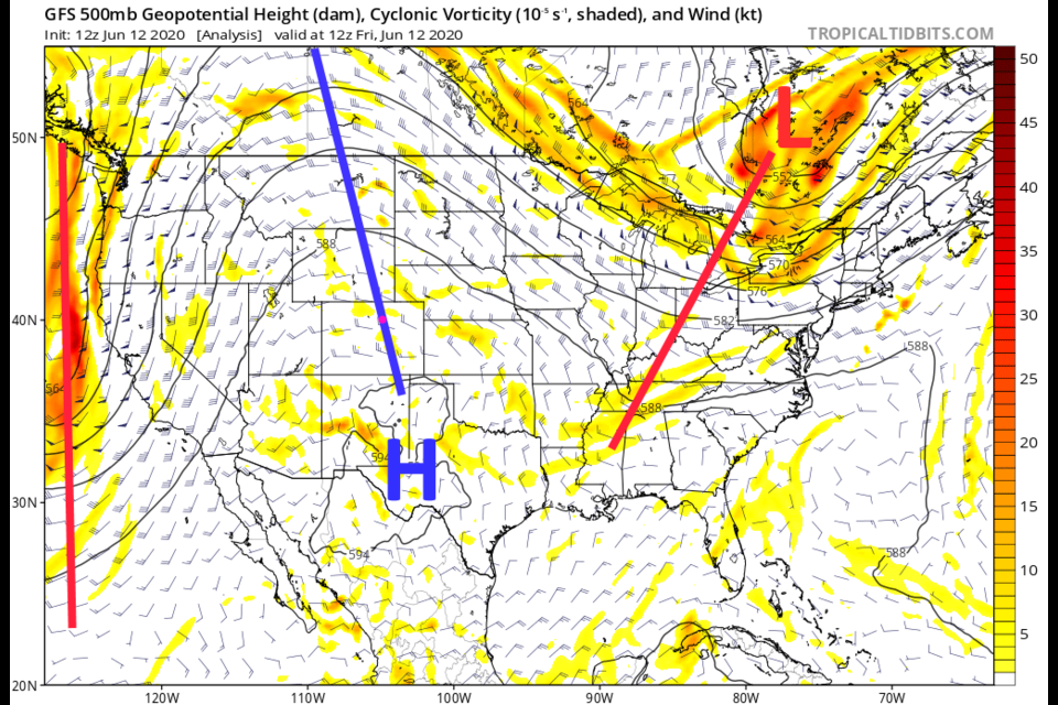
Forecast Discussion:
There is a very large ridge sitting over the western U.S. (Figure 1 in the gallery above). This is creating the hot dry weather. The trough to our west will begin to move eastward, towards Colorado, as it lifts over the top of the ridge. This will give us a small chance of storms mainly Saturday afternoon. The ingredient we need for these storms is moisture. There is some moisture in northern New Mexico and Kansas that might slowly feed in (Figure 2) but the forecast for precipitatable water (how much water is available to rain out in an optimal situation) Saturday afternoon is pretty wimpy. The forecast precipitatable water map paints mainly brown and yellow shading over the state Saturday (Figure 3) indicating low moisture levels.
That trough doesn't get much closer than what is shown in the Saturday PM map in Figure 4. The orange arrow indicates the direction of hot air flowing from the desert southwest into Colorado. Still, the Storm Prediction Center has a chance of storms right down and east of the Rockies Saturday with a marginal risk of severe weather almost down to Fort Collins (Figure 5). The primary risk is for high winds and hail. This "might" be extended further south if the ingredients needed come together better. Check with the National Weather Service's Storm Prediction Center at https://www.spc.noaa.gov/ and keep an eye on your weather alert apps.
The Longer Range Forecast:
Except for a smaller chance of storms on Sunday afternoon, we remain quite hot with healthy southwest flow across the state (Figure 6). High temperatures will keep landing in the 90'sF Sunday through Wednesday. The ridge finally breaks down (a bit) later next week. We will start to see normal temperatures (finally) and storm chances pick up again Wednesday afternoon (Figure 7). My next update will be Sunday PM, see you then!

