In Brief:
Dry hot weather at the start of the week will be replaced by more normal (cooler) temperatures at the end of the week and a return of showers.
Update 6/15 10am:
One notable addition to the forecast is haze and smoke. There are fires burning in the West (Arizona and southwest Colorado). The southwest winds behind the ridge are transporting that smoke up into eastern and northern Colorado (see Figure 1 update in the gallery). This will be an unpleasant feature of the weather pattern for many days to come (the overall pattern isn't going to change much and the fires are still a long way from being contained as of Monday AM). This smoke is pretty dense all the way up to Minnesota with some smoke making it far into Canada and across the Great Plains.
End 6/15 10am update.
Forecast Discussion:
We had a marginal risk of severe weather predicted for most of Colorado on Saturday. It looks like early convection and cloud cover cooled the state enough to inhibit severe storm activity. There were no severe weather reports submitted to the National Weather Service for Saturday - as of Sunday afternoon.
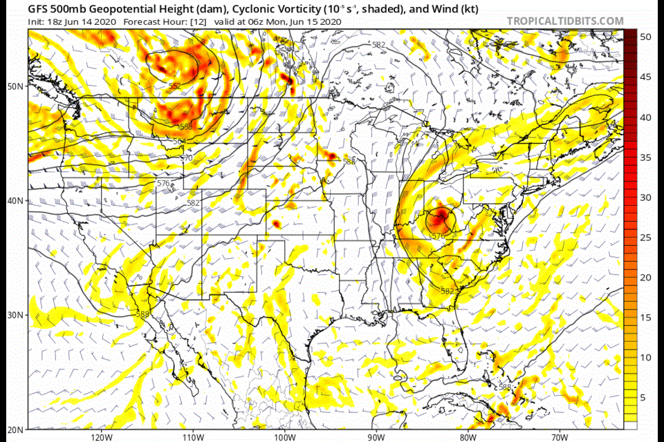
Things are settling into a summer pattern with a ridge coming and going over the western U.S. Figure 1 is an animation of the 500mb pattern for the next 10 days. You can see troughs traveling past us to the north.The ridge wobbles east for a bit then returns later in the period. The start of this week is dominated by that ridge (seen in the animation) and a surface high pressure system (Figure 2 in the gallery). The forecast is for hot and dry weather.
The Longer Range Forecast:
Only around Thur-Saturday, this week, does a trough dig deep enough south to cool us a bit and bring moisture in for afternoon storms. When that trough approaches by Wednesday and Thursday, some moisture gets pulled into the state. You can see the best moisture feed, for example, in the map of precipitatable water in Figure 3. The low-level low pressure center in southern Colorado is helping to pull motion from the Gulf of Mexico up through west Texas into Kansas and northwest into northern Colorado (green shading).
For the week ahead, you can see the 10F drop in temperatures Thursday-Saturday and the return of afternoon storm chances. We "probably" won't see severe weather unless the moisture increases more and the trough digs deeper than expected. The end of next weekend looks like a return of the ridge with hot and dry weather.

