In Brief:
Other than severe weather chances today and rain Monday PM, warm spring/summer weather is the story for the next week.
Forecast Discussion:
A trough is pushing into the west (big red line) with a short wave zipping over the state today (shorter red line - Figure 1 in the gallery). You can see the healthy moisture supply in place for storms, that the short wave will create, in the water vapor satellite image (white, pink, and blue colors - Figure 2). With all the ingredients coming together, we now have a slight risk of severe weather over much of Colorado (2 on a scale of 1-5 - Figure 3). Breaking down the risks: the western 1/2 of the state has a 2% of seeing a tornado spawned from a supercell within 25 miles of any given point (your house? - Figure 4). There is a 5% chance of large hail within 25 miles of any one point around Longmont (Figure 5) and a 15% chance of damaging winds along I-25 (Figure 6) with in 25 miles.
The high resolution model simulates how radar/storms will look hour by hour. Figure 7 has the first wave of thunderstorms hitting around 2pm with the next wave (breaking up some) approaching an hour later (Figure 8). The highest chance of rain and storms stretches from about 10am to 5pm today (Figure 10).
The Longer Range Forecast:
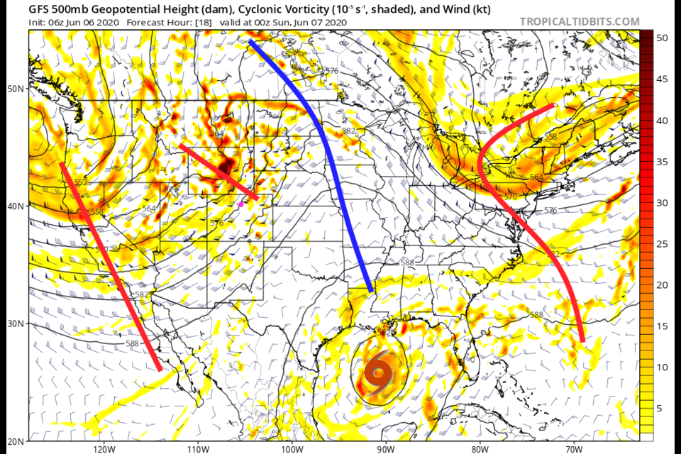
The next story, in chronological order, is the landfall of tropical storm Cristobal very close to New Orleans late Sunday night early Monday AM (Figure 9). Up to a foot of rain or more will hit locations around that region of the Gulf coast. It still is not expected to gain hurricane strength winds, but that isn't all the damage tropical storms can do.
Back at home, another trough is approaching Sunday into Monday (Figure 11). This will bring down a cold front and cool air aloft Monday PM (Figure 10). Pretty good rain chances arrive Monday night into Tuesday morning. It will be quite chilly Tuesday. Beyond that, we warm up to above normal temperatures again with a newly formed ridge overhead (Figure 12).

