In Brief:
While a ridge continues to dominate the nation (and Colorado) bringing the heat, some moisture is sneaking into Colorado bringing back an afternoon chance of thunderstorms.
Update 7/14 4pm:
Just a quick update (without a new graphic)... the air flow around the western side of the big southern U.S. ridge is from the southwest and west across northern Colorado. This is bringing in smoke from a few new Western fires, including one on the Western Slopes of Colroado. The NWS has issued an air quality alert because of this. You might notice some haze (made more noticable by increased atmospheric moisture).
End 7/14 4pm update.
Forecast Discussion:
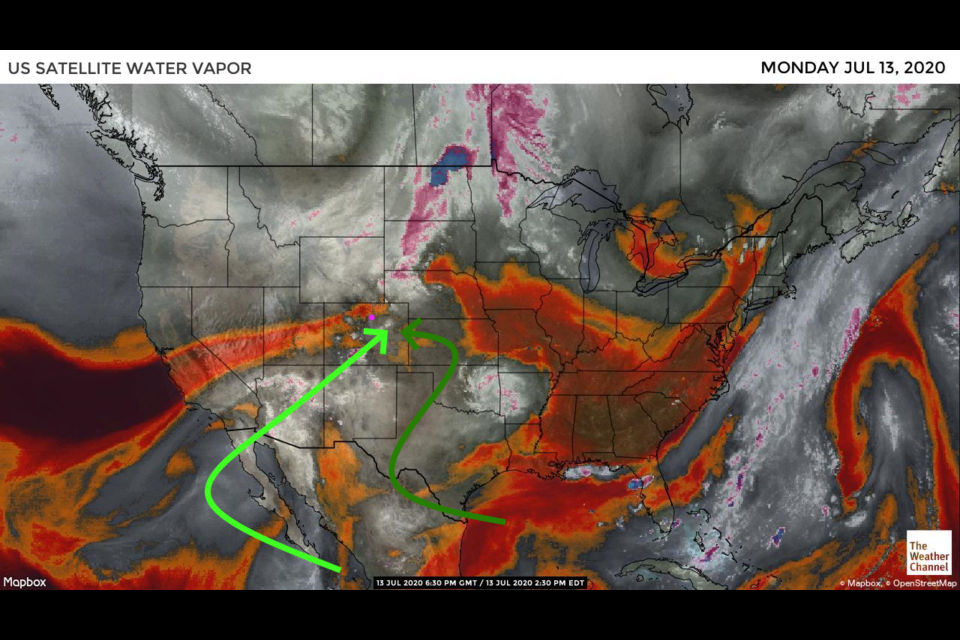
Figure 1 in the gallery shows that some moisture is making it around the west side of the ridge aloft (light green arrow) and at the surface (dark green arrow). We have plenty of heat, and now energy (latent heat - energy needed to keep water in a vapor state) for a welcome return of thunderstorms (hopefully without lightning induced fires). The forecast pattern for Tuesday is very similar with moisture still pooling abnormally high over the state but especially east of the Rockies (Figure 2). We have a chance of severe weather back to I-25 again Tuesday - for hail and high winds (Figure 3). Tornado threats will remain way out in the northeast corner of the state where moisture is deeper and the winds are more favorable.
The Longer Range Forecast:
The daily afternoon thunderstorm pules are going to remain in the forecast for the next week (Figure 4). The trough we covered last time will indeed cool us to the 80'sF for a couple of days, but the near 100'sF temperatures are back at the end of the week. The 5 day rainfall total map shows some folks getting VERY high 1-3 inch rainfall totals (not necessarily exactly the pattern you see in Figure 5). We seem to get about 1/4 to 1/2 inch of rain around here over that time.

