In Brief:
Only small variations in the weather will be seen as the warm summer weather continues with afternoon storm chances.
Update 7/21 1:30pm:
The storms have begun to fire in the mountains as of 1pm. The NWS has issued a severe thunderstorm watch (not as "immediate" as a warning) for much of eastern Colorado effective until 9pm (Figure 3 update). There is also mid-level smoke/haze being dragged into the system from the fires in the West (Figure 4 update). Air quality may be an issue later today and overnight into tomorrow. What an active day! Keep an eye on the western and northwestern sky the rest of the day.
IF it clears tonight, you'll also be able to see comet NEOWISE to the lower left of the bowl of the Big Dipper (Ursa Major) about 45minutes after sunset on into the night (it gets hard to see by midnight).
End 7/21 1:30pm update.
Update 7/21 10:30am:
From the storm Prediction Center: a Slight Risk (2 out of 5 scale) of severe weather (Figure 1 update in the gallery above) has been issued for the foothills and I25 corridor of Colorado. Moderate instability is forecast to develop along the Front Range by late afternoon (3-7pm mainly), due to strong heating and ample low-level moisture with easterly surface winds. Storms are likely to form over the higher terrain, then move slowly southeast across southeast WY and the Front Range of CO. Large hail to golf ball size is possible, with a report or two approaching 2.00". A few damaging gusts may also occur as outflows increase through evening, and storms move into the Plains. Low-level winds will be weak, with minimal tornado threat expected. Storm coverage, from the HRRR, seems better further south, but conditions are right for storms up into Wyoming (Figure 2 update).
End 7/21 10:30am udpate.
Forecast Discussion:
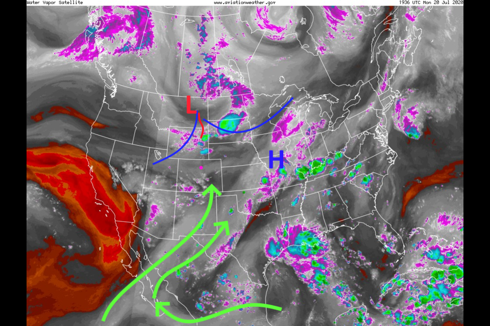
A moderate flow of moisture continues (white/grey shading highlighted by green moisture flow arrows, Figure 1 in the gallery) into the West. A passing trough and daytime heating may create some severe weather Monday just east of I-25 and out on the eastern Colorado Plains (Figure 2). The next front, approaching from the northwest is seen in Figure 1 and will arrive Tuesday (Figure 3). Later Tuesday there are rain chances in the northern mountains and the eastern Plains (Figure 4). A few of the cells may reach severe levels all the way back to the cities along the I-25 corridor (Figure 5). The primary risk is for hail from the storms as they move slowly to the east-southeast. Most folks won't see the widely scattered thunderstorms, the GFS even leaves Longmont out of the rainfall lottery in a recent run (Figure 6).The Longer Range Forecast:
The ridge builds back over the West by Wednesday (Figure 7) bring upper 90'sF back for highs (Figure 8). A passing short wave trough kicks thunderstorm chances up a bit on Friday. Rain chances for any specific day this week are small. The GFS gives us up to 1/4th inch of water over the next 5 days.

