In Brief:
A few more days of warmth and afternoon storms will be replaced by HEAT and very few storms.
Update 7/5 12pm:
I hope you had a great Independence Day! The Storm Prediction Center still has a Marginal risk of severe weather - primarly for strong/damaging thunderstorm straight line winds for this afternoon (see Figure 1 update in the gallery). After that, the storm chances decrease each day going forward as the heat gets turned up.
End Update 7/5 12pm.
Forecast Discussion:
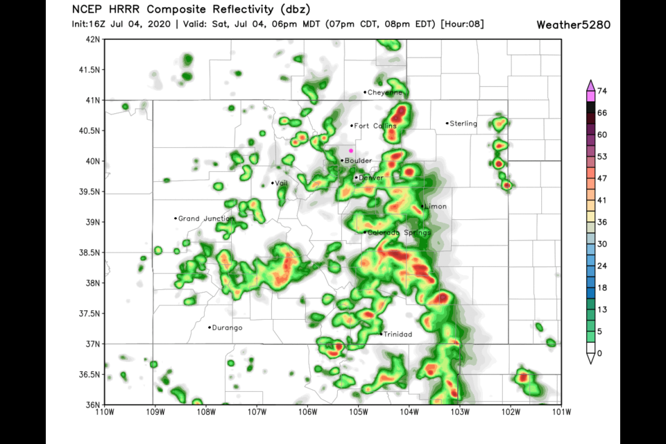
We will barely reach 90F today (Independence Day) - enjoy the "cool" air! Storms will roll off the mountains this afternoon but don't seem to impact Longmont much. The closest the storms come to our town on the HRRR model is shown in Figure 1 in the gallery above. After this they move east and the storms to the west of that line fade out into the evening. There should be very little storm activity around I-25 by 9-10pm (typical fireworks time).
For Sunday, we warm up just a bit and have better moisture in place (Figure 2). Stronger storms with more overall coverage than Saturday are expected. The Storm Prediction Center has a Marginal Risk (1 on a scale of 1-5 with 5 being the most severe) back to the I-25 communities. The primary risk, due to a layer of dry air aloft, is for strong damaging thunderstorm winds. They are not highlighting hail or tornadoes at this time (Figure 3).
The Longer Range Forecast:
The long range is going to be hot and dry. We have a very large ridge setting up coast to coast across the country by about Monday/Tuesday (example from Wednesday shown in Figure 4). The cool air is trapped north of the jet stream axis (pink arrow in that figure). We should see a few days top 100F this week and hotter to the southeast. The storm chances will fizzle. There will be very few storms on any given evening, and then, mainly only up in the mountains.
On a personal note, I'm taking a bit of a break for the holiday weekend. This post will cover 3 days (I don't plan for that to be a habit except for vacation times). Stay safe out there and stay cool next week.

