In Brief:
Dry smoky heat holds through Tuesday then moisture returns with a small chance of afternoon storms (and a slight cool down).
Update 8/17 11am:
Smoke will continue to rotate around the nearly stationary high pressure center to our West. We "might" see a bit less smoke as a lighter smoke load is coming in from the northwest near Longmont. Note, ashift of 10 miles in the plume could darken the sky and drop ash at any time - we are RIGHT on the edge of the worst of the smoke Monday. See Figure 1 update.
End 8/17 11am update.
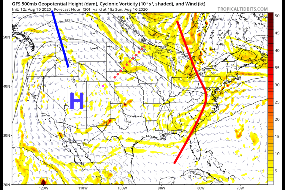
Forecast Discussion:
The two big stories this forecast period is the high pressure center + heat and the smoke from multiple fires. The upper air high is centered over the Grand Canyon brining northwest air flow into the state with compressional heating and down slope flow (Figure 1 in the gallery above). A passing shortwave (dotted red line) to our north east will allow a "few" thunderstorms to form - mainly to our east (but there will be cloud build ups in the Foothills with a touch of rain and lightning (bad!) possible). Figures 2-4 show the rotation of smoke around the high pressure center Saturday into Sunday this weekend. Smoke will be VERY thick and irritating. We might see a bit of relief later Sunday as the winds become a bit more northerly aloft with the passing trough (Figure 4).
The rainfall over the next 3 days will be close to nothing for most of the state (Figure 5).
The Longer Range Forecast:
By Wednesday the pattern has changed VERY little over the nation. Only the tilt of the ridges and troughs have shifted a bit. That does give us more northerly winds and a small cool down (Figure 6). By Tuesday/Wednesday, the high has dragged in tropical moisture from the Pacific and Gulf of Mexico that finally makes it into northeast Colorado (Figure 7). We see a small chance of afternoon monsoon-lite (and monsoon-like) storms with possible a bit of rain around town (Figure 8).
Temperatures remain above normal through Tuesday and return to only a bit above normal Wednesday and beyond. You can see the pulses of afternoon storm chances in Figure 9 with that return of atmospheric moisture. Summer keeps on comin'.


