The Video Weather Forecast for the Upcoming Week
In Brief:
Higher mountain winds will keep fire danger high until a strong cold front hits Saturday evening brining extremely cold air and significant snow.
The Forecast Discussion:
The surface map in Figure 1 shows our next system gathering strength in the Pacific Northwest. Our Thursday cold fronts are down in Texas entering Mexico. Winds are still quite stiff in the mountains at this time (close together thin yellow lines over Colorado).
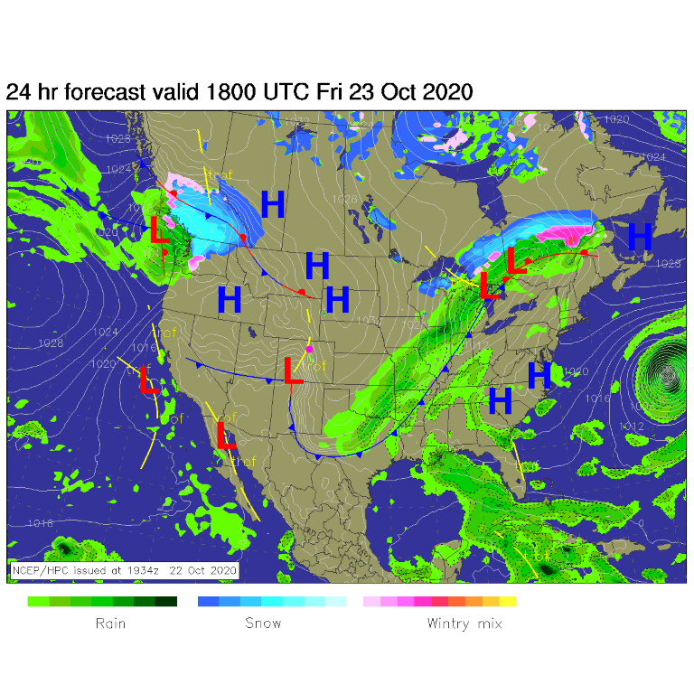 Figure 1: the forecast surface analysis for noon Friday from NCEP
By Saturday morning, warm air is sinking off the mountains to our west with an overall west to east air flow across the state. Winds will pick up again a bit on Saturday as the big front approaches. That is not good for the ongoing fires. Figure 2 shows the storm dumping a lot of snow up-stream from us while we remain dry one more day.
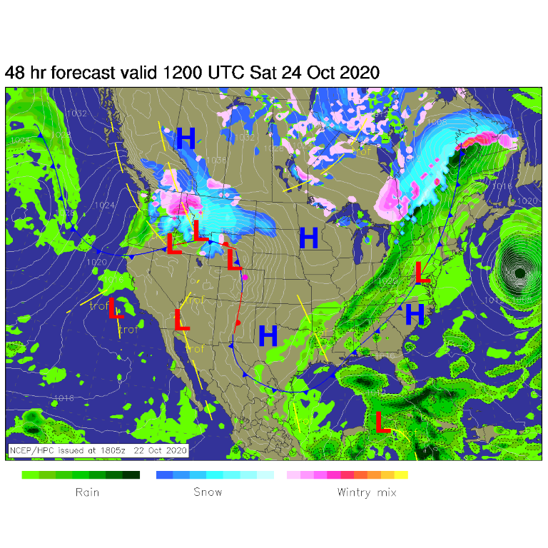 Figure 2: the forecast surface analysis for noon Saturday AM from NCEP
The blue arrows in the smoke forecast maps (Figure 3) show the middle level air flow. The multiple Colorado mountain fires are the worst in the nation ongoing. There will be a sharp line between smoke plume and no smoke plume due to the velocity of the upper level winds.
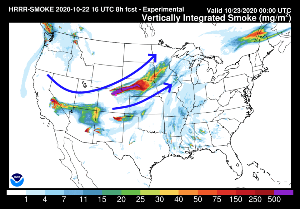 Figure 3: the HRRR smoke at all levels forecast for Thursday PM
There is a small chance of showers late Thursday night and early Friday morning after the Thursday evening cold front (Figure 4). We remain quite cold Friday.
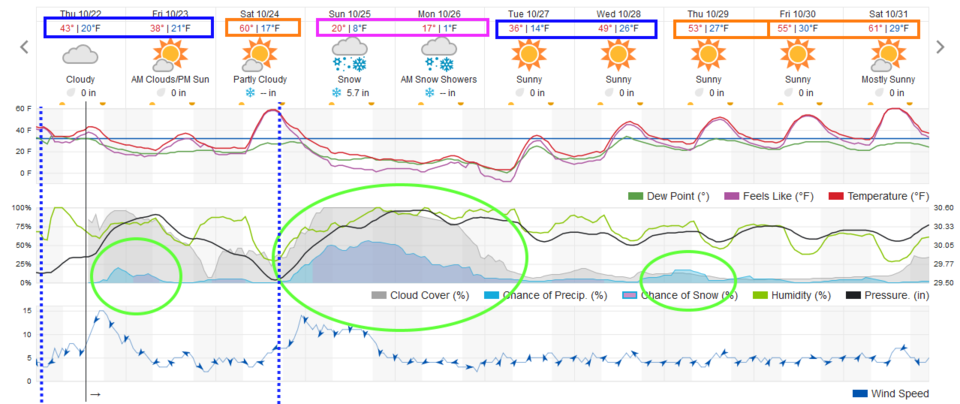 Figure 4: the 10 day graphical forecast for Longmont from weatherunderground.com
The Longer Range Forecast:
The above mentioned west winds bring the high temperature rapidly back to around 60 degrees on Saturday then the strongest cold front we've seen in a long time slams down the Front Range around 7 p.m. (in Longmont, earlier to the north, later in Denver - Figure 4).
Even though the front arrives Saturday and the snow begins Saturday night, the stronger colder portion of the upper air trough is still swinging towards us on Sunday (Figure 5).
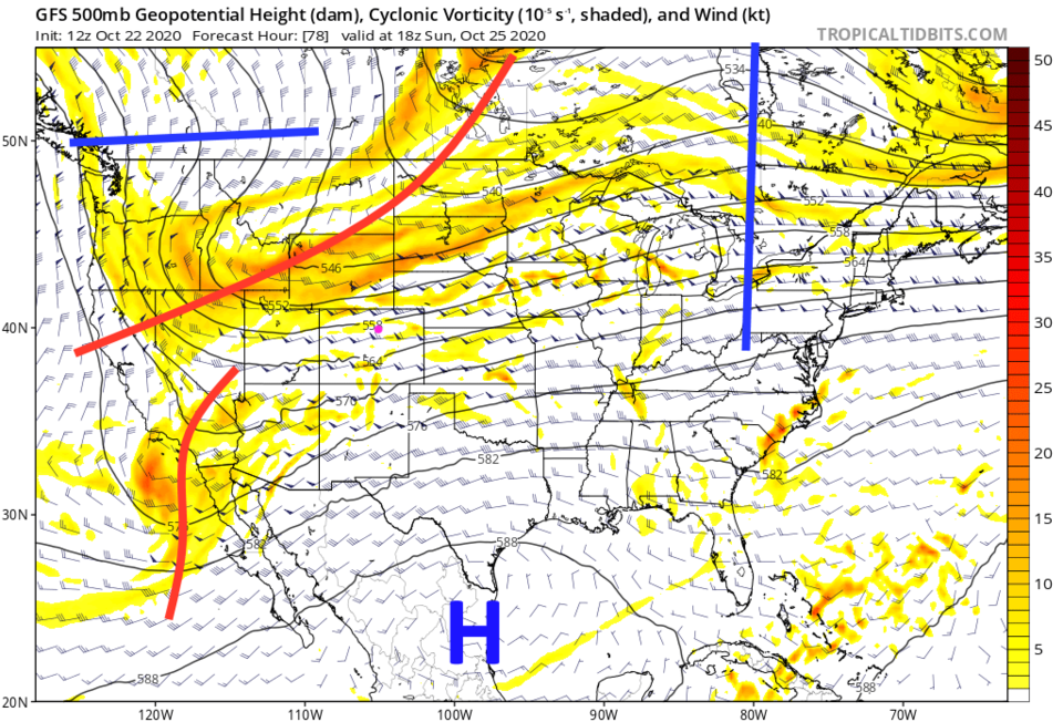 Figure 5: the 500mb forecast upper air map from the GFS and tropicaltidbits for Sunday noon.
 When the trough finally arrives, it gets really cold. You can see in Figure 4 that we have highs only in the upper teens Sunday and Monday and nighttime temperatures may go below 0 degrees Monday night into Tuesday morning. Wow, this is a year of extremes (Figure 6).
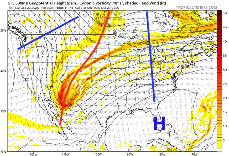 Figure 6: the 500mb forecast upper air map from the GFS and tropicaltidbits for early Tuesday morning.
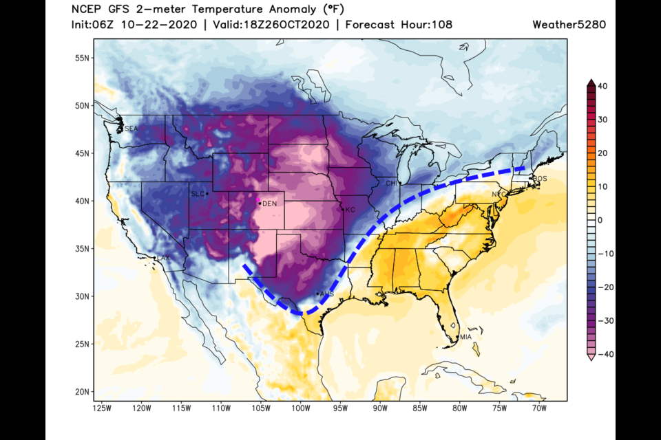
 The air temperatures Sunday will be some 40 degrees below normal across a large swath of the nation. You can clearly see the cold front as the dashed line in Figure 7.
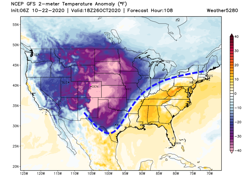 Figure 7: the surface temperature anomaly for Monday noon.
Right now, it looks like it will snow most of the time Saturday evening to early Tuesday morning (that is subject to change of course). With the strength of the jet stream overhead, we'll have "banded" precipitation again. That pattern of heavier water totals/snow depth lines is highlighted in Figure 8 (and 9) with the dashed red lines. We may get 0.5 to 0.75 inch of water. The areas on fire may see 1/2 to 1 inch of water (Figure 8).
With so much intense cold air, most of that will fall as snow with 5-7 inches around Longmont and I-25 and 10-16 inches of snow up on the fires. That didn't put out the Cameron Peak fire in September (because it went right back to a rain-free pattern again). This will help a lot though! We'll get a snowfall round up put together on Saturday right before the storm hits.
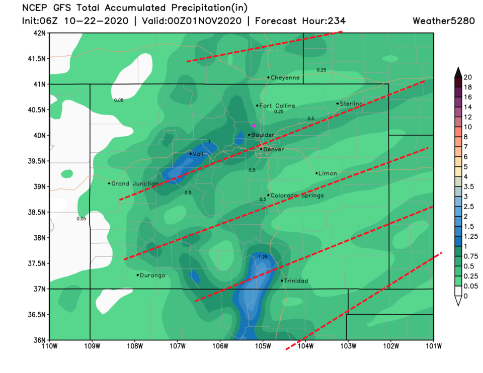 Figure 8: the total precipitation forecast for the next 10 days from the GFS and weather5280.com
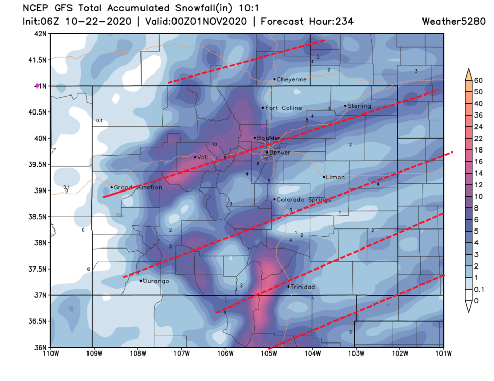 Figure 9: the total snow forecast for the next 10 days from the GFS and weather5280.com


