In Brief
Thunderstorms rolling off the mountains are the rule, more or less each day, with near normal temperatures.
Independence Day Update:
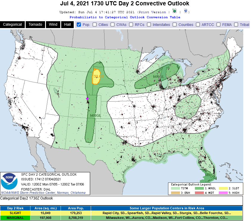
Storms were hefty dropping more than a 1/2 inch this afternoon. As things look, the rest of the evening, including firework shows, should be ok along I-25 with mostly clear skies (and humidity + mosquitoes). Storms return on Monday with a Marginal Risk of severe weather returning to communities along the interstate (Figure 2 update). The main risk is for damaging straight line winds from stronger storms. Wow, what a WET summer it has become.
 Figure 2 update: the SPC severe storm forecast for Monday 7/5.
End Independence Day update.
Thursday Update:
Moisture is increasing with increasing up slope flow today. Storms will begin nearly stationary today over the mountains and, especially, the new burn scars. Figure 1 shows the rainfall totals from the HRRR model through midnight tonight. Some (ultimately random) areas get 1 to 2 inches of rain today. Because of this, the NWS has issued the following Flash Flood Watch.
...FLASH FLOOD WATCH IN EFFECT THROUGH THIS EVENING...

The National Weather Service in Denver has issued a

* Flash Flood Watch for Portions of central, north central, and
northeast Colorado, including the following areas, in central
Colorado, Central and Southeast Park County and Jefferson and West
Douglas Counties Above 6000 Feet/Gilpin/Clear Creek/Northeast Park
Counties Below 9000 Feet. In north central Colorado, Larimer
County Below 6000 Feet/Northwest Weld County and Larimer and
Boulder Counties Between 6000 and 9000 Feet. In northeast
Colorado, Boulder And Jefferson Counties Below 6000 Feet/West
Broomfield County, Elbert/Central and East Douglas Counties Above
6000 Feet and North Douglas County Below 6000 Feet/Denver/West
Adams and Arapahoe Counties/East Broomfield County.

* Through this evening.

* Increasing moisture and instability today will lead to widespread
thunderstorm development by the early afternoon. Heavy rain and
flash flooding will be possible in these slow moving storms,
especially over burn areas.

* Rapid increases in water in creeks and small drainages could make
roads become quickly impassable.

PRECAUTIONARY/PREPAREDNESS ACTIONS...

You should monitor later forecasts and be prepared to take action
should Flash Flood Warnings be issued.
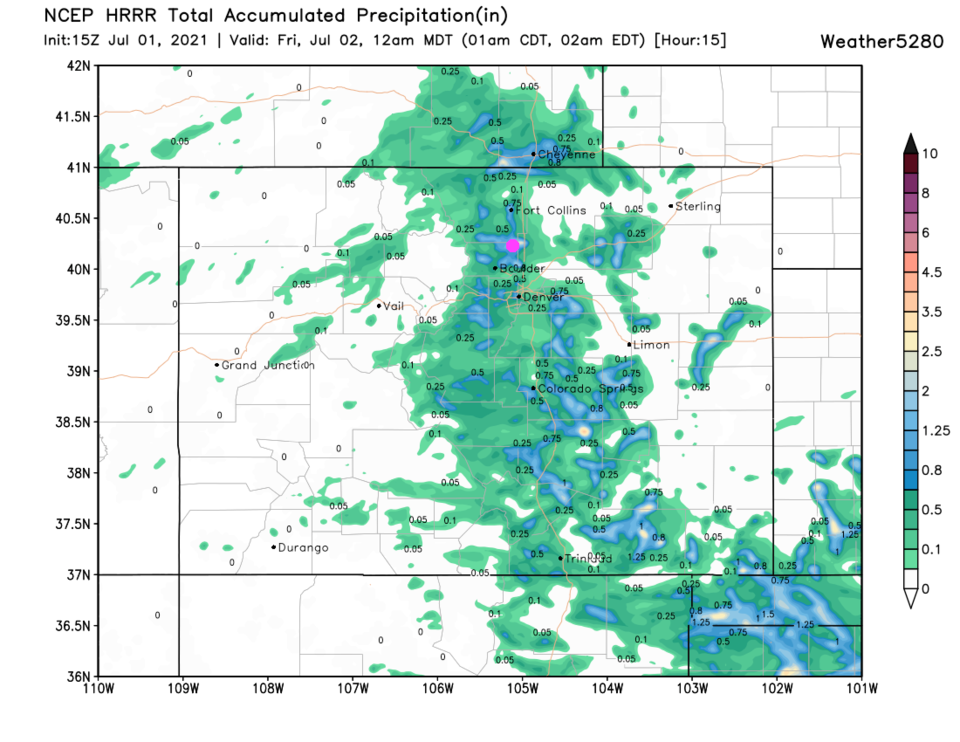 Figure 1 update: the HRRR 15 hour forecast through midnight July 1st into July 2nd from weather5280.co
End Thursday update.
Forecast Discussion:
The big picture is: we return to near normal temperatures with daily thunderstorms (Figure 1). The details give us a wetter day Friday and more heat on the weekend. The water vapor satellite image shows a low to our west and a high to our east pumping moisture and clouds (white/grey shades and pink shades) into the Rockies and out on the plains (Figure 2). That pattern is created by the current upper air pattern of troughs, ridges, and high and low pressure center circulations (Figure 3). The GFS shows above normal atmospheric moisture now and across the next week or more (Figure 4). Friday should be the wettest day with a passing short wave trough and weak cool front.
Without a strong flow aloft (Figure 3, no close-together-black-lines) and little cold air aloft, severe weather is not likely over the next couple of days (Figure 5 and Figure 6).
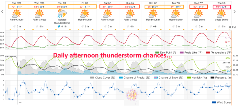 Figure 1: the 10 day graphical weather forecast from weatherunderground.com for Longmont.
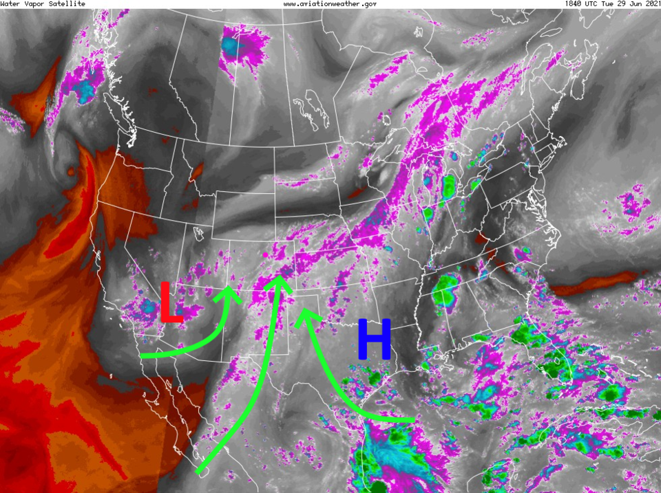 Figure 2: the water vapor satellite image from NOAA on Tuesday afternoon
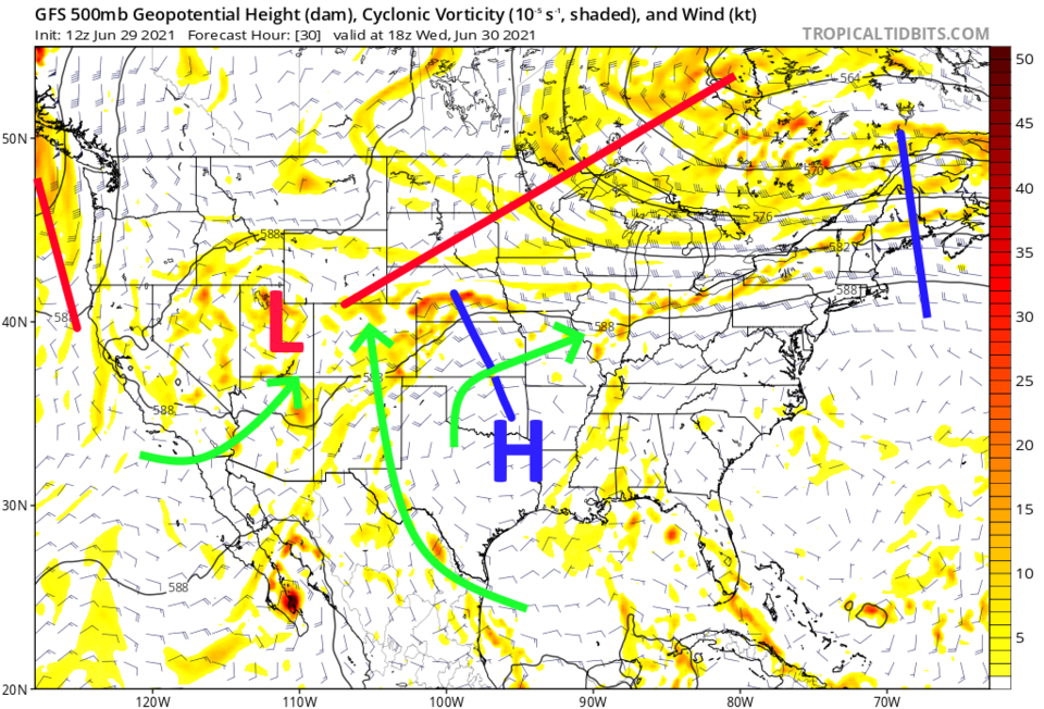 Figure 3: the 500mb upper air map for noon Wednesday from tropicaltidbits.com
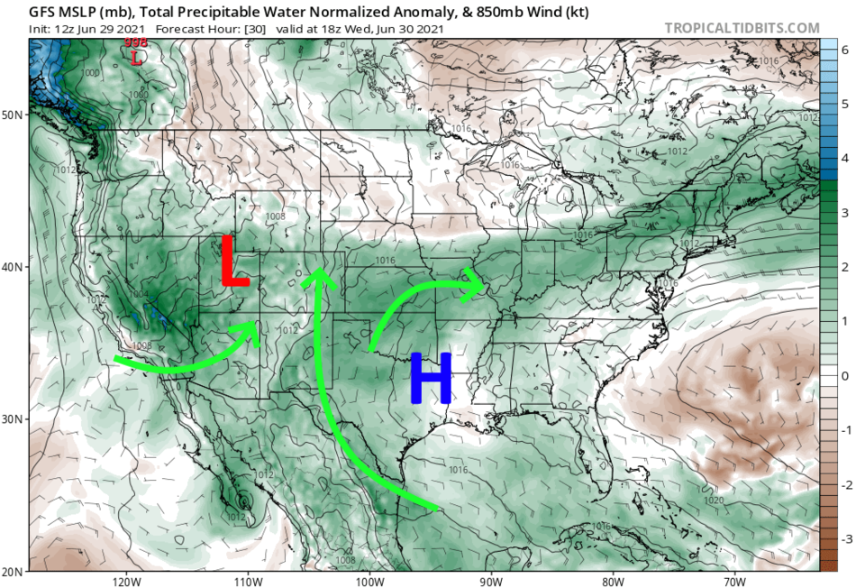 Figure 4: the precipitatable water departure from normal map for noon Wednesday from tropicaltidbits.com
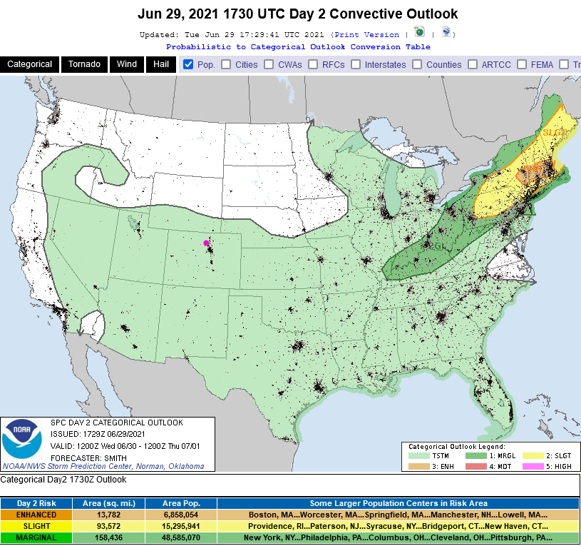 Figure 5: the SPC severe storm forecast Day 2 for Wednesday.
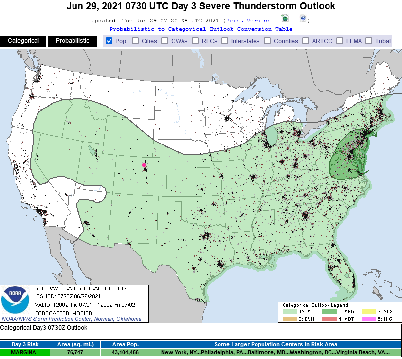 Figure 6: the SPC severe storm forecast Day 3 for Thursday.
The Longer-Range Forecast:
By Independence Day, a high pressure center gets reestablished over northern Arizona (Figure 7) warming us up, but northerly flows aloft will keep us from seeing extreme heat. It will also help kick off afternoon storms each day (Figure 1) as we typically see with "northwest flow". The mountains and some locations on the plains see significant rains these next five to ten days (Figure 8 and Figure 9) from these storms. The western slopes will see small amounts of rain now and then. Overall, it is a nice way to spend summer!
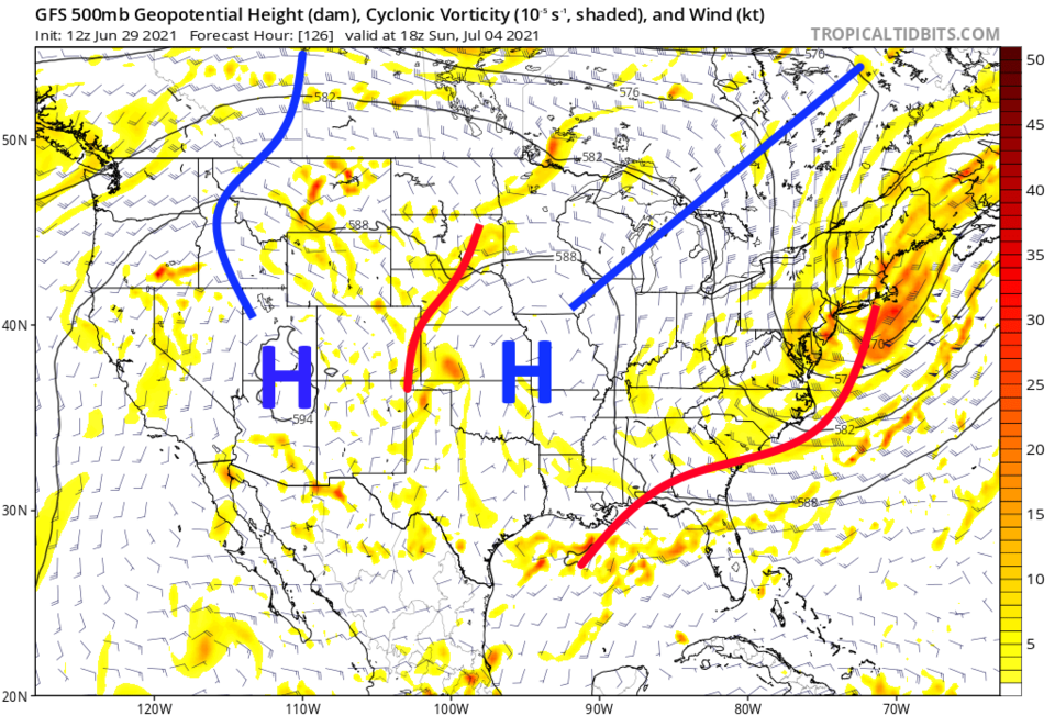 Figure 7: the 500mb upper air map for noon Sunday from tropicaltidbits.com
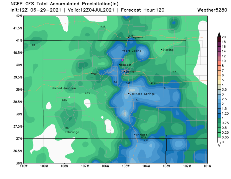 Figure 8: The GFS total precipitation forecast for the next 5 days from weather5280.com
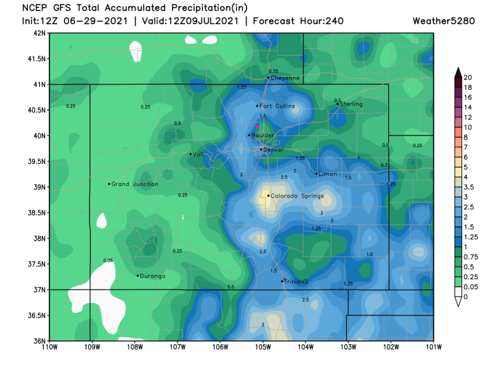 Figure 9: The GFS total precipitation forecast for the next 10 days from weather5280.com


