In Brief:
Afternoon thunderstorms (briefly severe now and then) and highs in the 80'sF are the rule for the week.
Update 5/28 8:30a:
As Figure 1 update shows in the gallery, we are under a Marginal Risk (1 on a scale of 1-5) of severe weather later this afternoon. Some storms may produce large hail and damaging winds, but the storms will be very widely scattered fast-moving, and the local NWS office really feels this is barely a Marginal Risk situation. So we may be a 0.75 on a scale of 1-5. A cell or two may reach severe levels for a part of its life cycle.
End 5/28 8:30 a.m. update.
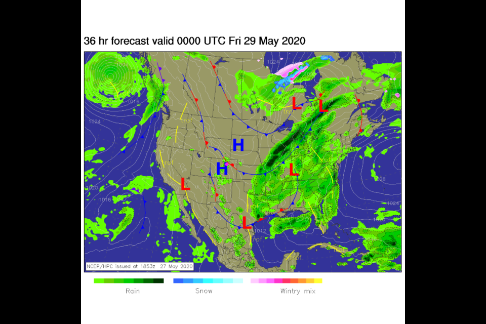
The Forecast Discussion:
We are caught between two stationary fronts on Thursday (Figure 1 in the gallery of images). Moisture will be in place from the Gulf of Mexico and the Pacific. Daytime heating will use these convergence zones and that energy to kick off daily thunderstorms all week (red boxes in Figure 2 in the gallery). We will see storms pop up in the early afternoon in the foothills to the west. The storms will then drift off across I-25 before dying out on the plains to the east. Brief heavy rain, dangerous lightning, and pea-sized hail are possible right under storm cells.
The Longer-Range Forecast:
Looking at the weekend, it will continue to reach for the upper 80'sF every day before the afternoon storms wander down to cool us off (red boxes in Figure 2 in the gallery). If you are lucky to get a direct hit by a storm, you might pick up a good amount of rain. On average, though, most folks will see less than a quarter of an inch of rain over the next four days (Figure 3 in the gallery). Be prepared for the heat - Saturday morning will be about 15F above normal (Figure 4 in the gallery) and we'll get even hotter by Monday when a 90+F high temperature is likely. Keep an eye on the western skies every afternoon. Be prepared to shelter from lighting and brief shots of pea-sized hail from a thunderstorm direct hit.
The Video Forecast from Longmont Public Media

