Skip to content
Join our Newsletter

Update 1/11 11am: Next Storm/Next Snow Forecast Discussion from the Cherrywood Observatory – January 10-12, 2020

This content was originally published by the Longmont Observer and is licensed under a Creative Commons license.

In Brief:

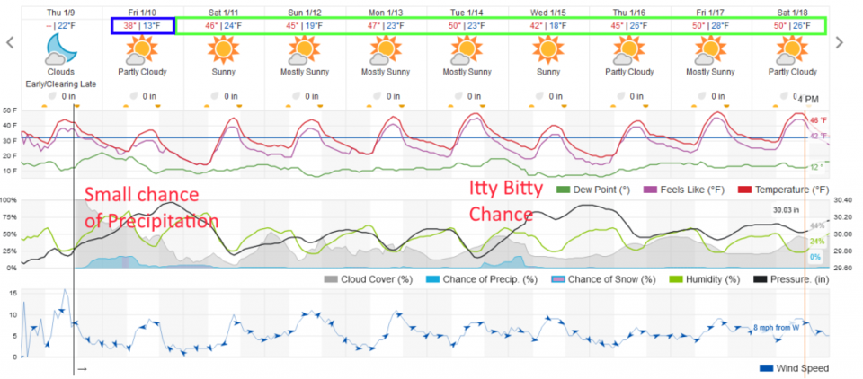
Friday will be chilly with a chance for showers and snow showers throughout the day ending mid-late afternoon. We warm to the upper 40's F to near 50F for the most of the next 9 days with only a blip-on-the-radar chance of showers mid-week next week. Where is our exciting winter weather?

Update 1/11 11am:

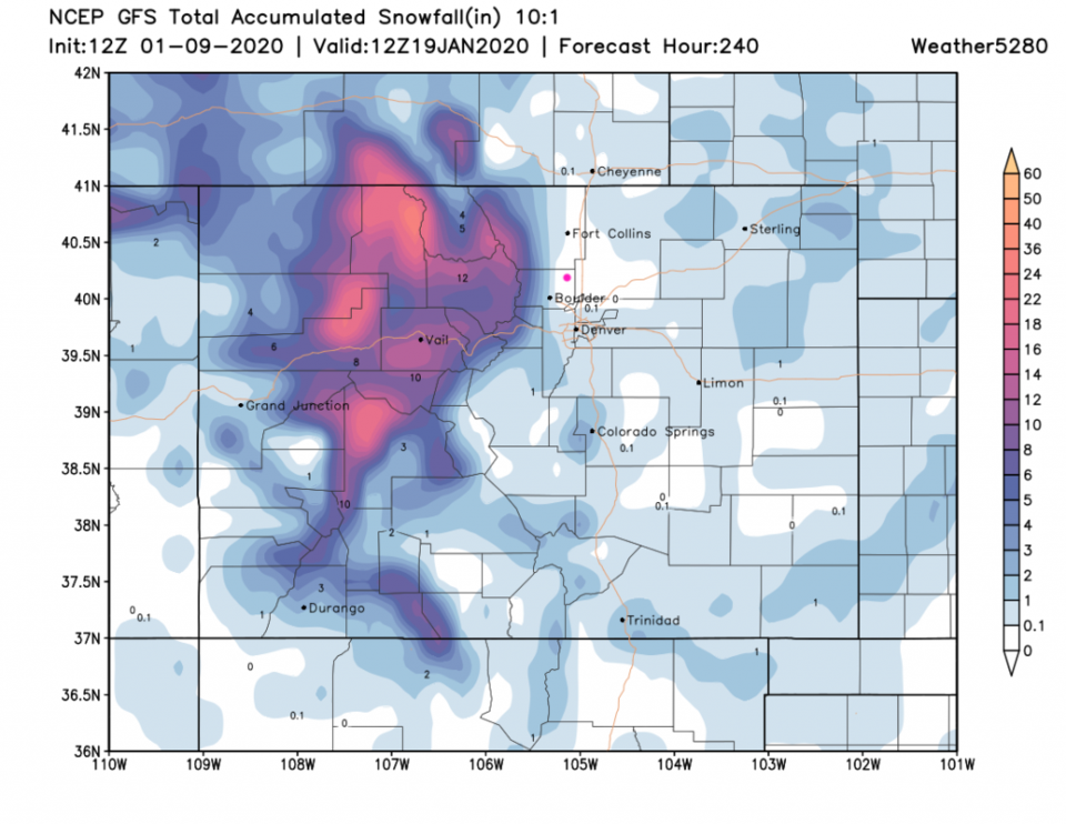
I received about 1/10th of an inch of dusty snow pre-dawn yesterday - and that was it. The storm even had trouble keeping the skies as cloudy as had been expected. That wasn't much of a storm. The trend of nearby snow (the mountain conveyor belt of moisture) continues for the next 10 days (Figure 1 update). Longmont remains almost snow-free. The mid-week snow chances are now fading out. I think I'll go out and do some pre-Spring yard work today. WYSIWYG - what you see for weather today is what you'll have for most of the next 10 days (just a few degrees variation is likely day-to-day).

Figure 1 update: 10:1 (snow to liquid) snowfall totals through the next 10 days from the GFS and weather5280com for Colorado made Saturday early morning.

End 1/11 11am update.

Forecast Discussion:

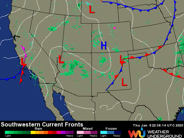
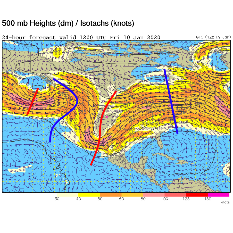
We get fronts and we get cold weather, but we can't seem to get snow. Our front from last night is all the way down into New Mexico and Texas (Figure 1). The cold air coming in Friday is sitting under the deep trough moving by today (Figure 2 - Friday). Our chances of precipitation are still very low (Figure 3) with the 'heaviest' period of snow (rain?) from late morning through late afternoon (Figure 4).

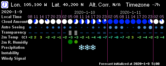
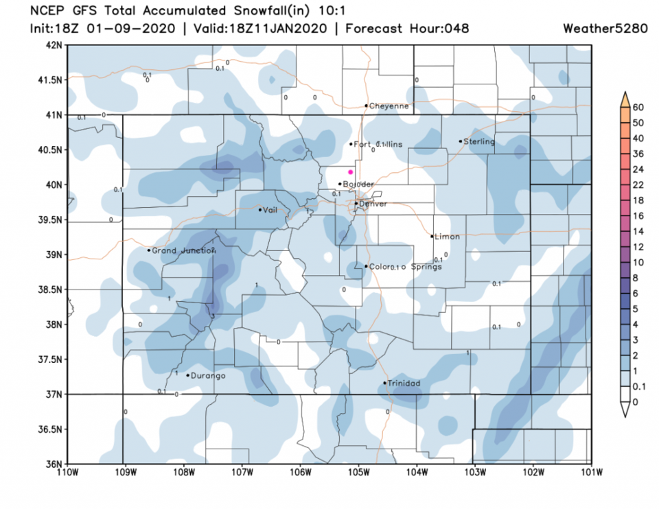
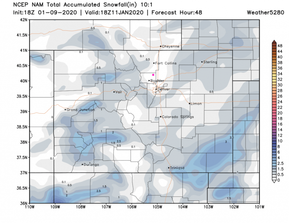
The GFS keeps us snow-free (Figure 5) as does the NAM (Figure 6). Neither have much measurable water either (rain + melted snow).

The Longer Range Forecast:

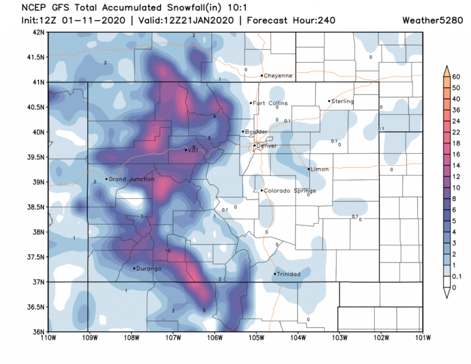
We warm to just a bit above normal for high temperatures for the next week and beyond (Figure 3). The GFS keeps us snow-free for the next 10 days (Figure 7) though a system will pass the state (like this one) mid-week next week.

Figure 1: the current surface analysis map from Thursday PM and the weatherunderground.com
Figure 2: The 500mb forecast upper air analysis for early Friday AM. Pink dot is Longmont. Red lines are troughs, blue lines are ridges.
Figure 3: the graphical forecast for the next 10 days for Longmont, CO from weatherunderground.com
Figure 4: The 2.5 day sky conditions forecast from 7! Timer (the GFS).
Figure 5: 10:1 (snow to liquid) snowfall totals through Saturday noon from the GFS and weather5280com for Colorado made Thursday afternoon.
Figure 6: 10:1 (snow to liquid) snowfall totals through Saturday noon from the NAM and weather5280com for Colorado made Thursday afternoon.
Figure 7: 10:1 (snow to liquid) snowfall totals through the next 10 days from the GFS and weather5280com for Colorado made Thursday afternoon.

Current Weather

Cloudy

Cloudy

48°F

UV Index
0 Low
Pressure
30.02 Rising
Visibility
8 miles
Dewpoint
44 °F
Humidity
87%
Wind
NNE 3.1 mph
Gust
8 mph
Wind Chill
47 °F

Hourly Forecast

Today
10 PM
47°F
Rain
Today
11 PM
46°F
Rain
Tomorrow
12 AM
46°F
Rain
Tomorrow
1 AM
46°F
Cloudy
Tomorrow
2 AM
46°F
Rain
Tomorrow
3 AM
46°F
Rain
Tomorrow
4 AM
46°F
Rain
Tomorrow
5 AM
46°F
Rain
Tomorrow
6 AM
46°F
Cloudy
Tomorrow
7 AM
47°F
Cloudy
Tomorrow
8 AM
47°F
Mostly cloudy
Tomorrow
9 AM
49°F
Mostly cloudy

7 Day Forecast

Mostly cloudy w/ t-storms

Wednesday

71 °F

Turning cloudy; a thundershower in parts of the area this morning followed by thundershowers this afternoon


Rain

Wednesday Night

46 °F

Rain and drizzle


Partly sunny w/ showers

Thursday

59 °F

A touch of rain in the morning; otherwise, cooler with increasing amounts of sun


Partly cloudy w/ showers

Thursday Night

40 °F

A couple of showers in the evening; otherwise, partly cloudy


Mostly cloudy

Friday

68 °F

Mostly cloudy


Clear

Friday Night

38 °F

Clear


Mostly sunny

Saturday

77 °F

Mostly sunny, pleasant and warmer


Mostly clear

Saturday Night

41 °F

Mainly clear


Mostly cloudy

Sunday

74 °F

Sun followed by clouds; breezy in the afternoon


Intermittent clouds

Sunday Night

49 °F

Windy in the evening; becoming partly cloudy


Sunrise and Sunset

Sunrise
6:02 AM
Sunset
7:54 PM

Based on AccuWeather data