This content was originally published by the Longmont Observer and is licensed under a Creative Commons license.
In Brief:
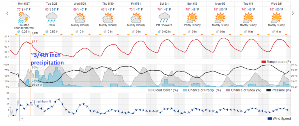
Rain chances pick up today around 1pm with a cold front passing Longmont around 4pm. Rain showers will taper off late night Tuesday with under 1 inch (probably around 3/4ths inch) falling over this day and a half.
We warm up and see afternoon thunderstorms most days with a bit of rain and lighting. For temperatures we'll stay below normal for a few days then return to normal by the end of the week.
2:30pm update
There is now a slight risk (2 on a scale od 1-5) of severe weather this afternoon for hail, strong winds, and a tornado. Please monitor the weather and your weather apps for the rest of the day for NWS watches or warnings.
end 2:30 pm update
Forecast Discussion:
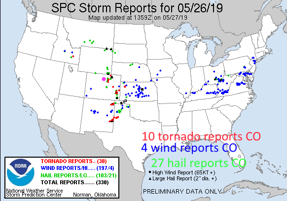
It was an active thunderstorm day in Colorado Sunday (and my family was out hiking at Rabbit Mt.-yikes). There were 10 tornado reports, 4 wind reports, and 27 hail reports yesterday in our state (Sunday- Figure 1). There were 4 tornadoes in Weld county (but that IS a rather large county).
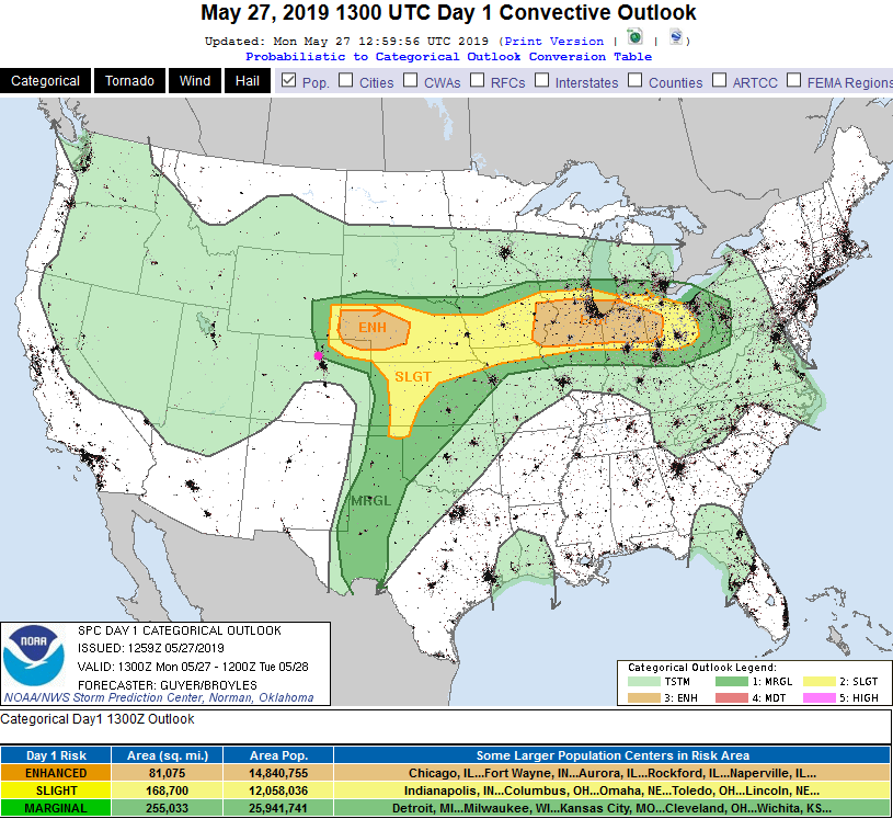
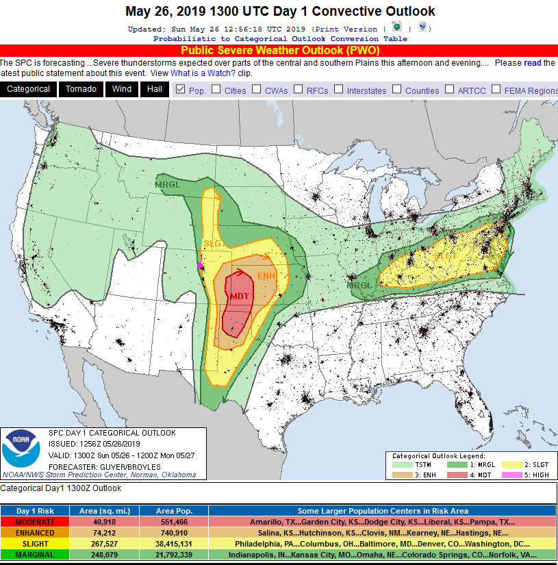
Today - there is a Marginal Risk (1 on a scale of 1-5) of severe weather almost down to Longmont and almost out to Estes Park. Berthoud, Loveland and Fort Collins are all in the Marginal Risk zone. A super cell thunderstorm or two with tornadoes and large hail are possible. The risk is much greater up in the northeast corner of the state (where a Slight and even Enhanced risk will exist this afternoon).
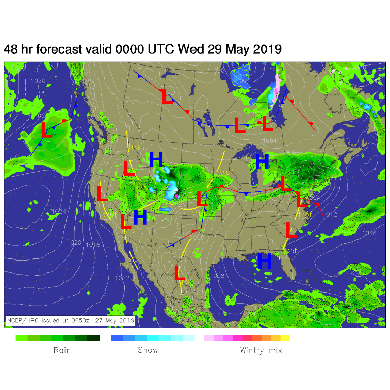
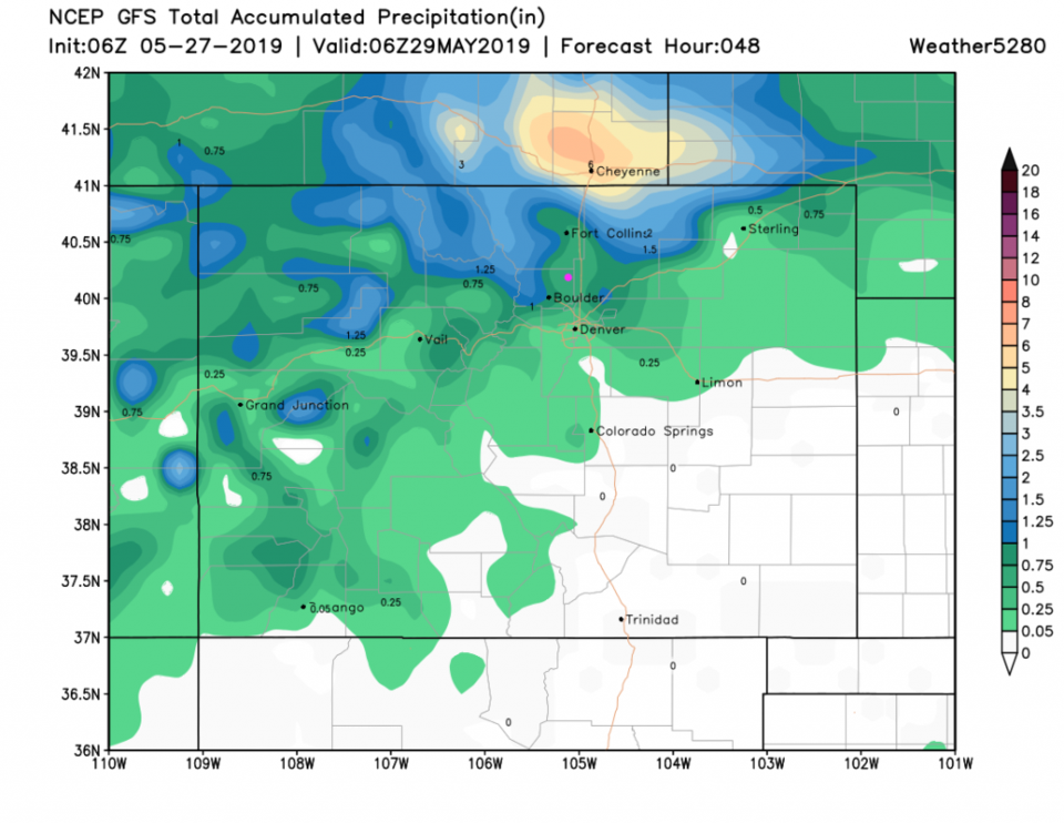
On and off rain showers will occur through late night Tuesday (Figure 3). We should see about 3/4th of an inch of rainfall in Longmont for this event (Figure 4 and Figure 5).
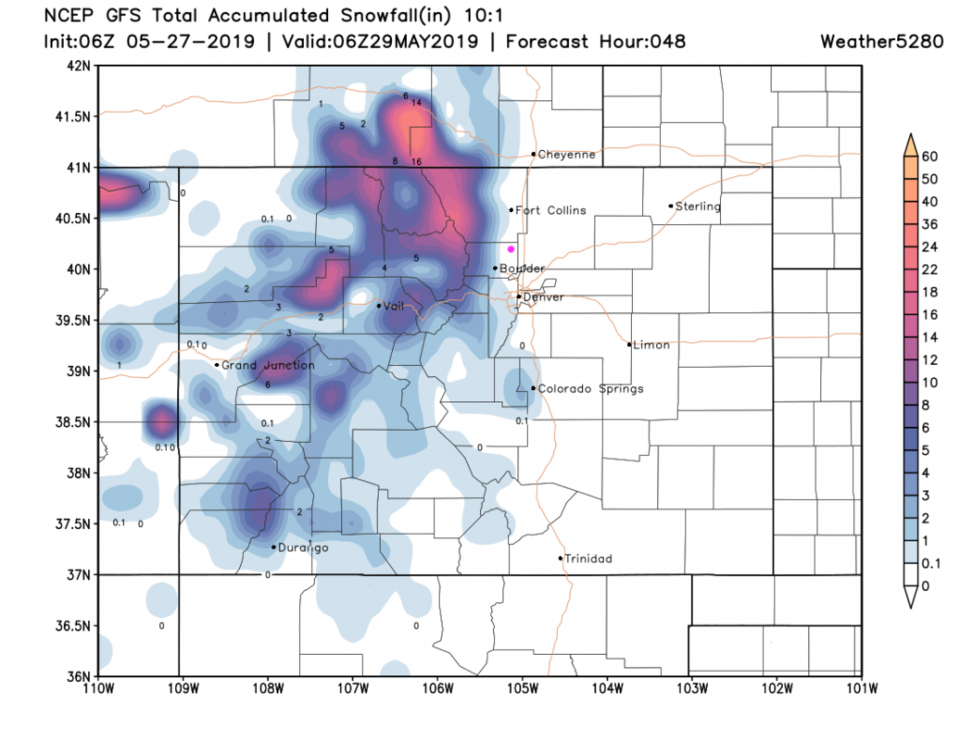
There will be accumulating snow above 8000 feet (but snow may dust grassy surfaces even down to Boulder and far southwest Denver- Figure 6). The NWS is planning to issue a Winter Storm Watch for the northern Colorado Mountains as 1 to 1 1/2 feet of snow may build up at higher elevations.
The Longer Range Forecast:
We slowly warm to normal by the end of the week (Figure 4) with a return of wandering afternoon thunderstorms that drift off the higher elevations once daytime heating kicks them off. More on those later!