This content was originally published by the Longmont Observer and is licensed under a Creative Commons license.
In Brief:
Scattered showers wandered around I-25 Saturday PM. Now the heat is on. We approach or pass 100F with nearly ideal heating conditions Sunday and Monday/Labor Day. We will probably break both daily and the month of September temperature records. A front begins a cool down Monday PM right after the blow torch. Next weekend looks Fall like with returning rain.
11am 9/2 Labor Day Update:
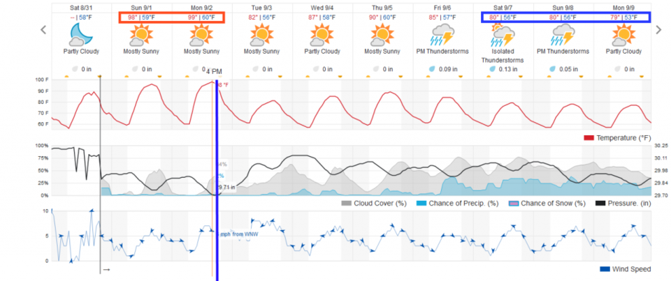
With a wind shift still slated for later this afternoon/early evening (that will start a 10-15F cool down) we should hit or exceed 100F between 3-5pm today (Figure 1 update).
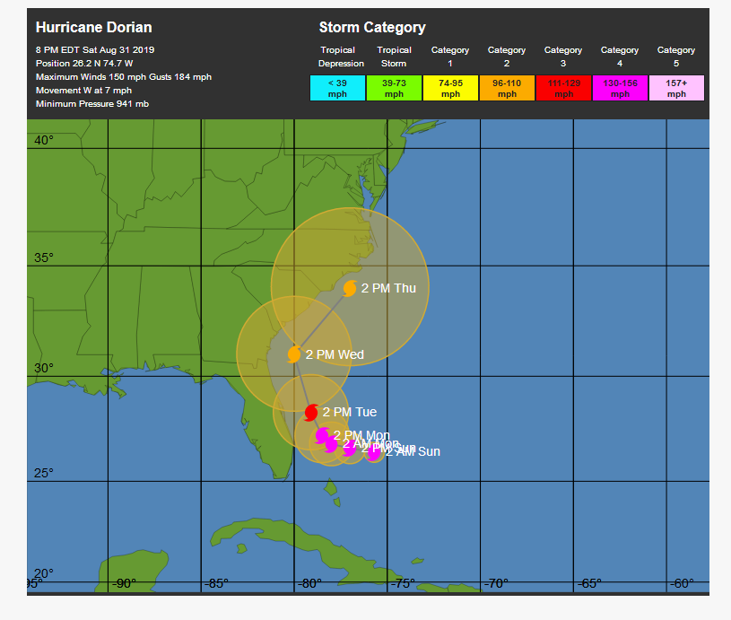
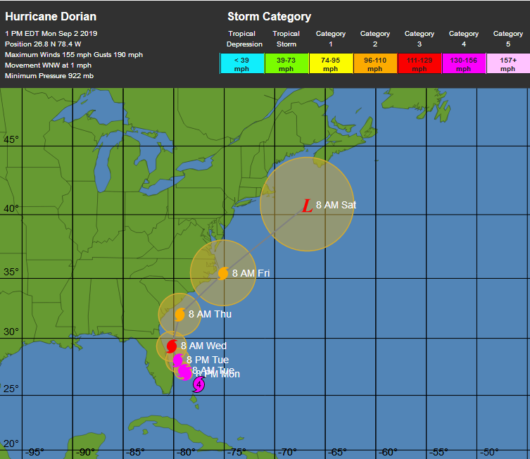
Hurricane Dorian has been weakened by interaction with the Bahama's and has been down graded to Cat 4 storm (Figure 2 update). It is expected to hug the SE U.S. coast with a landfall in Florida, Georgia, or the Carolina's still possible. It was the most powerful Cat 5 storm recorded in the Atlantic yesterday with 1 minute sustained winds at 185mph, a central pressure down to 910mb, with a 10 second wind gust at 225mph. (The Enhanced Fujita scale for tornadoes places EF-5 tornadoes at wind speeds greater than 200mph). Unbelievable. Really unbelievable. It has been parked over the islands for much of 24 hours. Reports of extreme devastation are expected once we get information from residents out of the storms path.
End 11am 9/2 Labor Day Update.
Forecast Discussion:
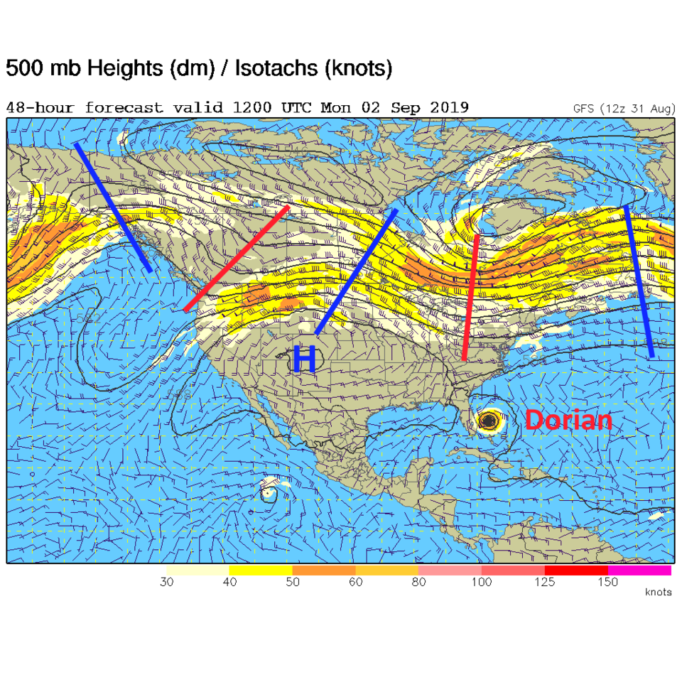
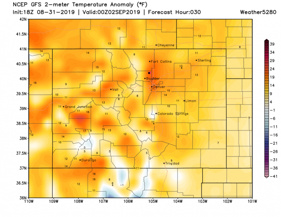
The giant western ridge builds with the high center almost centered on Colorado for the rest of the weekend (Figure 1). The 500mb height will be at or above record heights. We will see temperatures around town, with down slope flow adding heat to the heat, almost 20F above normal (Figure 2). The weatherunderground.com temperatures will be at (or above 100F) Sunday and Monday/Labor Day. The record highs for these days should be broken (Those records for DIA are: Sunday 97F in 1995, Monday 95F in 1983), as should the record high for all of September (that 97F record). Air quality will be poor with sinking stagnant stable air. Don't go run around outside if you have any medical issues.
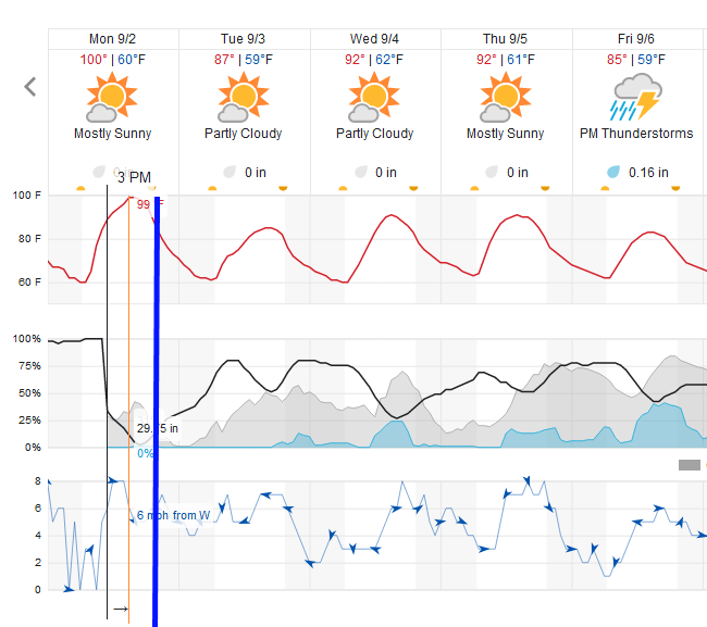
The good news? A cold front will push in Monday late afternoon and we drop 15F or more into Tuesday (Figure 3).
The Longer Range Forecast:
We hang out in the 80s'F most of the week before another few cold fronts cool us to the upper 70'F next weekend as rain chances return (Figure 3).
Hurricane Dorian update:
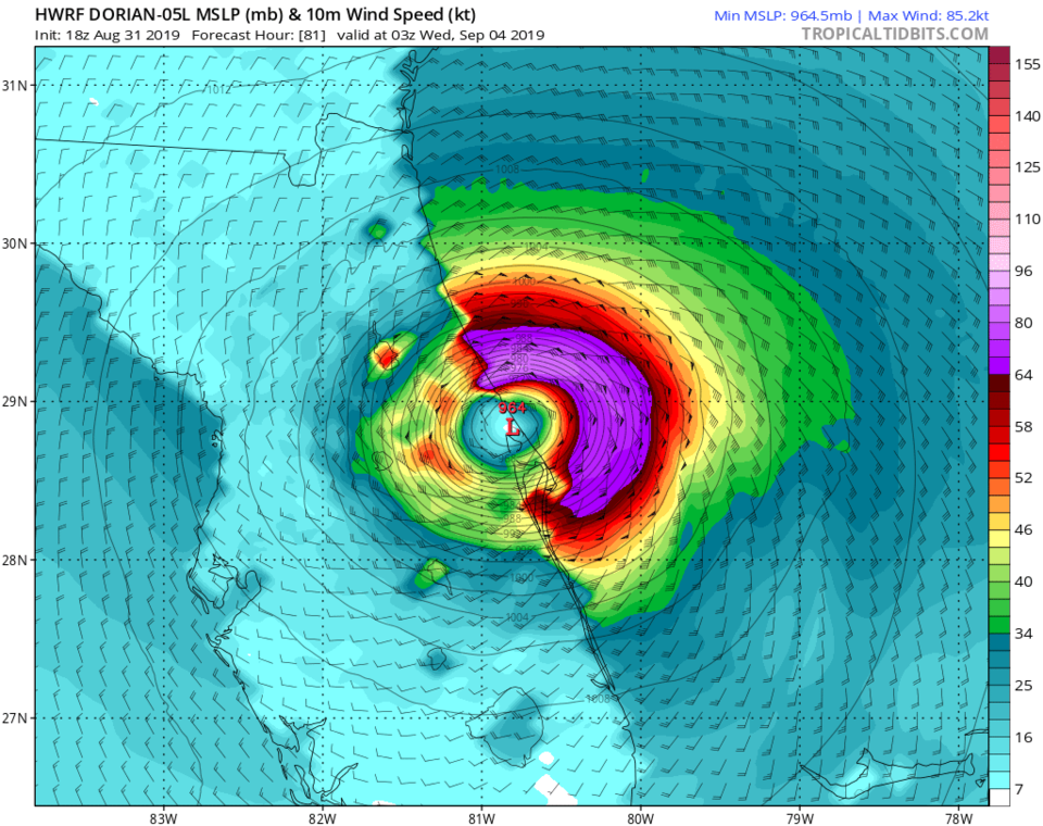
The National Hurricane Center forecast track for the hurricane has trended much farther to the east staying off the coast of Florida and the U.S. (Figure 4). BUT- not all models are agreeing as we can see in the HWRF model that has Dorian making landfall near Cape Canaveral late Tuesday (Figure 5). The more recent model runs are trending back towards Florida and the SE U.S. - so no one out there is safe yet. Keep your eye on this if you have friends or relatives out there.