This content was originally published by the Longmont Observer and is licensed under a Creative Commons license.
In brief:
Mild weather gives way to really warm weather for the weekend. We have a small chance of showers Tuesday then some rain Thursday through Saturday AM (unsettled conditions). A dusting of snow might happen overnight Friday PM to Saturday AM along I-25. Spring is springing again.
Forecast Discussion:
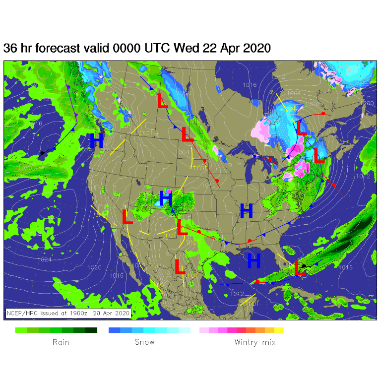
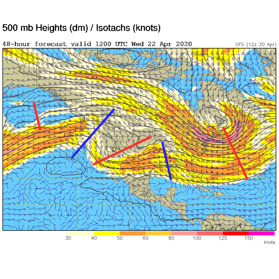
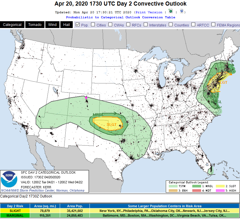
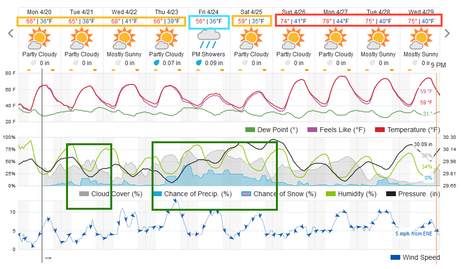
An upper level ripple is passing the state Tuesday. It will pull some moisture up into the state and maybe create a splash of rain and a rumble of thunder for Longmont (Figure 1). That ripple is visible in the upper air map in Figure 2. Look at the overall giant ridge pattern over the western U.S. This will be responsible for the warm weather going forward. The chance of thunder for Tuesday might not extend as far north as Fort Collins Tuesday (Figure 3). Rainfall amounts will be spotty and light Tuesday (Figure 4).
The Longer Range Forecast:
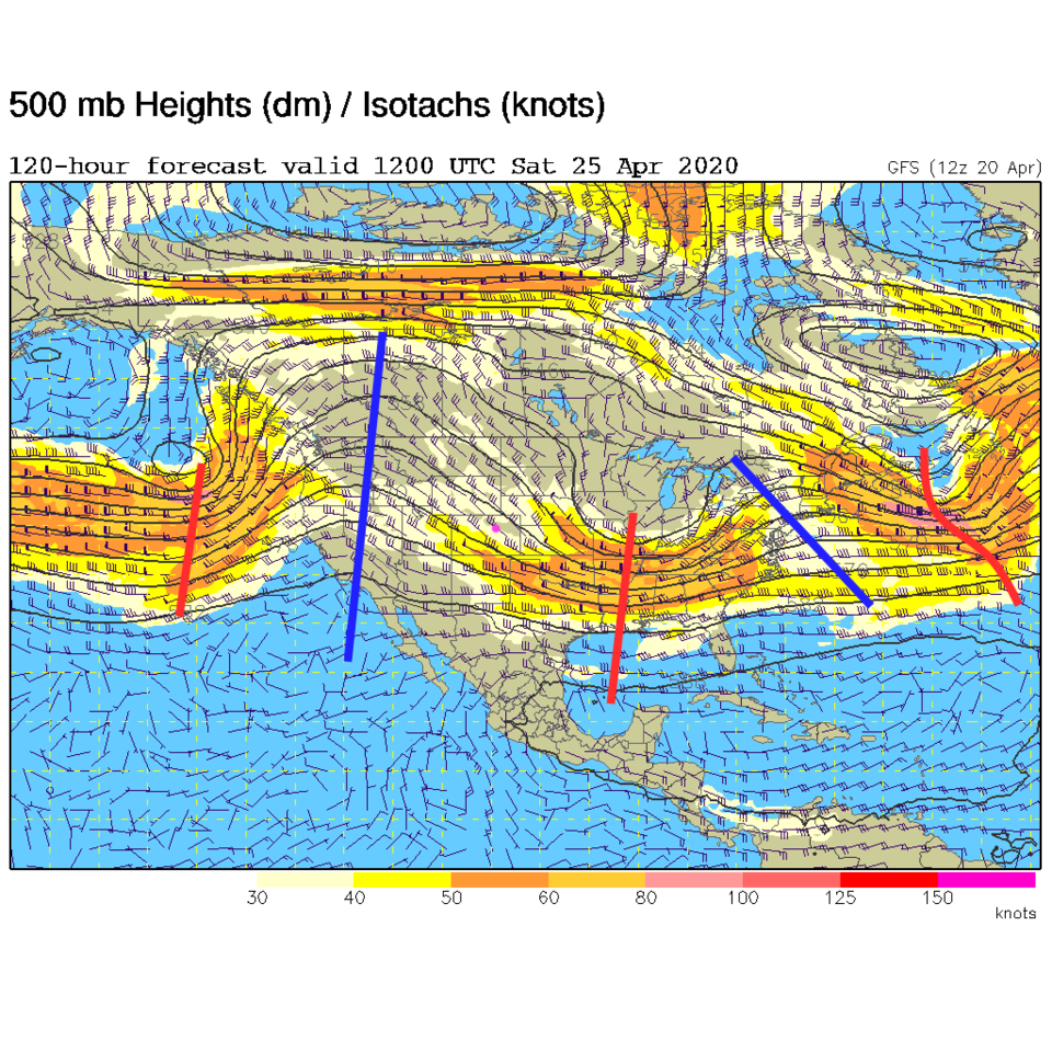
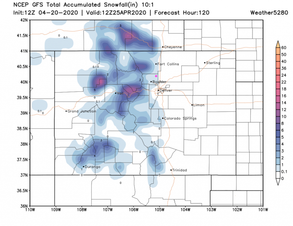
Later in the week, a larger trough passes (it has passed in Figure 5). This slow moving feature will give us moderate rain shower chances from Thursday PM to Saturday AM (Figure 4). If temperatures drop low enough early Saturday morning, and if showers are moving by, we might get a dusting of snow (Figure 4).
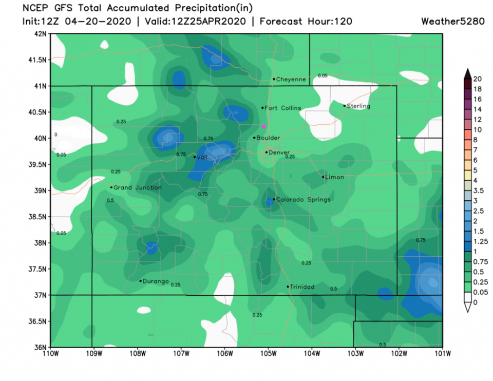
That snowfall will be very light, but the GFS does see it (Figure 6). Rainfall amounts through Saturday should remain between 0.25 and 0.5 inch of water (Figure 7). Nothing big.
Starting Sunday, temperatures will really soar thanks to that large ridge in Figure 5.
We **** might **** kiss 80F for the first time in 2020. Cross fingers! (The weatherunderground.com model doesn't warm it up quite that much.)