This content was originally published by the Longmont Observer and is licensed under a Creative Commons license.
Forecast Discussion:
Update 10am:
We've had a weak wind shift (hardly a cold front) enter the state from the north that is creating a weak, but moist up slope flow over northeast Colorado. An afternoon small short wave in the upper atmosphere will help increase instability. Add the very high temperatures (but include a cap in the atmosphere - which is a warm layer that inhibits thunderstorms from forming) - and you have the ingredients for a marginal risk of severe thunderstorms this afternoon from Denver north including Longmont, Berthoud, and Ft. Collins but not including Boulder or Estes Park.
Storms should be widely scattered. Most Front Range residents will only see a thunderstorm or two in the distance. For those that get hit, damaging hail and winds (and lightning and fire danger) are the risk. Storms should start to bubble up at 1pm and begin to get strong after 2pm. Later storms that form will move off onto the eastern plains by 6-8pm. Skies will clear after sunset.
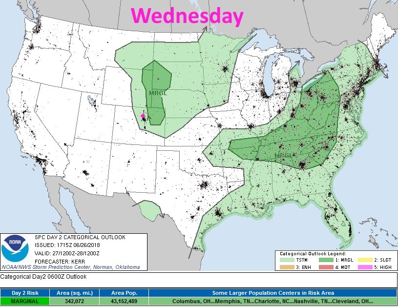
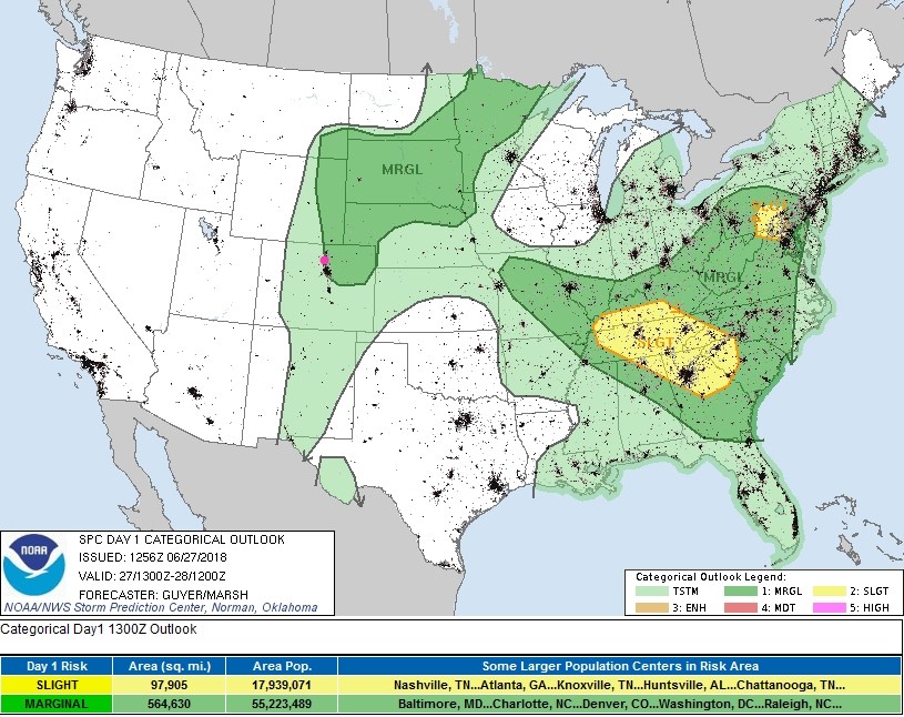 Figure 1 update: the day 1 SPC thunderstorm and severe weather forecast made Wednesday (valid Wednesday).
End 10am Update.
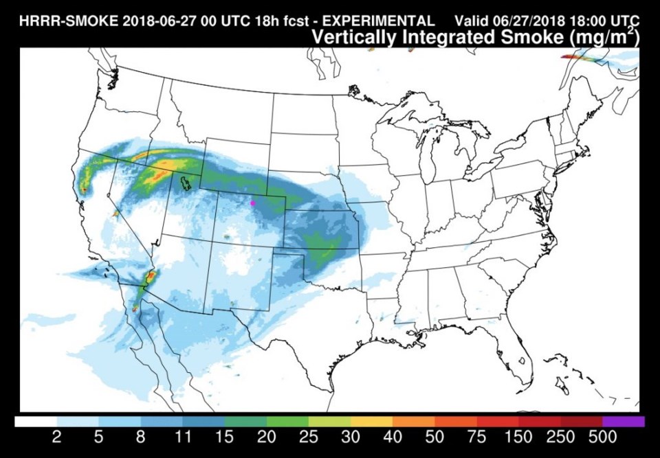
We are climbing the mountain of heat this week, but we have a surprise chance of thunderstorms return this afternoon! You may notice that the sky is a bit smoky again. This time it is from fires in California and Nevada (see Figure 1).
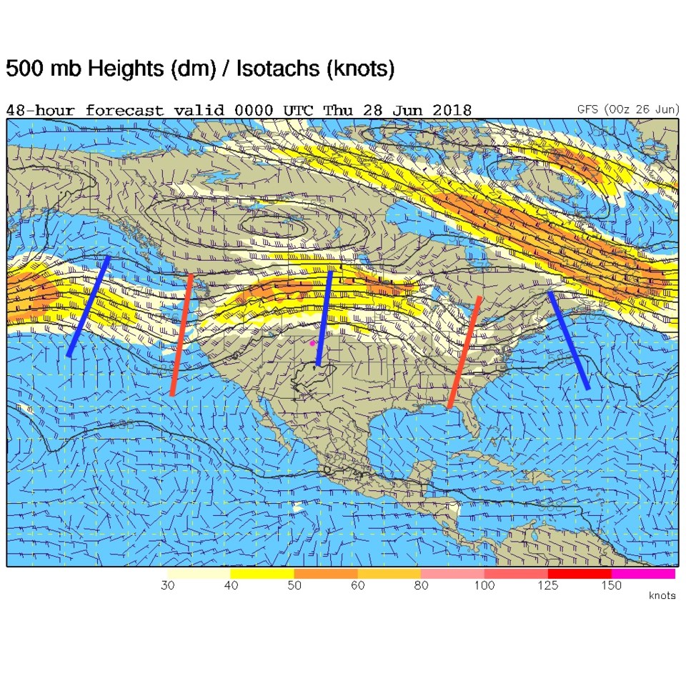
The 500mb map shows the ridge right overhead today (Figure 2), but the SPC sees a short wave trough that will be running over our hot and somewhat moist atmosphere. They see a marginal risk of hail and strong damaging winds just east of I-25 later today. And there is a chance of a thunderstorm up into the foothills (Figure 3).
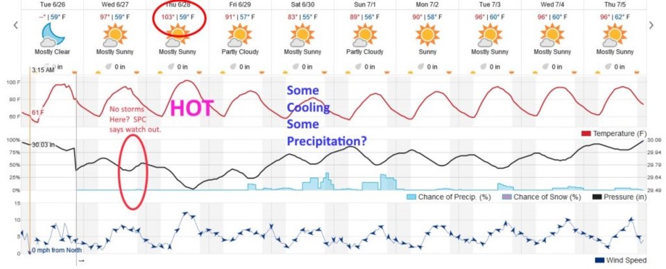
Figure 4 takes us out the for the next 10 days. This model really doesn't see the chance of thunderstorms today (there is a minute bump in the % chance of rain). Tomorrow we should set a new high temperature record and may climb as high as 105F. Wow.
The longer range forecast:
We still see a deeper trough coming in for the weekend with "some" cooling and "some" chances of afternoon rain... but neither are looking too notable. 90'sF return the following week.