This content was originally published by the Longmont Observer and is licensed under a Creative Commons license.
Forecast Discussion:
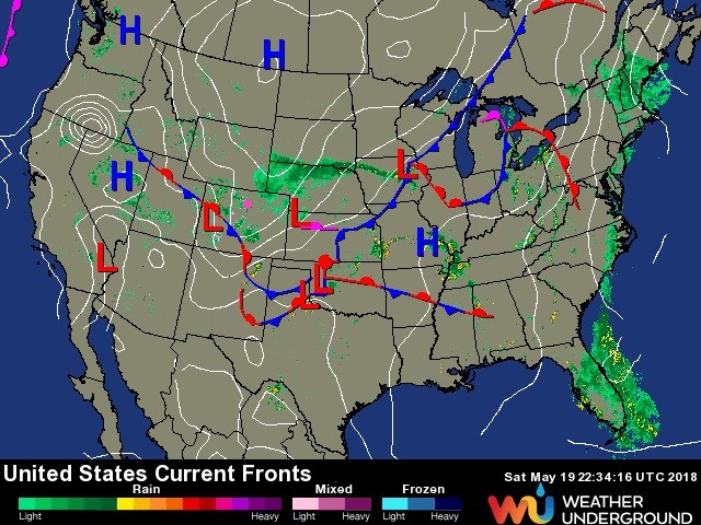
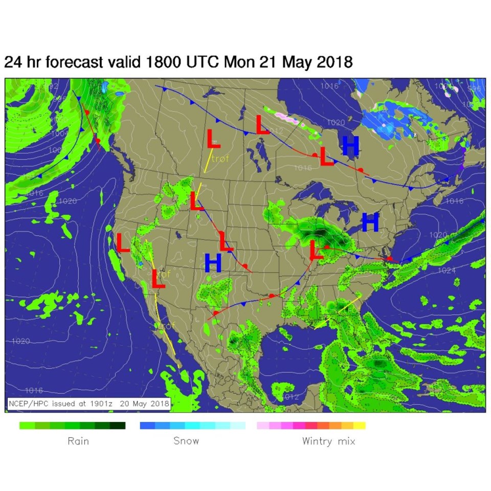
We have a return of southwest flow from Sunday into Monday (behind the front to our southwest; Figure1). A short wave kicked off more showers on Sunday, that largely missed Longmont (red lines near Colorado in Figure 2).
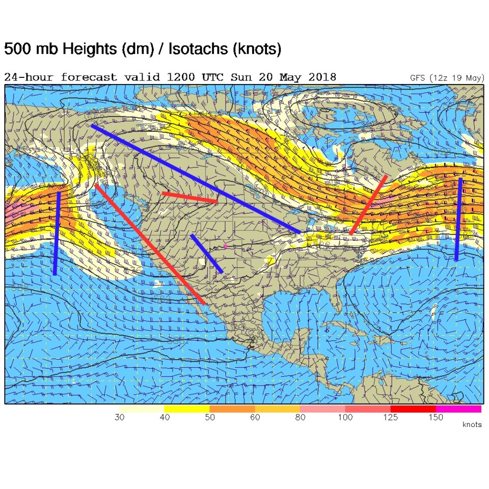
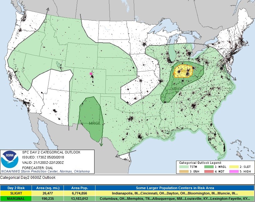
For today, high pressure is forming over Colorado (Figure 3). There is a general troughiness (Figure 5, red line to our west) in the upper air pattern still, and with plenty of moisture around, afternoon thunderstorms are possible with temperatures returning to 80F. Though a storm may briefly become strong and dump some small hail and blast a small area with strong winds, overall, just general, normal strength, thunderstorms are expected (Figure 4).
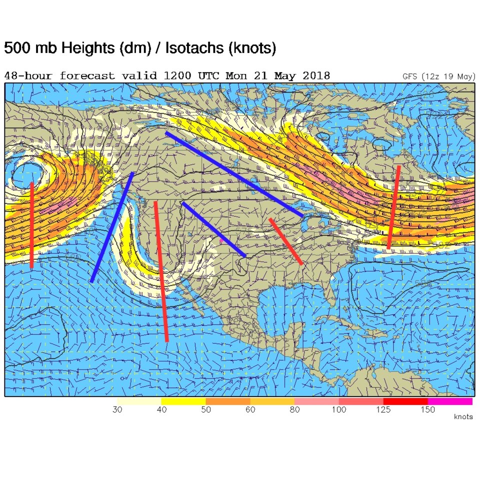
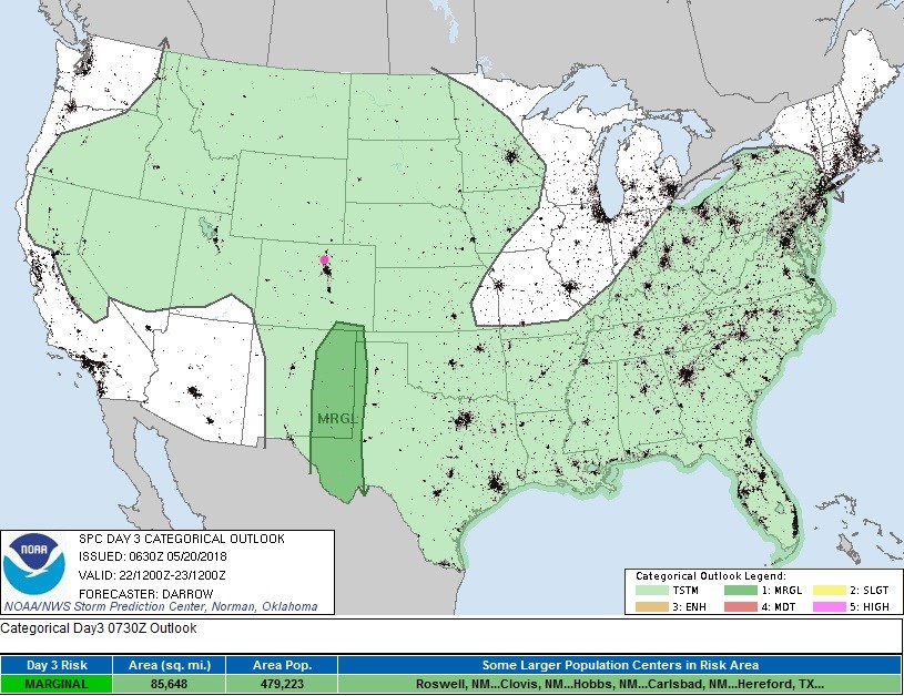
This western trough (Figure 5 again) will kick off severe thunderstorms way down in New Mexico tomorrow (Figure 6) as it will today (Figure 4). We're too far north, in this pattern, for the severe weather.
The longer range forecast:
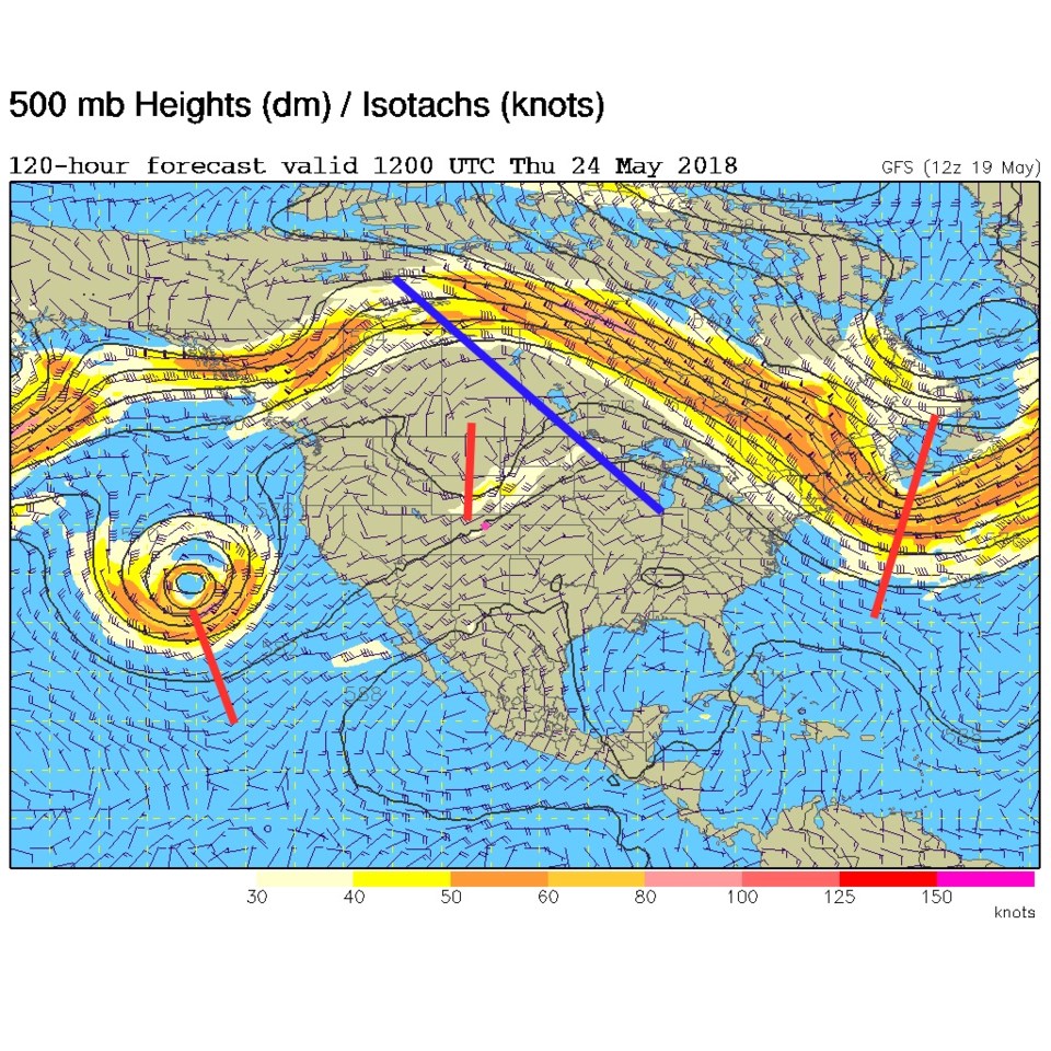
We climb to around 80F everyday this week and have a chance of wandering afternoon thunderstorms. This is very normal, early summer-like weather. Figure 7 shows the overall (northern branch of the jet stream) ridge over the western U.S., but shows a short wave in the southern branch passing on Thursday morning. A persistent cut-off low is rolling around in the Pacific.
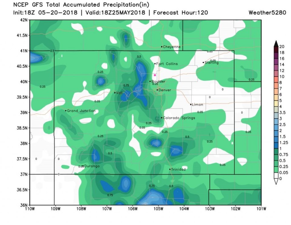
The precipitation outlook for the next five days (Figure 8) shows the spotty nature of the rainfall this week. We may or may not see one of these cells, it will be a random hit if we do.