This content was originally published by the Longmont Observer and is licensed under a Creative Commons license.
Forecast Discussion:
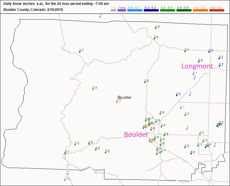
It was a cold night Thur/Fri with snow flurries that dusted the landscape. Figure 1 shows a quarter inch of snow in Longmont and 1/2 to 1 inch of snow in Boulder. It warmed to the 40'sF and then down slope winds picked up Friday PM keeping night time temperatures in the 40'sF for while.
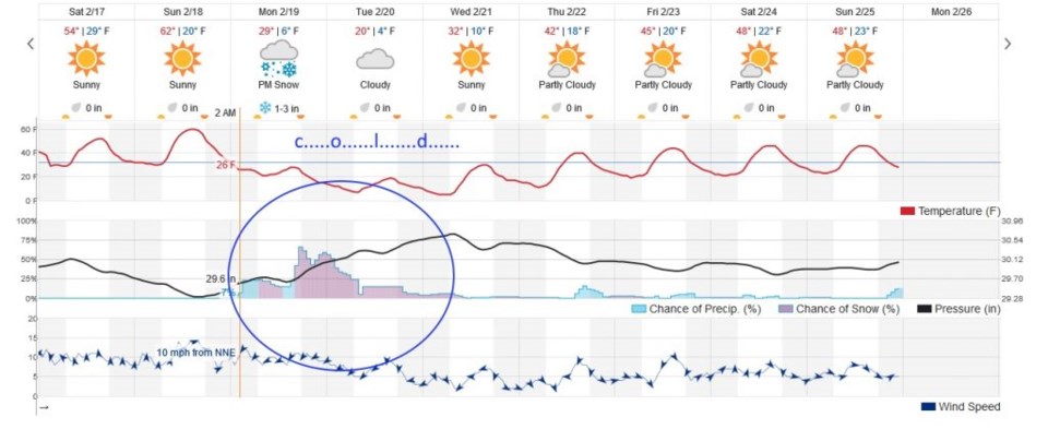
Today will be clear and somewhat warmer (50'sF).
The longer range forecast:
Oh oh, it's happening again! Our Monday/Tuesday storm is shrinking for the Longmont and Denver area. We are looking more at 1-3" of snow from the weatherunderground.com model (but really cold air for 3 days) (Figure 2).
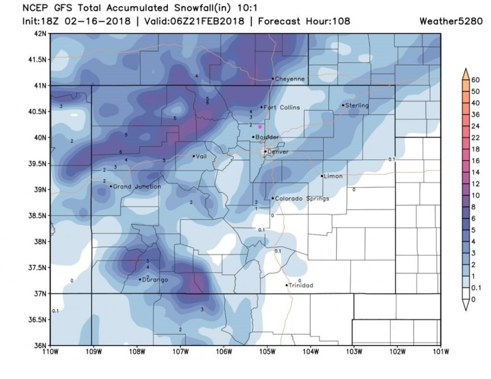
The GFS is now calling for 1-2" as well for Longmont (Figure 3). Let's let another day go by and we'll look at this freshly!