This content was originally published by the Longmont Observer and is licensed under a Creative Commons license.
By John Ensworth
Discussion:
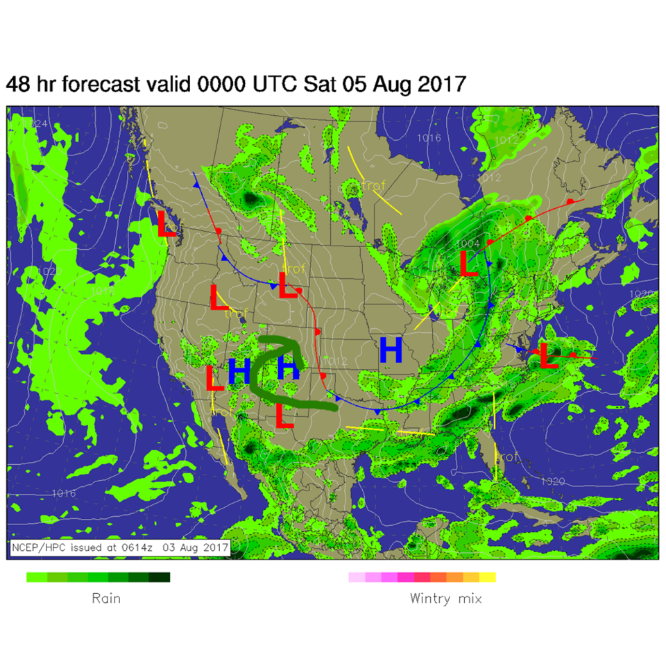
We are pulling rapidly out of the cool weather that was in place on Thursday. Longmont received about 0.10” of rain in the morning… yea! (This is being drafted midday as I’m going camping, so I don’t know what did or did not form Thursday afternoon.) With high pressure out in Missouri, we’ll have some wrap around circulation bring in moisture by later today, Friday. Figure 1 shows this circulation in green arrows and the approaching moisture.
Figure 1: Future surface map with anticipated precipitation Friday PM.
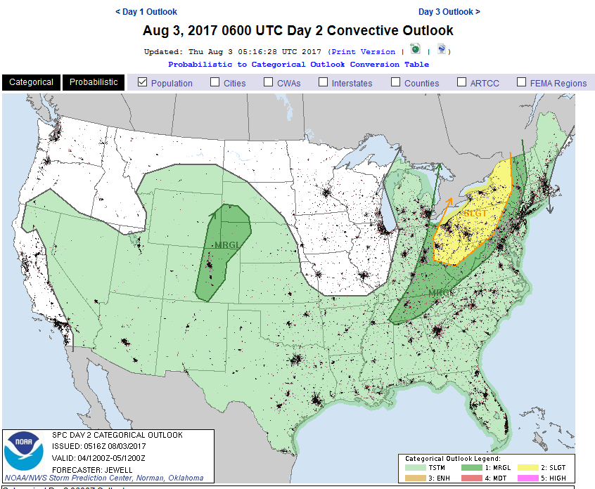
Because of this moisture and heat and the favorable change in wind direction and speed as one goes up overhead in the atmosphere (called shear), severe weather is possible today. Figure 2 shows where the marginal risk is today. The primary threat is for large and damaging hail.
Figure 2: The SPC in Norman OK severe weather outlook for Friday, issued Thursday midday.
In a look at the longer range: With the ridge off the west coast, the upper air flow continues out of the northwest allowing cool fronts to invade every few days with short waves traveling down the flow. (As discussed yesterday.)
Our next stronger front invades Sunday with another short wave (purple box in Figure 3). The ridge position is marked off the West Coast in dark blue. Figure 4 shows how this pattern continues on into next week with a parade of short wave troughs that will keep knocking down temperatures and giving us chances of rain. Hit and miss rain, but chances of rain.
Figure 3 The Sunday AM 500mb map with shortwave trough highlighted.
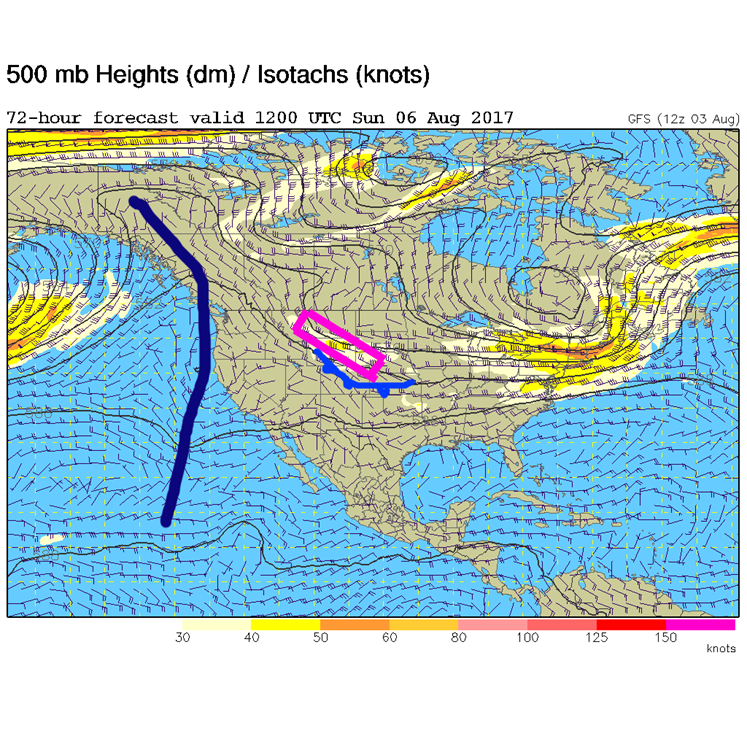
Figure 4 The Monday AM 500mb map with shortwave troughs highlighted with red lines, the big ridge in blue.

*** This feature will run as close to daily as possible in this location on the Longmont Observer. ***
This article will provide a brief discussion concerning the ‘why’ behind the weather with a focus on severe weather, unusual weather, and snow (especially trying to predict snow depth and its human impact in Longmont).
Bio:
John Ensworth works from Longmont as the Principle Investigator for the NASA Science Mission Directorate Earth and space science education product review through the IGES (The Institute for Global Environmental Strategies – www.strategies.org) . He is in his 14th year running this review. He is an astronomer (from the 2nd grade onward) and became a meteorologist (in the 5th grade) when a thunderstorm in Arizona rained on his telescope when the weather service had only forecasted a 10% chance of rain. He has college degrees in physics and astronomy and climatology and a graduate degree in meteorology and earth science. He lectures at the Little Thompson Observatory in Berthoud, the Estes Park Memorial Observatory in Estes Park, and for a number of online universities. He built and runs a backyard observatory near Pace and 17th in northeast Longmont where he has lived for 8 years with his wife, daughter, son, and two cats. Invitations to open house nights at this observatory, LTO, and EPMO will be posted with future discussions when they are scheduled.
Forecasting severe weather and snow amounts via text lead to this column. He began texting friends about the weather right after the September 2013 flood. The readers of this column will, hopefully, keep him honest in what he ‘thought’ he had forecasted for ‘the most recent’ storm.


