This content was originally published by the Longmont Observer and is licensed under a Creative Commons license.
By John Ensworth
Discussion:
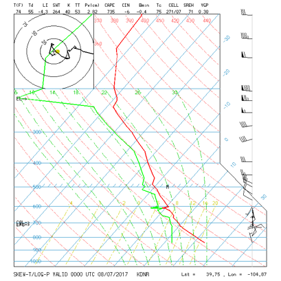
The front has swept down far south of the state and a steady easterly low-level flow of moisture is pushing into the state – at least through Tuesday. Figure 1 is our before-mentioned upper air sounding – the temperature, moisture, and winds measured above Denver as a balloon rises. We’ll cover element by element over time, and so far we’ve looked at precipitatable water. That value this time is 2.82 cm or 1.11 inches. That is a healthy amount of moisture and says that thunderstorms that do form can drop a lot of water (locally flooding amounts). But you can ‘see’ the moisture just be looking at the red line (temperature) and the green line (dew point). Wherever- up in the atmosphere- that they are close, there is a lot of moisture. They are close almost all the way up.
Figure 1: The Denver sounding released Sunday evening.
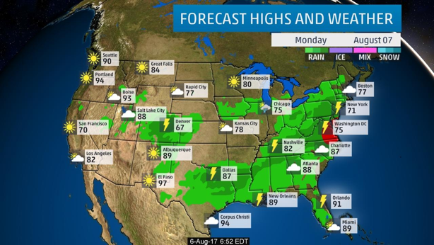
For a quick snapshot of the precipitation, here is the Monday forecast from the weather channel (www.weather.com) showing rain and thunderstorms (Figure 2).
Figure 2: Forecast map for Monday - rainfall regions indicated.
And into Tuesday, the rain chances remain in place, even if it is a bit drier (Figure 3).
Figure 3: Forecast map for Tuesday - rainfall regions indicated.
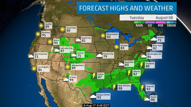
Figure 4 shows another (computer generated, GFS) forecast for storms and precipitation on intoMonday night. Still wet wet wet.
Figure 4: The NCEP forecast for 6pm Monday – widespread light rain.
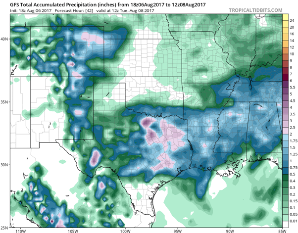
The next model output graphic is the GFS total precipitation from Sunday night until Tuesday 6am. This is a pretty high-resolution view. Areas in NE Colorado are up in the 1.50-2.00 inch area. Longmont (hard to pick out) seems to be around 0.75” if I’m looking at the right spot (Figure 5).
Figure 5: GFS total rainfall Sunday PM to Tuesday AM.
In a look at the longer range:
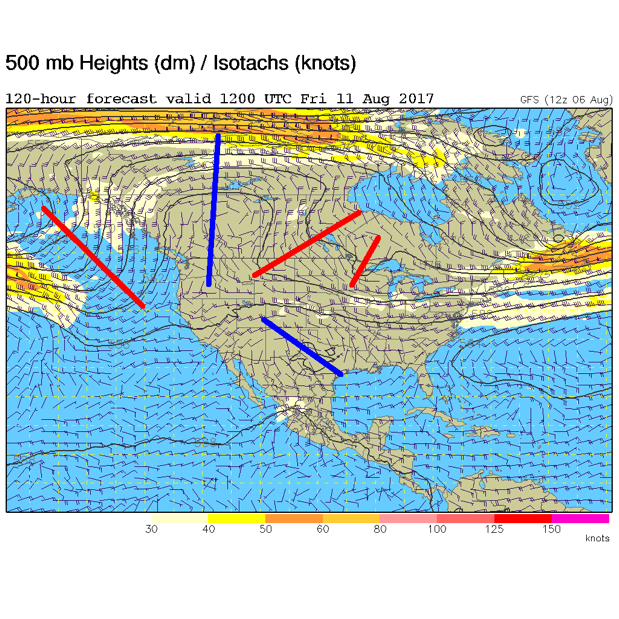
Northwest flow (as discussed for a week now) will keep us cooler and wetter than normal. Figure 6 shows that the big ridge is onshore again by Friday morning with continued northwest flow, but warmer temperatures. Afternoon thunderstorms will still be possible.
Figure 6: GFS forecast 500mb map with ridge marked in blue and troughs in red.
*** This feature will run as close to daily as possible in this location on the Longmont Observer. ***
This article will provide a brief discussion concerning the ‘why’ behind the weather with a focus on severe weather, unusual weather, and snow (especially trying to predict snow depth and its human impact in Longmont).
Bio:
John Ensworth works from Longmont as the Principle Investigator for the NASA Science Mission Directorate Earth and space science education product review through the IGES (The Institute for Global Environmental Strategies – www.strategies.org) . He is in his 14th year running this review. He is an astronomer (from the 2nd grade onward) and became a meteorologist (in the 5th grade) when a thunderstorm in Arizona rained on his telescope when the weather service had only forecasted a 10% chance of rain. He has college degrees in physics and astronomy and climatology and a graduate degree in meteorology and earth science. He lectures at the Little Thompson Observatory in Berthoud, the Estes Park Memorial Observatory in Estes Park, and for a number of online universities. He built and runs a backyard observatory near Pace and 17th in northeast Longmont where he has lived for 8 years with his wife, daughter, son, and two cats. Invitations to open house nights at this observatory, LTO, and EPMO will be posted with future discussions when they are scheduled.
Forecasting severe weather and snow amounts via text lead to this column. He began texting friends about the weather right after the September 2013 flood. The readers of this column will, hopefully, keep him honest in what he ‘thought’ he had forecasted for ‘the most recent’ storm.


