This content was originally published by the Longmont Observer and is licensed under a Creative Commons license.
In Brief:
The rest of Friday will see wind on into the evening. Gusts may be strong and damaging (we are still under a high wind warning - see yesterday's post of your weather apps). Things calm down and we warm to 5-10F above average for temperatures until a front arrives Wednesday. Some rain and *maybe* some snow is on the way Wednesday/Thursday.
Update 1/18 11pm:
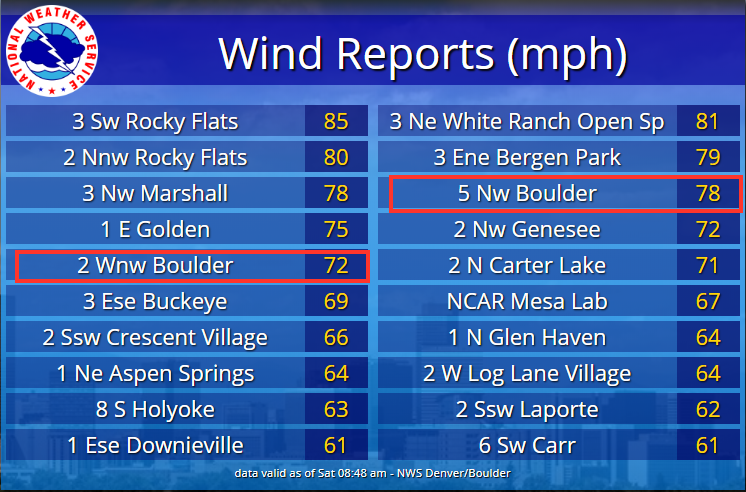
I didn't see excessive winds around our home, but it did get noisy at times. The NWS put out a chart of peak winds reported in this event (Figure 1 update). Locations near Boulder (Longmont) are boxed in red. They saw mid 70mph winds just to our west.
End 1/18 11pm udpate.
Forecast Discussion:
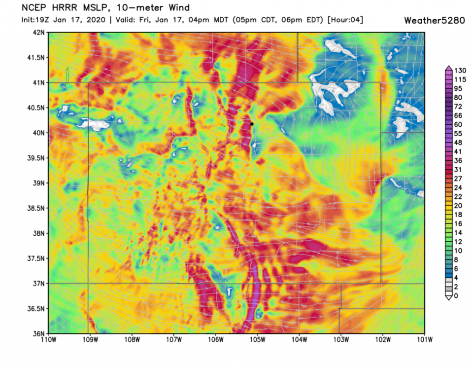
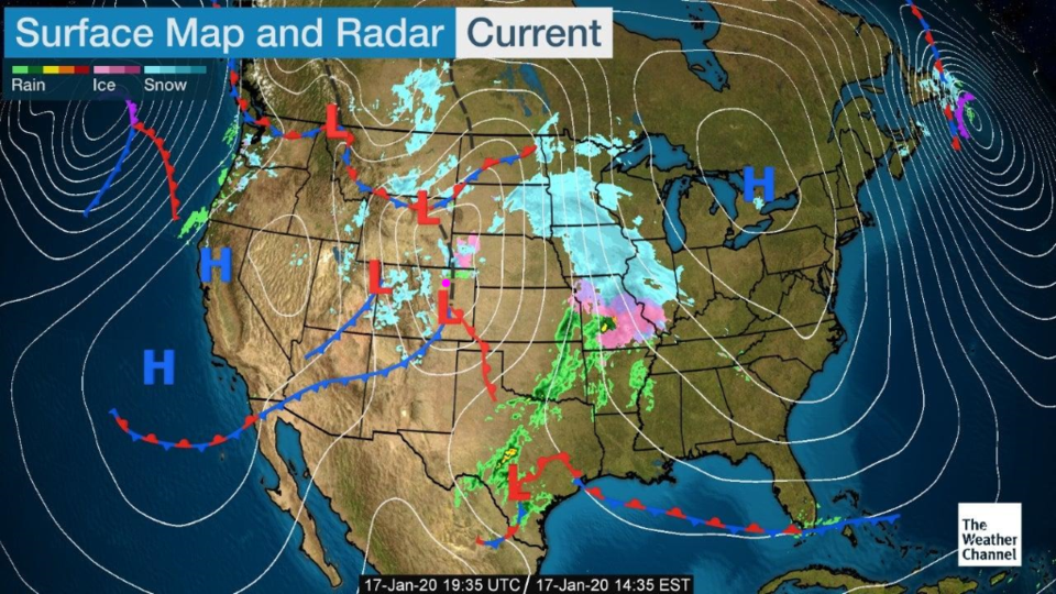
The high wind warning (see sustained wind speeds in Figure 1 at 4pm Friday) expires before dawn on Saturday giving us partly cloudy skies and 'about' normal temperatures for Saturday. The two fronts over the state Friday will clear us to the east early Saturday AM (Figure 2).
The Longer Range Forecast:
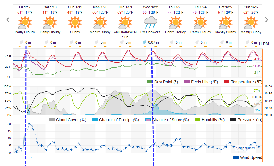
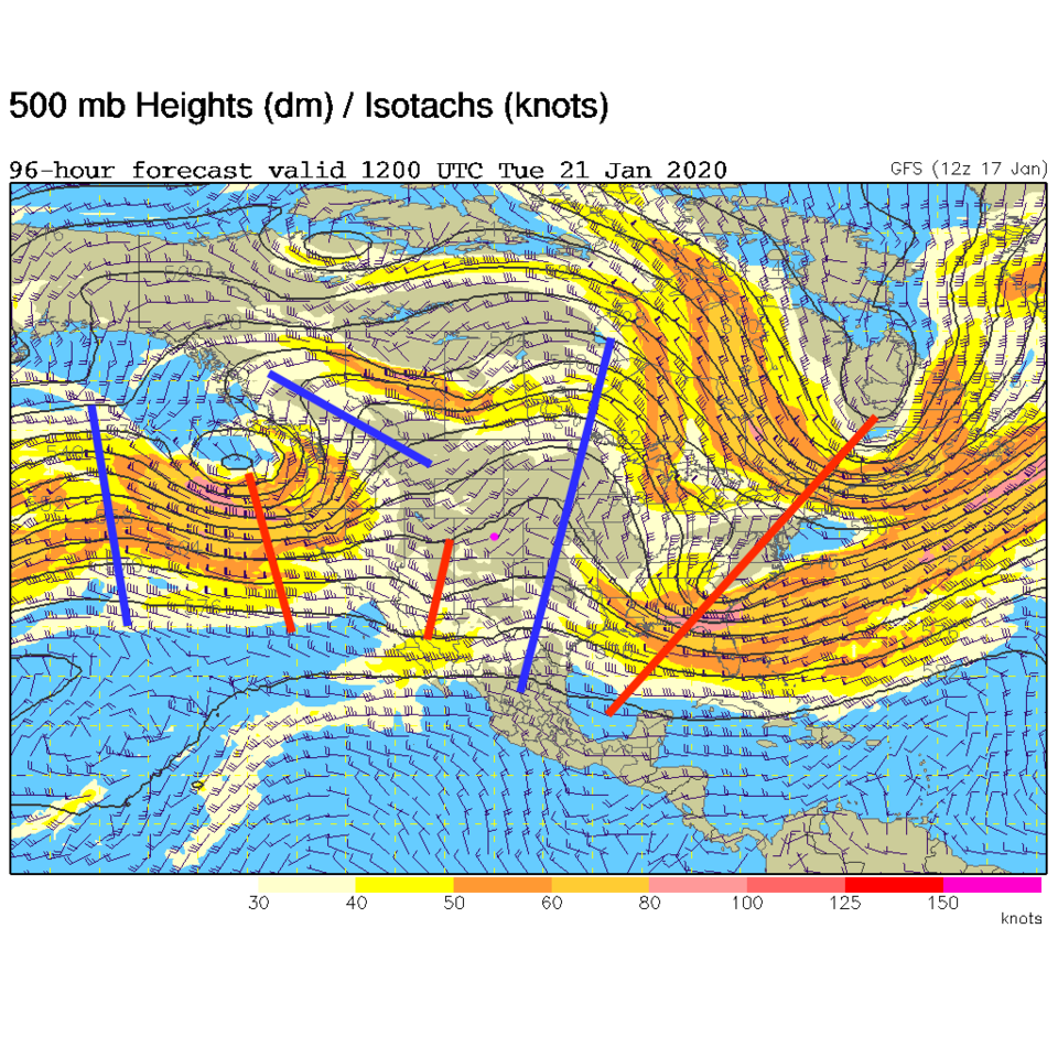
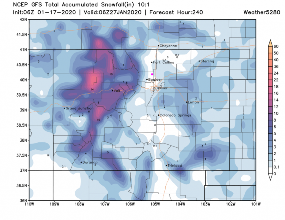
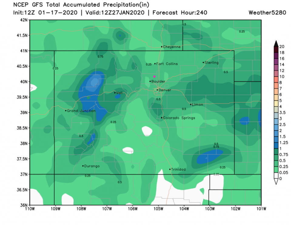
We warm to about 10F above normal by Tuesday and stay dry. That heat comes from the big ridge parked over the state early in the week (Figure 4). Our next front arrives Wednesday (Figure 3) and now looks like it will drop more rain than snow. The GFS puts a bit of snow around Longmont but not right in town (on this run) over the next 10 days (Figure 5). We might get a 1/4th inch of rain over that same period though (Figure 6).