This content was originally published by the Longmont Observer and is licensed under a Creative Commons license.
By John Ensworth
Discussion:
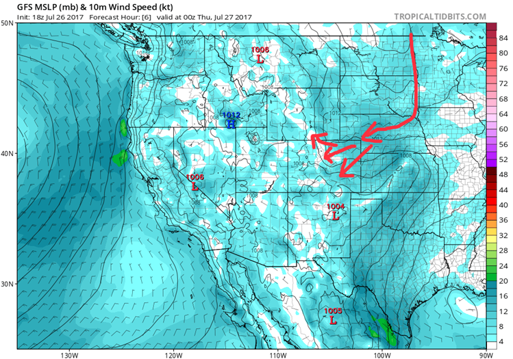
The moisture is still here (with a nice moist dew point of 64F Wednesday night) and the cool air is in place with north east winds flooding down across northeast Colorado. This air is from Canada and headed (backdoor style) into our state, see Figure 1. The cool air, though did diminish the instability along I-25 and in the foothills keeping big storms from taking off.
Figure 1: 10 meter above ground level winds and sea level pressure plotted. Colors are wind speeds via the scale on the right.
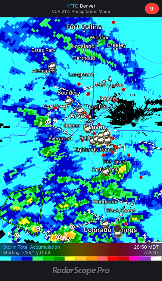
The rainfall, as of 9:00pm-ish last night was wetter than the previous day. The light blue is less than 0.10”. The medium dark blue is 0.1-0.2”. The dark blue is 0.2-0.3”.
The light green is 0.50”. The dark greens are 1.00”. The yellows are 2.00” and the dark oranges are 3.00”. There were flash flood watches issued for southern parts of the state yesterday.
Longmont has missed out (again, frown).
Figure 2: Radar estimated rainfall totals as of Tuesday 9:50pm.
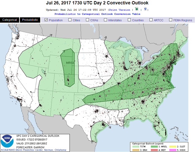
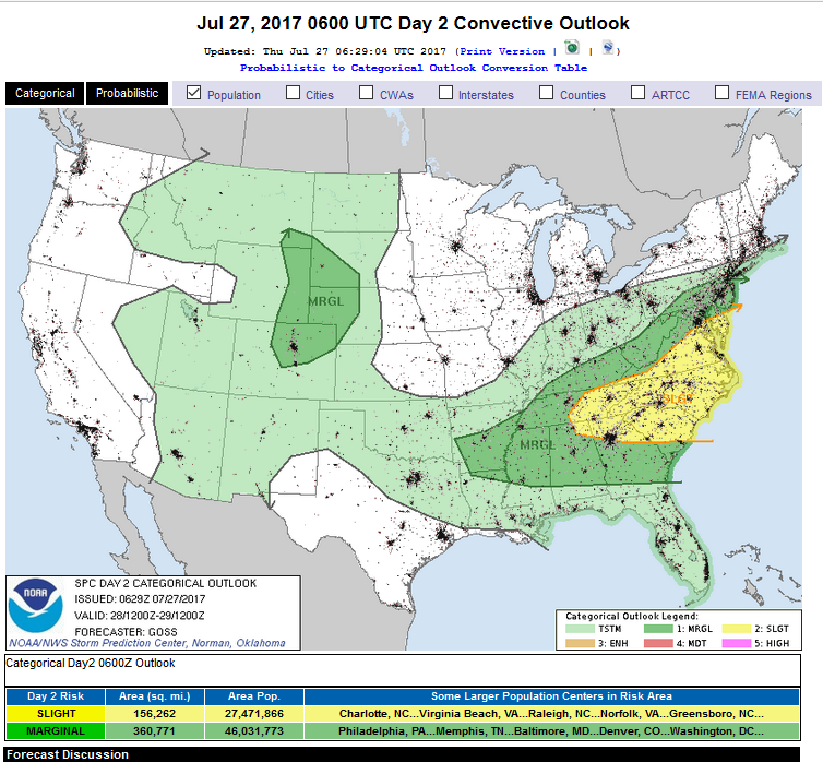
The ridge will shift just a bit backwards to the west on Thursday and the main moisture flow will remain over the mountains and western Colorado. Still, a good amount (above normal) of atmospheric moisture will be around through the weekend. The low level wind flow won’t be best for widespread rain, but small troughs in the upper level flow (called short waves) will be able to kick off storms with daytime heating (temperatures do go up from here). Afternoons on Thursday and Friday will, therefore, be able to see a few severe thunderstorms and even supercells (rotating thunderstorms) that can produce damaging hail and strong winds (for a few places, not everywhere). Figure 3 and 4 show the Storm Prediction Center outlook posting a Marginal Risk for parts of Colorado that includes Longmont for both Thursday and Friday.
Figure 3: The day 2 (from Wednesday night) Thursday severe weather outlook

Figure 4: The day 3 (from Wednesday night) Friday severe weather outlook
In a look at the longer range: The moisture sticks around into early next week, but the ridge inches back and makes the atmosphere sink slightly more than it has been. That will suppress widespread rain. Temperatures will also inch back to the low 90’s areas. More as the weekend approaches!
*** This feature will run as close to daily as possible in this location on the Longmont Observer. ***
This article will provide a brief discussion concerning the ‘why’ behind the weather with a focus on severe weather, unusual weather, and snow (especially trying to predict snow depth and its human impact in Longmont).
Bio:
John Ensworth works from Longmont as the Principle Investigator for the NASA Science Mission Directorate Earth and space science education product review through the IGES (The Institute for Global Environmental Strategies – www.strategies.org) . He is in his 14th year running this review. He is an astronomer (from the 2nd grade onward) and became a meteorologist (in the 5th grade) when a thunderstorm in Arizona rained on his telescope when the weather service had only forecasted a 10% chance of rain. He has college degrees in physics and astronomy and climatology and a graduate degree in meteorology and earth science. He lectures at the Little Thompson Observatory in Berthoud, the Estes Park Memorial Observatory in Estes Park, and for a number of online universities. He built and runs a backyard observatory near Pace and 17th in northeast Longmont where he has lived for 8 years with his wife, daughter, son, and two cats. Invitations to open house nights at this observatory, LTO, and EPMO will be posted with future discussions when they are scheduled.
Forecasting severe weather and snow amounts via text lead to this column. He began texting friends about the weather right after the September 2013 flood. The readers of this column will, hopefully, keep him honest in what he ‘thought’ he had forecasted for ‘the most recent’ storm.


