This content was originally published by the Longmont Observer and is licensed under a Creative Commons license.
By John Ensworth
Discussion:
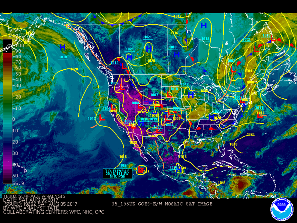
Our daily thunderstorm chances continue, but a stationary front will park across Colorado Sunday into Monday and really ratchet things up. Figure 1 shows the hot dry ground in the west (purple colors) on the infrared satellite picture. Our clouds and moisture show up as greens and blues with a weak front draped across eastern portions of the state (part of that is outflow from the big thunderstorms in Nebraska Friday night into Saturday AM that are down into Missouri in this image).
Figure 1: Infrared satellite image for Saturday afternoon with frontal systems added.
After the round or two of thunderstorms on Saturday afternoon/evening, we look to see what this next front will bring.
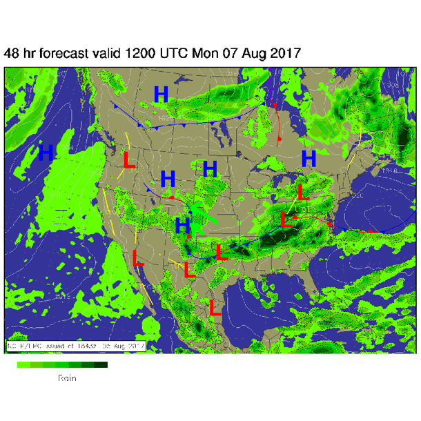
As shown in the last few posts, the upper level northwest flow with its embedded little ripples of energy can kick off storms. With the front pumping easterly and southeasterly moist Midwest air into the state (see Figure 2 light green arrows) – rain and thunderstorm chances will soar up to the 70-100% range Sunday into Monday night. Get that umbrella out!
Figure 2: Forecast map for Monday morning with fronts, pressure centers, and rainfall regions indicated.
With good solar energy (it is still August!), short waves, deep moisture and easterly upslope, there is a marginal risk of severe weather for this afternoon (Sunday). Locally damaging thunderstorm winds are the most likely threat. This marginal risk area is shown in figure 3.
Figure 3: Storm Prediction Center forecast for severe weather risk – Day 2 forecast issued for Sunday on Saturday.
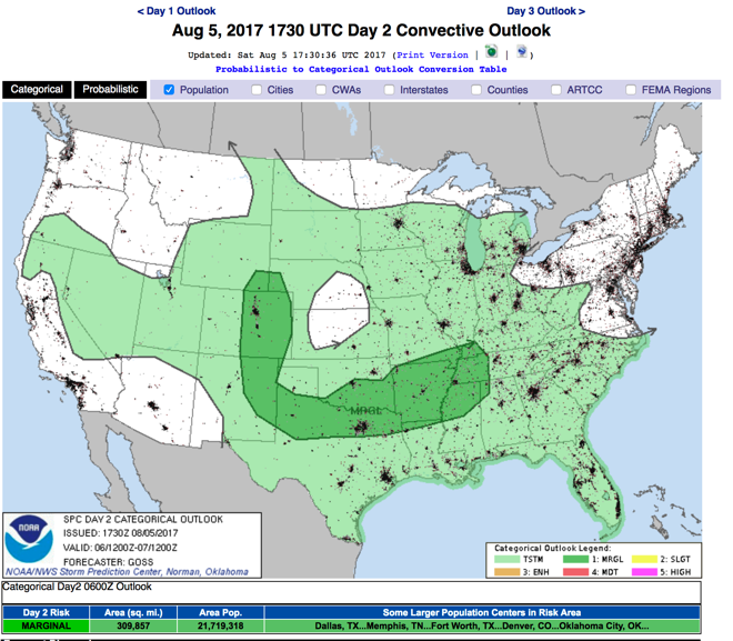
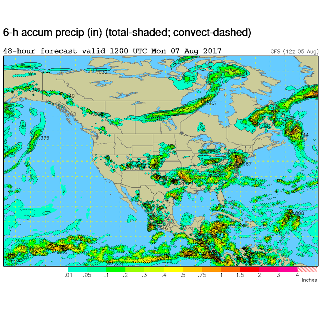
Figure 4 shows another (computer generated, GFS) forecast for storms and precipitation on into Monday midday. Wet wet wet.
Figure 4: GFS forecast for 6am Monday – precipitation total for the prior 6 hours.
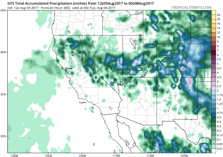
The next model output graphic is the GFS total precipitation from Saturday night until Monday evening. This is a higher resolution view (but includes rainfall from Saturday and Sunday as well). Areas in NE Colorado are up in the 2 inch or more area. Hurray!
Figure 5: GFS total rainfall Saturday PM to Monday PM.
In a look at the longer range: With the ridge still off the west coast, the upper air flow continues out of the northwest allowing cool fronts and/or short waves to affect the weather every few days with short waves traveling down the flow. (As discussed over the last couple of days.) Unsettled is the theme through the rest of the week. Details in a later post.
*** This feature will run as close to daily as possible in this location on the Longmont Observer. ***
This article will provide a brief discussion concerning the ‘why’ behind the weather with a focus on severe weather, unusual weather, and snow (especially trying to predict snow depth and its human impact in Longmont).
Bio:
John Ensworth works from Longmont as the Principle Investigator for the NASA Science Mission Directorate Earth and space science education product review through the IGES (The Institute for Global Environmental Strategies –www.strategies.org) . He is in his 14th year running this review. He is an astronomer (from the 2nd grade onward) and became a meteorologist (in the 5th grade) when a thunderstorm in Arizona rained on his telescope when the weather service had only forecasted a 10% chance of rain. He has college degrees in physics and astronomy and climatology and a graduate degree in meteorology and earth science. He lectures at the Little Thompson Observatory in Berthoud, the Estes Park Memorial Observatory in Estes Park, and for a number of online universities. He built and runs a backyard observatory near Pace and 17th in northeast Longmont where he has lived for 8 years with his wife, daughter, son, and two cats. Invitations to open house nights at this observatory, LTO, and EPMO will be posted with future discussions when they are scheduled.
Forecasting severe weather and snow amounts via text lead to this column. He began texting friends about the weather right after the September 2013 flood. The readers of this column will, hopefully, keep him honest in what he ‘thought’ he had forecasted for ‘the most recent’ storm.


