This content was originally published by the Longmont Observer and is licensed under a Creative Commons license.
Forecast Discussion:
10am Update:
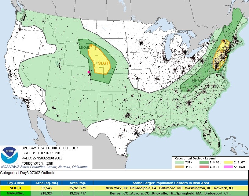
A slight risk has been added to areas just east of I25 today and a marginal risk. In the slight risk area (figure 1 update, yellow region) there is a risk for tornadoes. In all risk areas, hail, high winds, and heavy rain is possible. The discussion at the NWS today is that a flash flood watch will not be issued due to a small decrease in atmospheric moisture and a bit quicker storm motion.
End 10am Update.
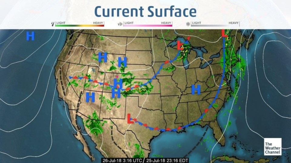
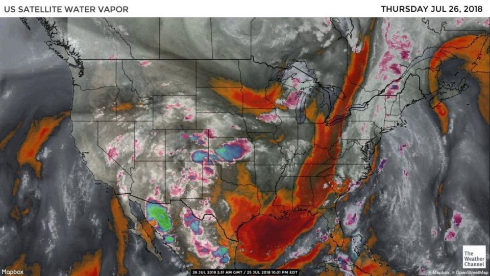
WYSIWYG (what you saw is what you'll get). The pattern chances very little today from yesterday (Figure 1). A front remains parked south of central Colorado. Copious amounts of atmospheric moisture are in place (Figure 2). The jet stream is close enough to send short waves overhead now and then to aid in severe thunderstorm development.
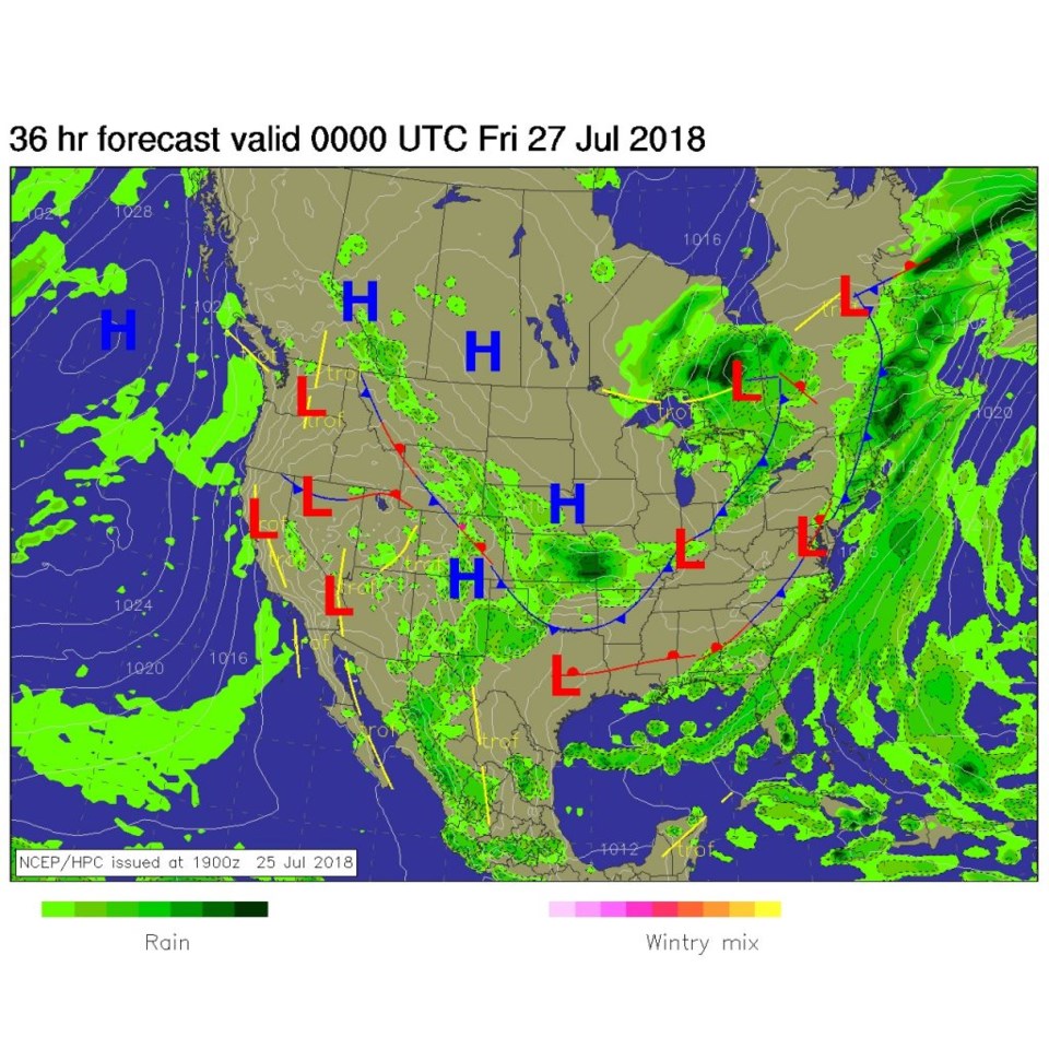
For today, the front drifts a bit closer to the Denver Metro and Boulder/Longmont. This will provide a focus line for some storm initiation later today (Figure 3). The SPC has us (and the I-25 corridor and even higher foothills to our west) with a marginal risk (1 on a scale of 1-5) for severe weather. Heavy rains, damaging winds, large hail are the current threat. I'm guessing this will be upgraded to a slight risk for places near Longmont and the Metro by morning. I'll update again if that occurs.

The longer range forecast:
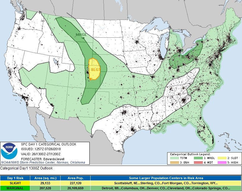
The pattern doesn't change much on Friday either (much). A short wave may come in earlier and rob the foothills and areas just west of I-25 of severe weather chances (figure 5). It may clear out a bit earlier west of I-25 as well.
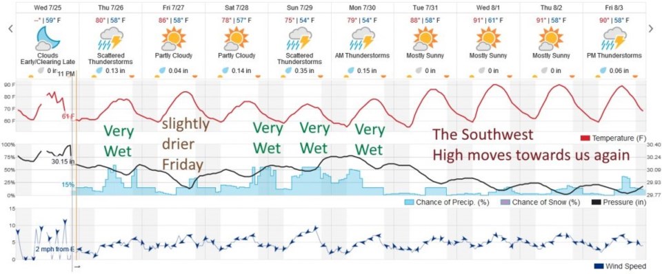
Figure 6 takes us out 10 days again. Friday is just a bit drier, then the high inches to the southwest again and we have a wet weekend (afternoons primary, except for Sunday). We remain wet into the start of next week before the southwest high returns to warm us up and cut off the monsoon moisture beginning on Tuesday.