This content was originally published by the Longmont Observer and is licensed under a Creative Commons license.
Forecast Discussion:
The storm is ongoing Monday evening as I write, so I'll update this place later in the day with some weather reports.
[9pm update - Snow and Rain totals!]
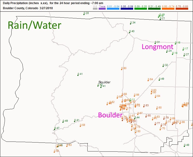
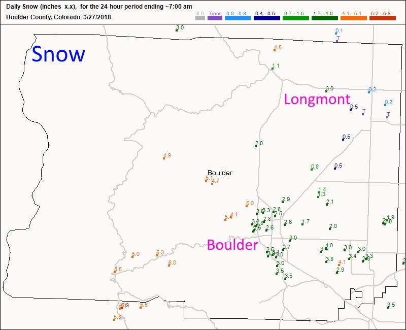
Figures 1 and 2 are Boulder county 24 hour totals... Longmont almost got to an average of 1/5th of an inch of water (great for the lawns!) and a trace to 1/4th inch of snow. Boulder did much better with 2.5-5 inches of snow.
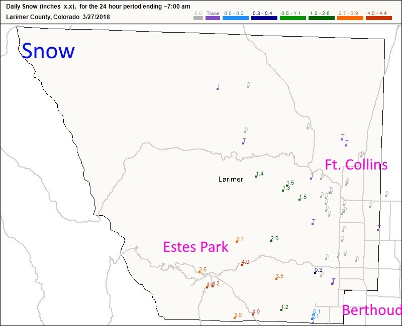
Figures 3 and 4 are Larimer county 24 hour totals... Estes got about 1/4th inch of water, Ft. Collins only got a few hundredths of an inch of water. Berthoud stayed under 1/10th inch. As for snow, only a trace was seen from Ft. Collins down to Berthoud, Estes park got 3-4 inches of snow.
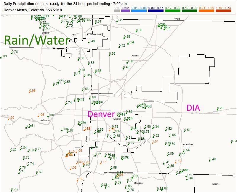
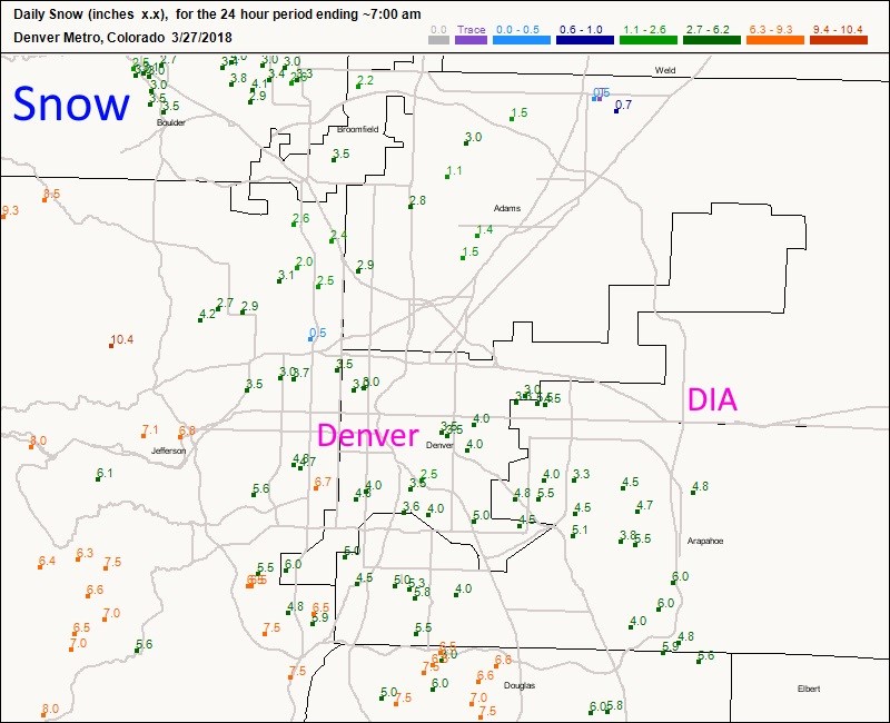
Figures 5 and 6 are the Denver Metro 24 hour totals... they were the big winners on my 'region.' the northern suburbs saw 1/3rd to 1/2 inch while an inch of water fell on the south and southwestern areas. The northern regions saw 1-3 inches while the southern foothills had 4-7.5 inches. Great water for them!

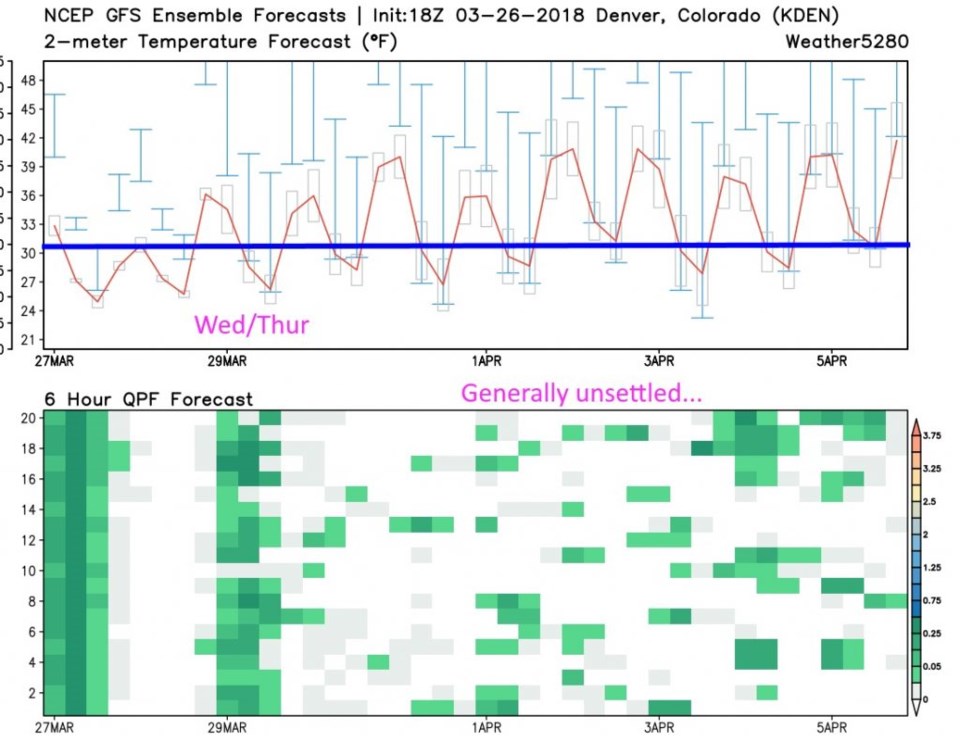
The longer range forecast:
The 10 day graphical look at the weather in Figure 1 shows a VERY similar storm (in the gross features) to this one hitting Monday/Tuesday. After that, things get very sketchy, but there are many changes of precipitation coming. This might be a nice spring after all (even though many ski resorts are setting their closing dates in April).