This content was originally published by the Longmont Observer and is licensed under a Creative Commons license.
Forecast Discussion:
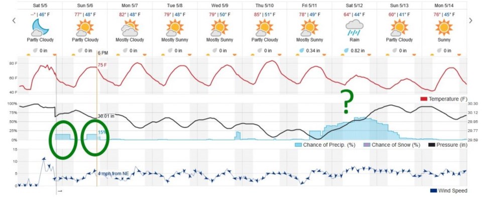
I'm going to take this quiet weather time to catch up on some family time. The NWS expects the middle/upper atmosphere to get quite warm on Monday to Wednesday and "cap" the atmosphere so thunderstorms don't form. There will be enough lower level heat and moisture to kick off severe thunderstorms otherwise. The severe storm prediction center does still have a chance of convection across Colorado on Monday. The weatherunderground model (Figure 1) doesn't have any Monday storm chances.
Figure 1 is the 10 day graphical forecast that shows the Sat PM and Sun PM chance of wandering mountain thunderstorms that might make it here. There is a LOT of disagreement between models for next weekend (beyond Thursday) - but some of our trusted models show another big rain storm possible. (Some show nothing for Colorado as a whole).
Watch for near 90F temperatures by Thursday. What a great week this will be, beyond a brief afternoon thundershower. Remember, lightning is dangerous no matter how big or small a thunderstorm cell is.