This content was originally published by the Longmont Observer and is licensed under a Creative Commons license.
By John Ensworth
Discussion:
The front remains draped down the Rocky Mountains (on the east side- see Figure 1) and moisture continues to flow in from the east. The high rain chances continue. Figure 2 shows the rainfall for our region of the state over the last seven days. Longmont is in the 0.5-1.0” region so far. But more rain is falling. Easterly winds continue to bring in moisture with precipitatible water values still above 1” (unusually moist for this time of year).
Figure 1: Surface pressure analysis, fronts and rainfall for Monday afternoon from the Weather Channel.
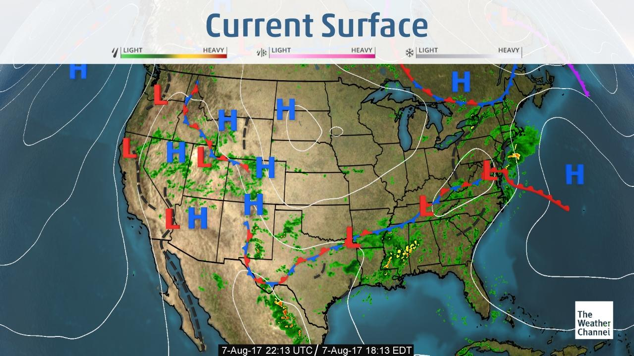
Figure 2: Seven-day rainfall total with Longmont marked with a red ‘O’. This map is from NOAA.
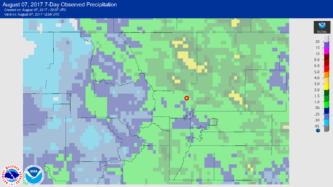
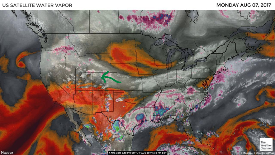
Figure 3 shows water vapor satellite image again. The southwest monsoon is cut off, but we are getting plenty of Gulf of Mexico moisture.
Figure 3: The water vapor satellite image for Monday PM.
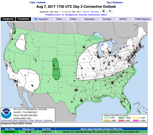
It looks like a short wave that created Monday afternoon rainfall will pull east of the state Monday night. Clearer skies, but similar high moisture levels, will mean more warming and more potent storms for Tuesday. The severe weather threat (Figure 4) for Longmont is back, as a Marginal Risk (1 on a scale of 1 to 5 in severity). The primary risk is damaging hail and thunderstorm winds.
Figure 4: The SPC severe weather threat for Day 2 – Tuesday, issued Monday.
In a look at the longer range:
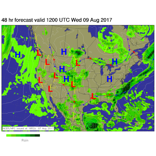
Nothing really changes through the end of the week, Figure 5 shows the continued chance of rain Wednesday. Temperatures will rise and skies clear a bit, but thunderstorms may gain more punch as well.
Figure 5: The Wednesday morning front and pressure system map with expected precipitation regions.
*** This feature will run as close to daily as possible in this location on the Longmont Observer. ***
This article will provide a brief discussion concerning the ‘why’ behind the weather with a focus on severe weather, unusual weather, and snow (especially trying to predict snow depth and its human impact in Longmont).
Bio:
John Ensworth works from Longmont as the Principle Investigator for the NASA Science Mission Directorate Earth and space science education product review through the IGES (The Institute for Global Environmental Strategies – www.strategies.org) . He is in his 14th year running this review. He is an astronomer (from the 2nd grade onward) and became a meteorologist (in the 5th grade) when a thunderstorm in Arizona rained on his telescope when the weather service had only forecasted a 10% chance of rain. He has college degrees in physics and astronomy and climatology and a graduate degree in meteorology and earth science. He lectures at the Little Thompson Observatory in Berthoud, the Estes Park Memorial Observatory in Estes Park, and for a number of online universities. He built and runs a backyard observatory near Pace and 17th in northeast Longmont where he has lived for 8 years with his wife, daughter, son, and two cats. Invitations to open house nights at this observatory, LTO, and EPMO will be posted with future discussions when they are scheduled.
Forecasting severe weather and snow amounts via text lead to this column. He began texting friends about the weather right after the September 2013 flood. The readers of this column will, hopefully, keep him honest in what he ‘thought’ he had forecasted for ‘the most recent’ storm.


