
This content was originally published by the Longmont Observer and is licensed under a Creative Commons license.
By John Ensworth
Discussion:
Thunderstorms were widespread Tuesday night with many examples of severe weather. Longmont received about 0.10-0.20” on average (higher out at the eastern edge of town) of rain. A cold front is now in place keeping today’s highs in the upper 70’s. Weird for August!! (We are in the top 10 or top 5 coolest Augusts in Denver so far… that could change- but this is at the ½ way mark).
Figure 1 shows the front heading down the Front Range and I-25 corridor at midnight Wednesday.
Figure 1: Surface analysis forecast map for midnight Wednesday morning.
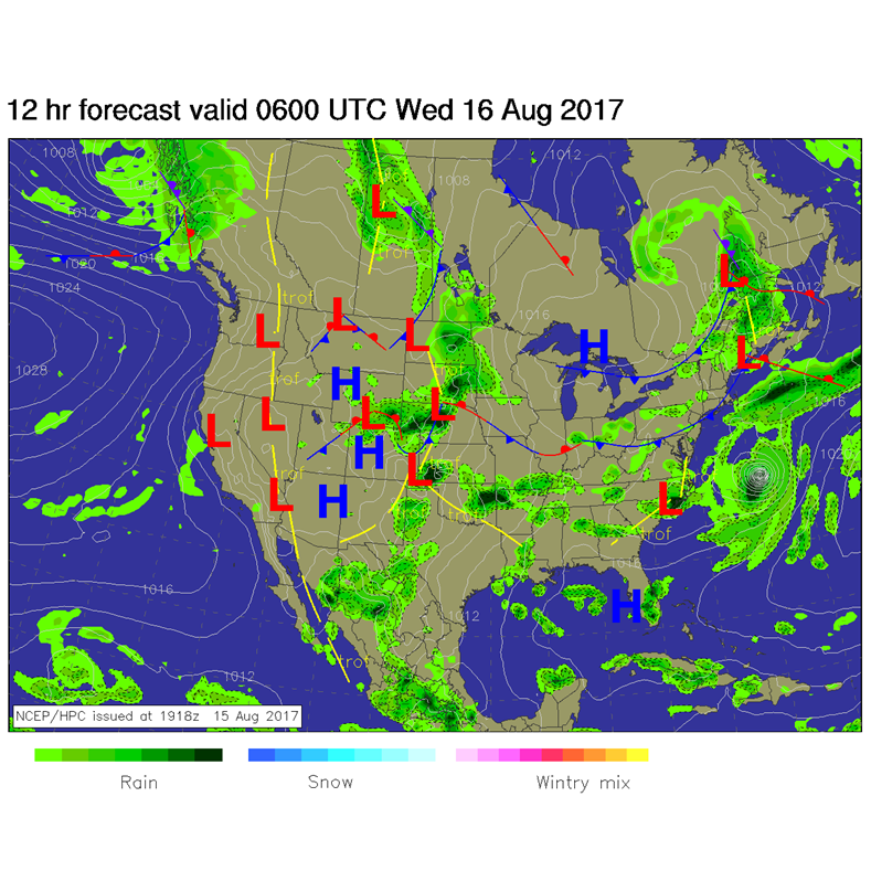
Figure 2 shows the front completely clear of the state by noon today (Wednesday). Low clouds and rain at times is possible through the early part of the day and thunderstorms in the afternoon when the sun warms things up some.
Figure 2: Surface analysis forecast map for noon Wednesday.
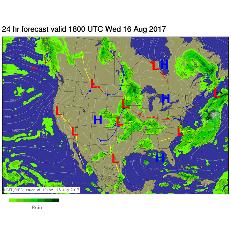
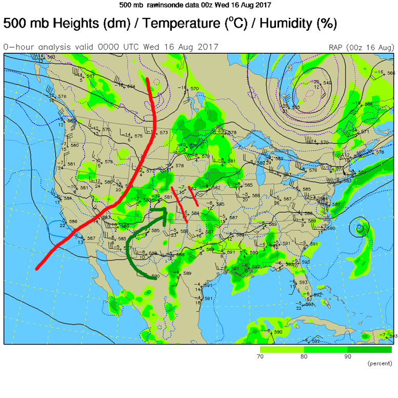
Figure 3 shows the upper air pattern analysis from Tuesday night. The big trough to our west is helping shuttle moisture up into Colorado (green arrow), and little short waves are kicking off rounds of thunderstorms. There are lots of these little short waves racing down the flow further upstream to help keep rain chances in place through the end of the week!
Figure 3: The Wednesday morning surface analysis forecast.
In a look at the longer range:
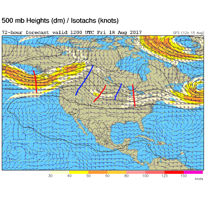
The big summer ridge never really builds overhead so temperatures stay near or just below normal through the end of the week. Figure 4 shows the rapid progression of short wave ridges and troughs moving through the nearly zonal flow. As temperatures recover after the front, we may see severe weather back into our neck of the woods in later days. More on that then!
Figure 4: The GFS forecasted 500mb map for Friday morning. Troughs are marked in red, ridges marked in blue.
*** This feature will run as close to daily as possible in this location on the Longmont Observer. ***
This article will provide a brief discussion concerning the ‘why’ behind the weather with a focus on severe weather, unusual weather, and snow (especially trying to predict snow depth and its human impact in Longmont).
Bio:
John Ensworth works from Longmont as the Principle Investigator for the NASA Science Mission Directorate Earth and space science education product review through the IGES (The Institute for Global Environmental Strategies – www.strategies.org) . He is in his 14th year running this review. He is an astronomer (from the 2nd grade onward) and became a meteorologist (in the 5th grade) when a thunderstorm in Arizona rained on his telescope when the weather service had only forecasted a 10% chance of rain. He has college degrees in physics and astronomy and climatology and a graduate degree in meteorology and earth science. He lectures at the Little Thompson Observatory in Berthoud, the Estes Park Memorial Observatory in Estes Park, and for a number of online universities. He built and runs a backyard observatory near Pace and 17thin northeast Longmont where he has lived for 8 years with his wife, daughter, son, and two cats. Invitations to open house nights at this observatory, LTO, and EPMO will be posted with future discussions when they are scheduled.
Forecasting severe weather and snow amounts via text lead to this column. He began texting friends about the weather right after the September 2013 flood. The readers of this column will, hopefully, keep him honest in what he ‘thought’ he had forecasted for ‘the most recent’ storm.


