This content was originally published by the Longmont Observer and is licensed under a Creative Commons license.
By John Ensworth
Discussion:
What you see is what you get. We have about 0.5-0.75” of precipitatable water over the mountains (they are higher so there is less atmosphere above ground level for water vapor to reside). And we’ll be up over 1” of precipitatable water on the Plains for much of this week. It is hard to come up with new ways to describe a pattern that isn’t changing much. Figure 1 is the same map as yesterday, but a day later. The low-pressure trough at the surface (not much of a cool front anymore) is draped right down the Rocky Mountains (black dashed line).
Figure 1: Surface pressure analysis, fronts and rainfall for Tuesday evening from the Weather Channel.
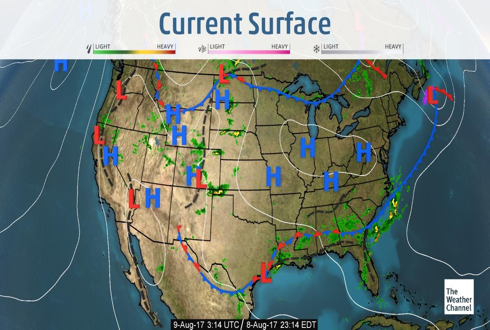
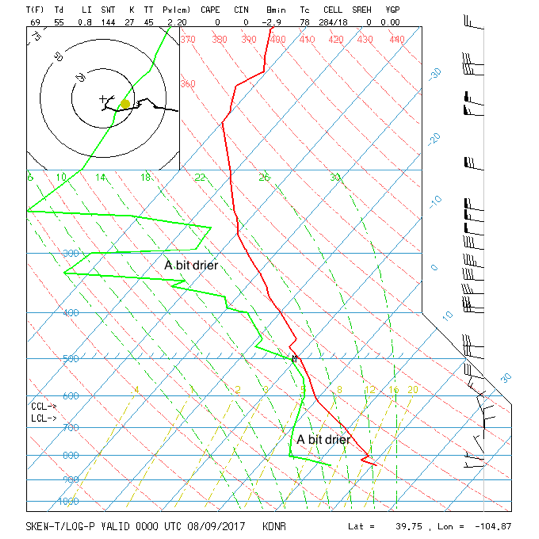
Figure 2 is our sounding again showing some lower level drying and upper level drying (the green line is further to the left from the temperature line than it has been the last couple of days). Precipitatable water is at 0.87” this evening, which is a bit low of late. This allowed a bit more heating and a few severe storms up and down the Front Range Tuesday afternoon.
Figure 2: Our Denver sounding for Tuesday night.
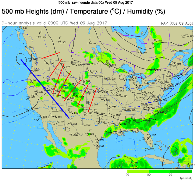
The trick to predicting the rainfall and convection blobs (multiple loosely organized thunderstorm clusters) is finding which of the ripples in the flow, the short waves, are real and which are not in maps like Figure 3. I drew in a bunch to seem to be present in the analysis, but some of them are not real. They are artifacts of the interpolation scheme that created this map. That is what makes forecasting who will get rain and exactly when, difficult!
Figure 3: The 500mb map for Tuesday night with ‘possible’ example short waves sketched in - red. The major ridge position is in blue.
Still, water has been falling. Looking at the CoCoRaHS reports for Longmont, adding up a rough average for Longmont from 8/3 to 8/7 – we have had around 1.90” of water that has come down on the eastern center of town.
In a look at the longer range:
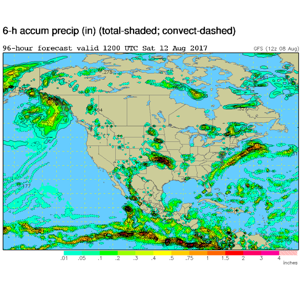
Nothing really changes through the end of the week, Figure 4 shows the continued position of the ridge to our west, and the continued northwest flow all the way out to Saturday morning. Figure 5 shows the precipitation in the regions around and in Colorado. It will be drier and warmer by the weekend, but afternoon storms will march on for some.
Figure 4: The Saturday morning upper air pattern, 500mb GFS forecast. The ridge is drawn in blue, troughs near us in red.
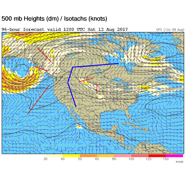
Figure 5: The Saturday morning GFS forecast precipitation regions.
*** This feature will run as close to daily as possible in this location on the Longmont Observer. ***
This article will provide a brief discussion concerning the ‘why’ behind the weather with a focus on severe weather, unusual weather, and snow (especially trying to predict snow depth and its human impact in Longmont).
Bio:
John Ensworth works from Longmont as the Principle Investigator for the NASA Science Mission Directorate Earth and space science education product review through the IGES (The Institute for Global Environmental Strategies – www.strategies.org) . He is in his 14th year running this review. He is an astronomer (from the 2nd grade onward) and became a meteorologist (in the 5th grade) when a thunderstorm in Arizona rained on his telescope when the weather service had only forecasted a 10% chance of rain. He has college degrees in physics and astronomy and climatology and a graduate degree in meteorology and earth science. He lectures at the Little Thompson Observatory in Berthoud, the Estes Park Memorial Observatory in Estes Park, and for a number of online universities. He built and runs a backyard observatory near Pace and 17th in northeast Longmont where he has lived for 8 years with his wife, daughter, son, and two cats. Invitations to open house nights at this observatory, LTO, and EPMO will be posted with future discussions when they are scheduled.
Forecasting severe weather and snow amounts via text lead to this column. He began texting friends about the weather right after the September 2013 flood. The readers of this column will, hopefully, keep him honest in what he ‘thought’ he had forecasted for ‘the most recent’ storm.


