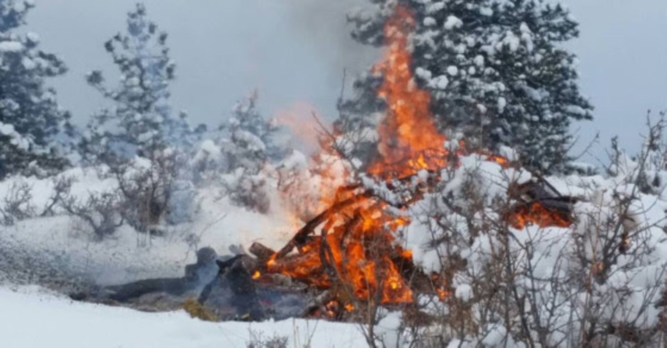
Boulder County Parks and Open Space and the Boulder County Sheriff’s Office Fire Management Program announced that controlled burns of agriculture and irrigation ditches in the area are scheduled to begin as early as Monday.
The burns depend on weather conditions, including relative humidity, fuel moisture and wind. Since burns only proceed when these conditions are suitable, burns could take place anytime between Jan. 29 and April 30, according to a news release from Boulder County.
“Agriculture burning is done to remove vegetation to control weeds and prepare areas for reseeding. Irrigation ditches are burned to remove unwanted vegetation for improved water delivery, nutrient cycling, and planting success,” the county said.
During a burn, locals can expect heavy smoke in the air. The county asks that people not call 911 as the burns are not emergencies and will be monitored to ensure the fires are fully extinguished.
Areas scheduled for controlled burns include:
- Josephine Roche property (Arapahoe Rd. and 119th St.)
- Gaynor Lake (1217 Fox Hill Rd.)
- Pella Crossing (11420 N. 75th St.)
- Wittemyer Ponds, Bailey-Kenosha Ponds, and Wheeler Ranch properties (12086 Mineral Rd.)
- Walden Ponds Wildlife Habitat (3893 N. 75th St.)
- Wambsganss property (12210 Niwot Rd.)
- Leggett, Ertl, Dougherty, Piazza, Swanson, and Stromquist Farms properties (Hwy. 287, Niwot Rd, Prospect Rd., East Countyline Rd.)
- Marfell Lakes and CMN – Fuhey properties (Arapahoe Rd. and 119th St.)
- Burchfield property (115th St., Vermillion Rd., and Wasatch Rd.)
- Doniphan property (115th St. and Lookout Rd.)
- Alexander Dawson property (109th St. and Jasper Rd.)
- Macy property (Hwy. 287 between Lookout Rd. and Hwy. 52)


