In Brief:
Warm dry weather through Christmas, mountain snows, a sprinkle/shower on Christmas Eve?
The Forecast Discussion:
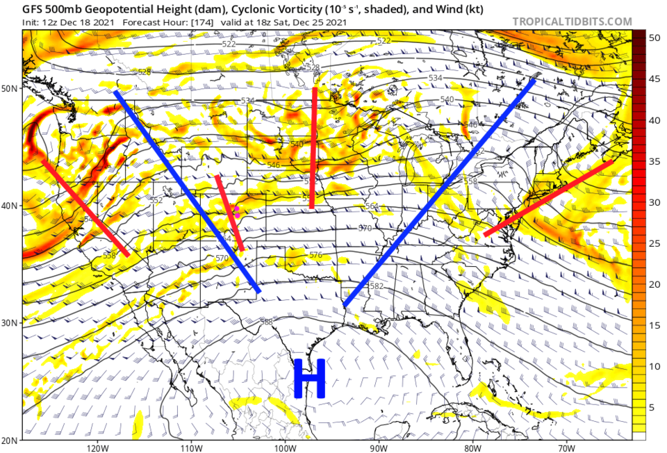
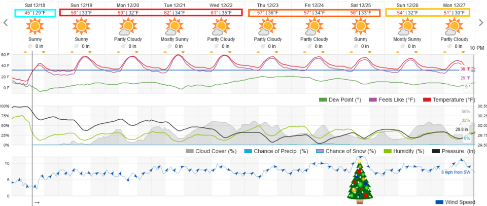
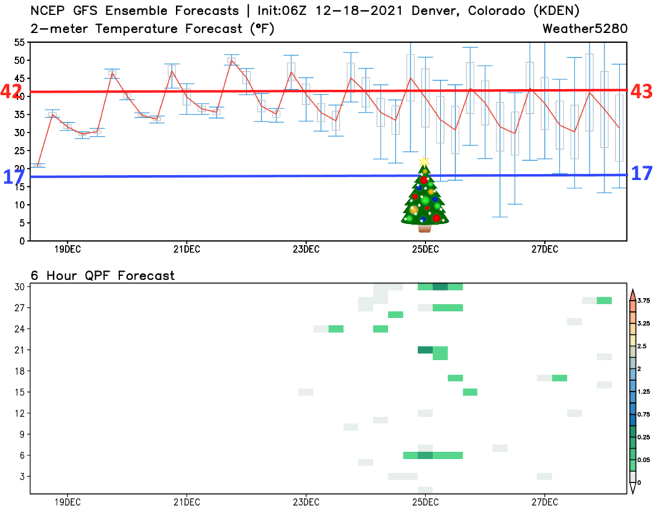
After our last windy cold front, things are warming up with another extended stretch of dry weather for the Front Range (Figure 1). The western U.S. is still topped with a giant ridge (blue line Figure 2). The next 6-7 days will have high and low temperatures above normal (Figure 3). The GFS ensemble (many runs of the same model with variations) shows a small chance of showers around Christmas Eve and Day along I-25. But it is a very small chance (green dashes in the lower panel).
The Longer Range Front Range forecast:
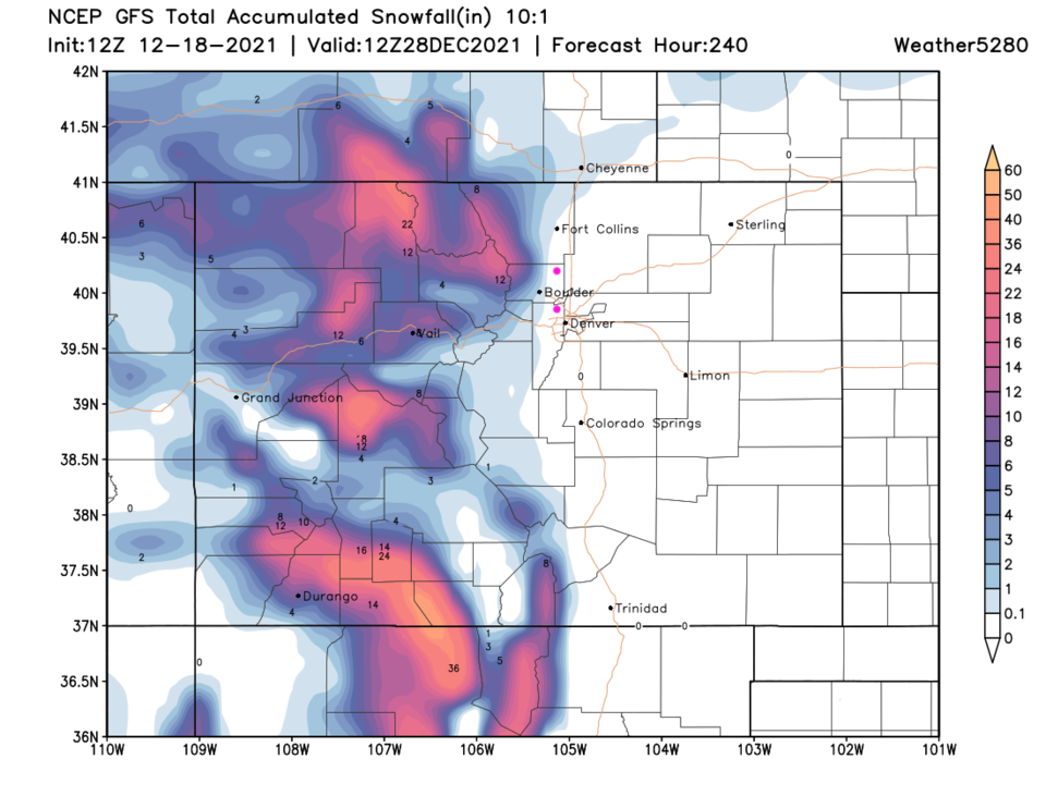
That small chance of Christmas precipitation is created by a small short wave rippling through the persistent ridge (Figure 4). The mountains should get healthy snow this week. Our snow pack has gone from around 50% to 76% of normal in the mountains. That is a good trend that should continue.
Christmas Forecast:
High temperature of 55F, a low temperature of 28F. Gusty west winds and partly cloudy skies.