In Brief:
Very seasonable temperatures and small chances of afternoon storms.
Tuesday Update:
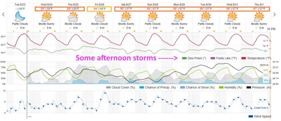
Wednesday will be dry with temperatures very close to normal. A fairly small chance of afternoon storms returns for the next week with little change in the temperatures (except briefly Friday- Figure 1 update). Exciting cold fronts and fall/winter weather will be here in time. Enjoy the quiet late summer weather for now.
End of the Tuesday Update.
The Forecast Discussion:
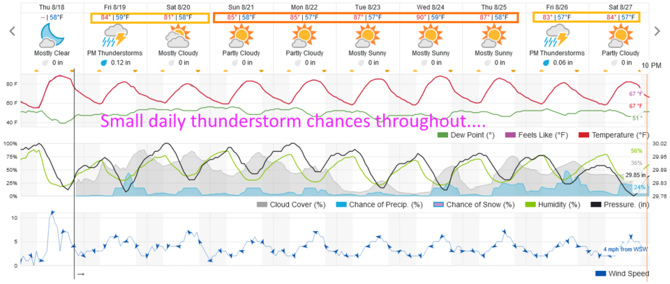
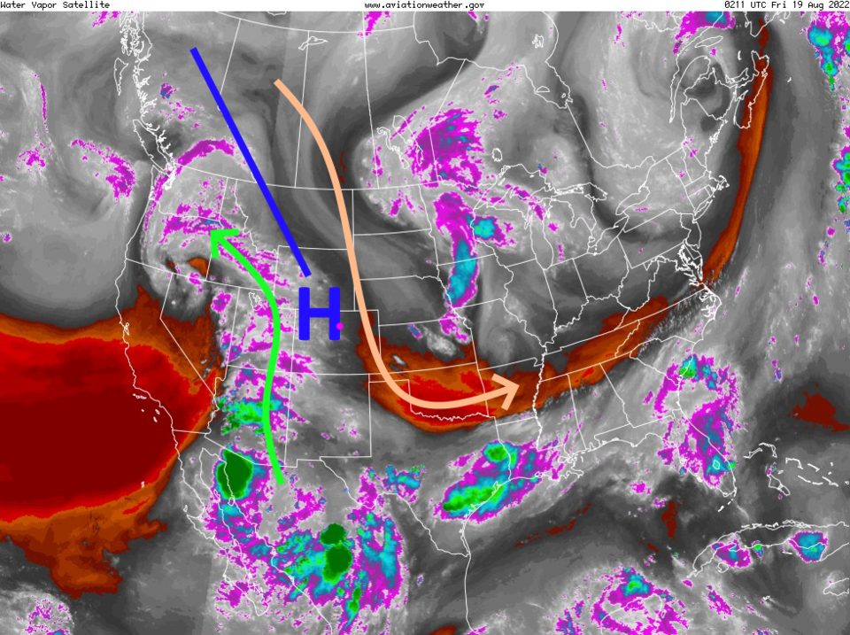
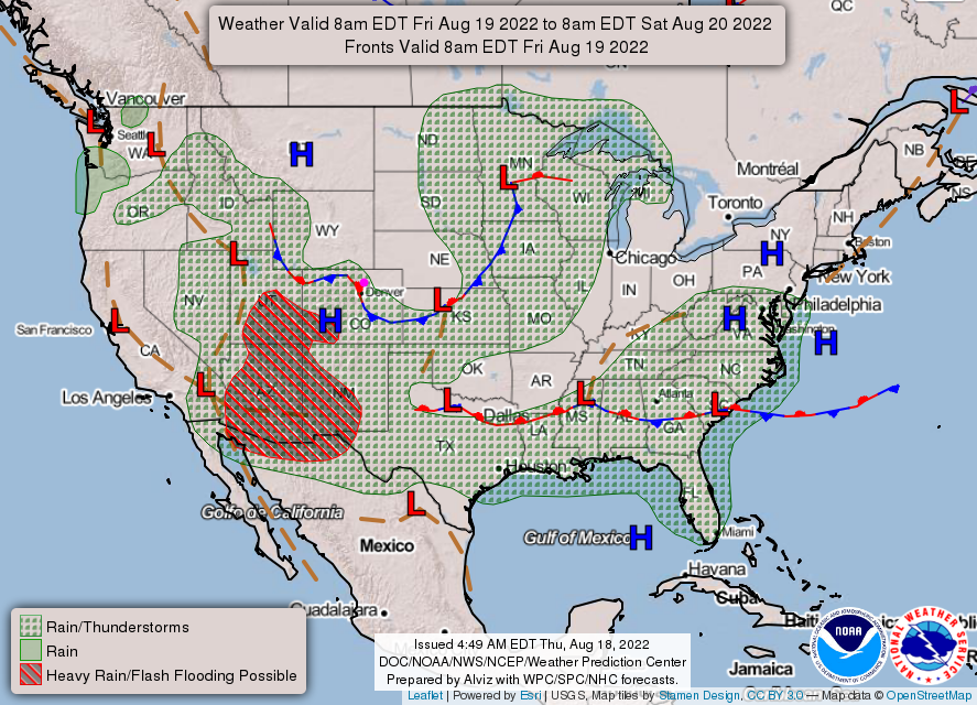
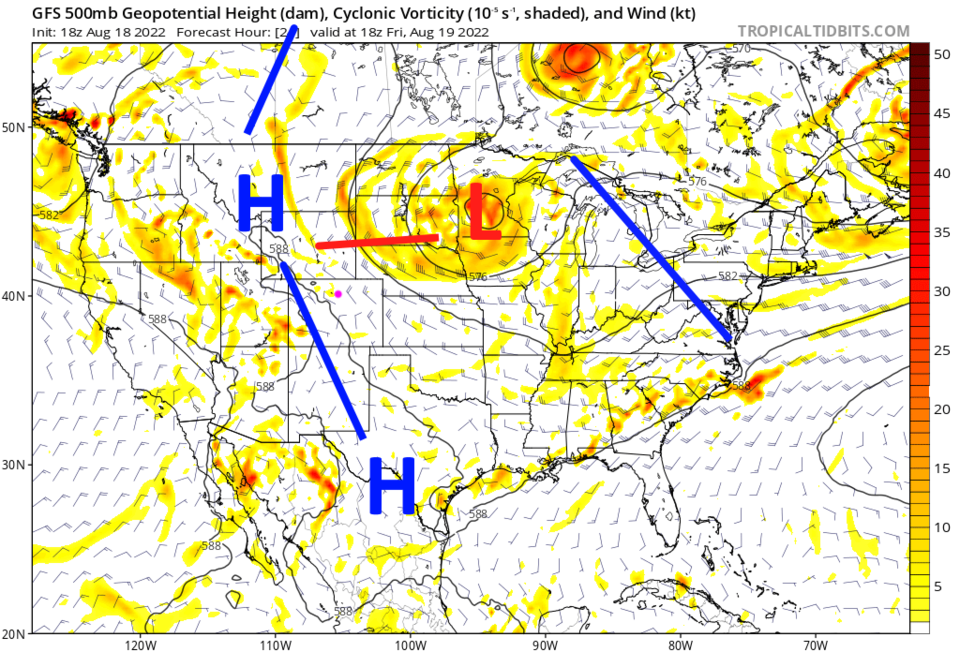
We are getting ready to say goodbye to summer. Temperatures drop into the 80s (most of the time) and storm chances remain confined to the afternoons and even then, fairly low (Figure 1) this week. The upper air ridge (blue line Figure 2) has shunted most of the moisture to the west and is bringing dry air down from the north over eastern Colorado. This is creating a stationary front along the Front Range with low storm chances to the northeast of the front (Figure 3).
Going forward a day, the ridge remains unmoved (Figure 4). What you see is what you'll get for a while!
The Longer Range Forecast:
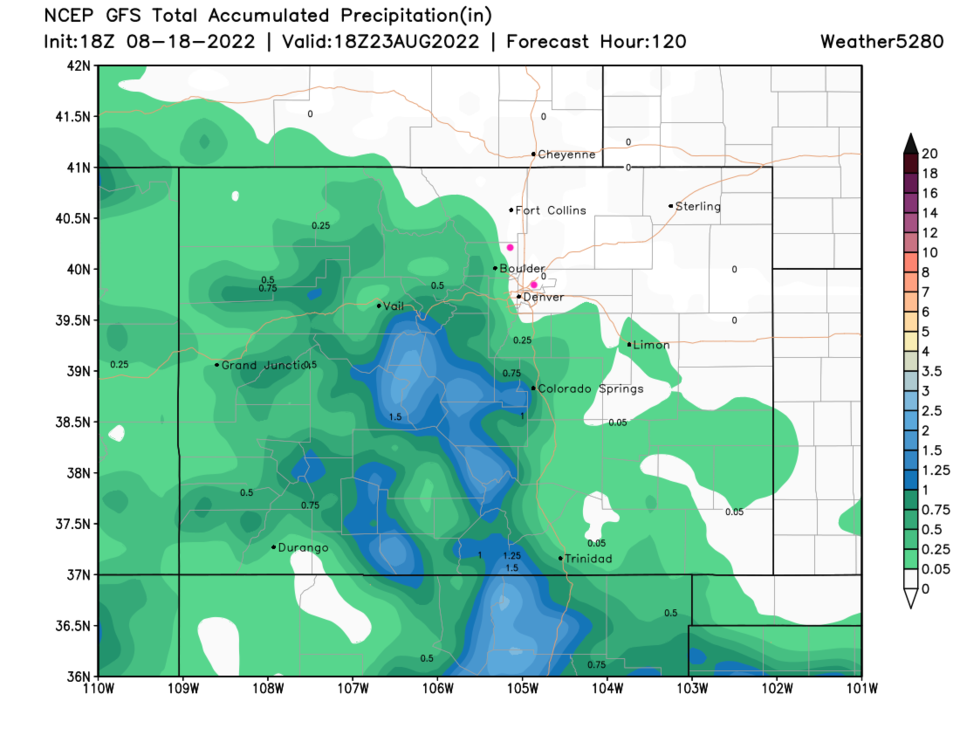
Over the next 5 days, we may see a stray storm hit spots along I-25 north of Denver, but don't hold your breath (Figure 5).