In Brief:
Wednesday cold front brings windy conditions Tuesday then a few inches of snow for northern Colorado.
Wednesday Update:
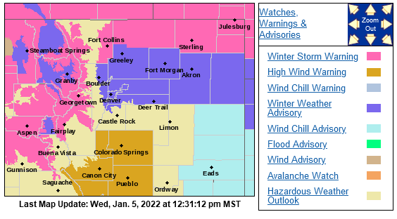
Longmont to Broomfield are under a Winter Weather Advisory. It looks like 3-5 inches to me, but the NWS is shaving an inch off of that:
Winter Weather Advisory
...WINTER WEATHER ADVISORY REMAINS IN EFFECT UNTIL 3 AM MST
THURSDAY...
* WHAT...Snow expected by late afternoon. Total snow accumulations 2
to 4 inches. Winds gusting as high as 35 mph.
* WHERE...Boulder and the western suburbs of Denver, Denver,
Greeley, and Byers.
* WHEN...Until 3 AM MST Thursday.
* IMPACTS...Roads will likely become slick and hazardous. Plan on
slippery road conditions. The hazardous conditions could impact
the Wednesday evening commute.
PRECAUTIONARY/PREPAREDNESS ACTIONS...
Slow down and use caution while traveling. The latest road
conditions for Colorado can be obtained by calling 5 1 1 or by going
to www.cotrip.org
Just to our north, there is the following Winter Storm Warning:
Winter Storm Warning
Issued: 12:36 PM Jan. 5, 2022 – National Weather Service
...WINTER STORM WARNING REMAINS IN EFFECT UNTIL 3 AM MST THURSDAY...
* WHAT...Snow expected to develop this afternoon. Total snow
accumulations between 2 and 5 inches. Winds gusting as high as 35
mph.
* WHERE...Fort Collins.
* WHEN...Until 3 AM MST Thursday.
* IMPACTS...Visibilities may drop below 1/4 mile due to falling and
blowing snow. Travel may become very difficult to impossible due
to heavy snowfall on roadways. Plan on slippery road conditions.
The hazardous conditions could impact the Wednesday evening
commute.
PRECAUTIONARY/PREPAREDNESS ACTIONS...
If you must travel, keep an extra flashlight, food, and water in
your vehicle in case of an emergency. The latest road conditions for
Colorado can be obtained by calling 5 1 1 or by going to www.cotrip.
org

End Wednesday update.
Tuesday Update:
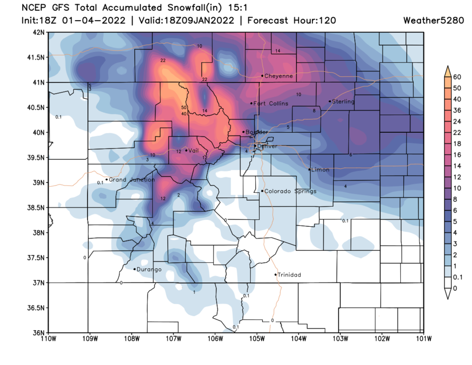
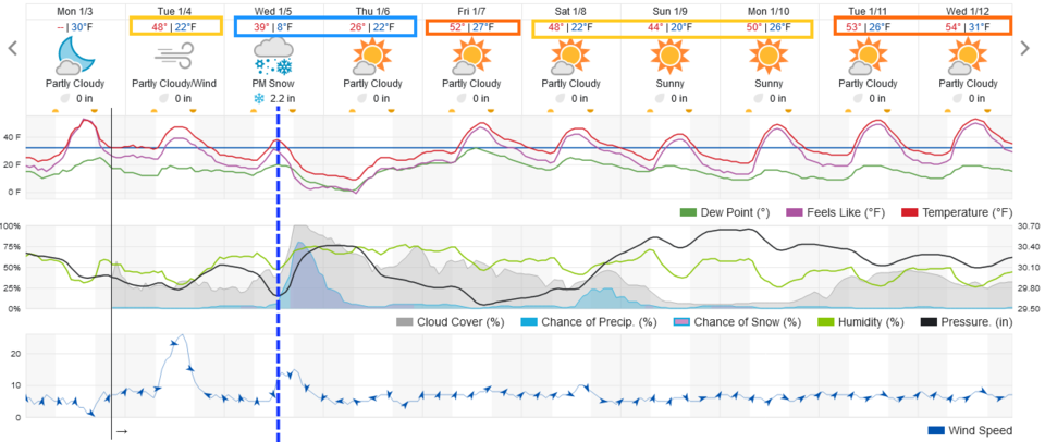
The models are increasing snowfall totals in the mountains and northern Colorado counties. Some new sample forecasts: Boulder 12-18", Longmont 5-7, Central Denver 4-6", Fort Collins 10-12". Stay Tuned! (Figure 1 update).
Forecast Discussion:
My forecast for the last storm was up to 6 inches in Longmont and Broomfield. Longmont received about 7.4 inches while Broomfield saw about 7.5 inches.
We are cool on Tuesday with 20-35mph winds moving in ahead of the next front. That front should arrive around 1 p.m. Wednesday with precipitation picking up shortly after that. The Broomfield to Longmont corridor should see 1-4 inches of snow out of this storm. (Figure 1). I'll include the Snowfall Roundup tomorrow.
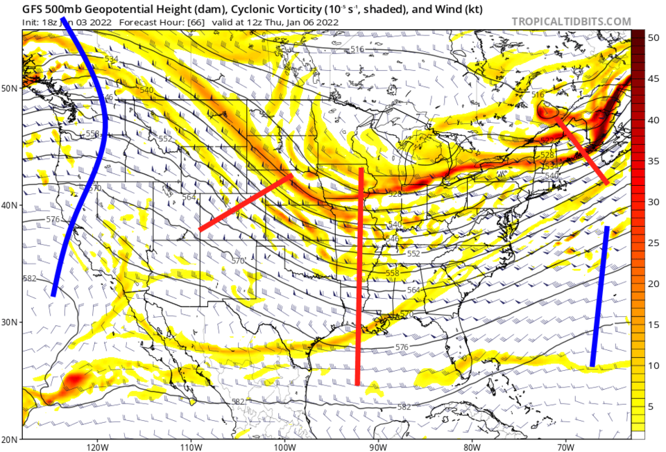
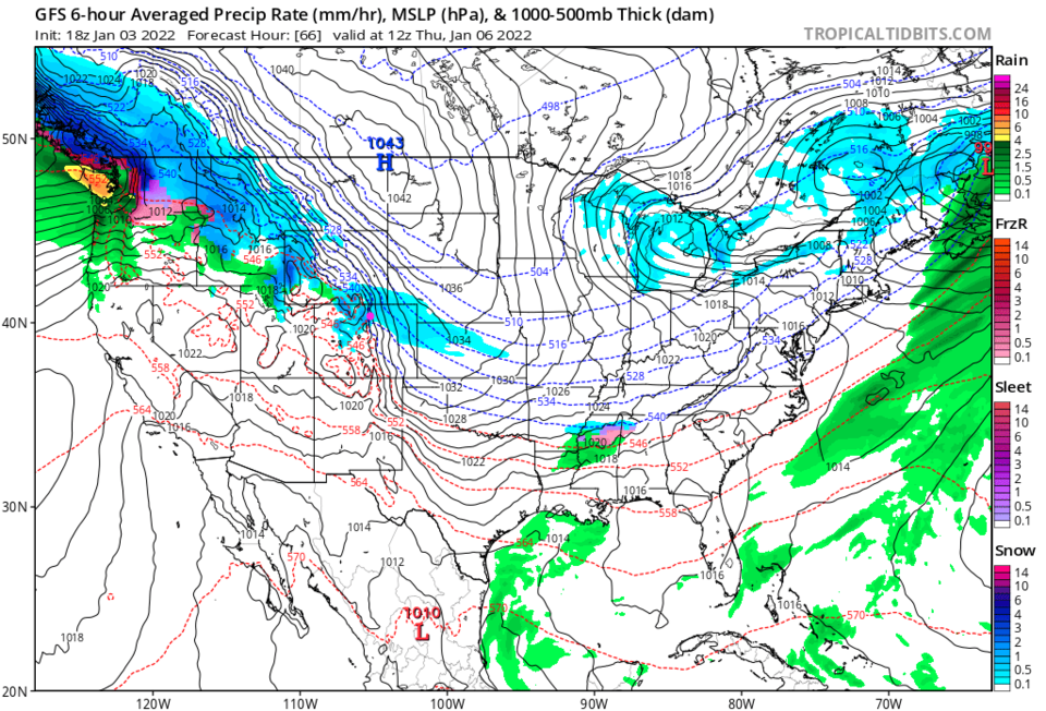
This is caused by a ripple in the jet stream flow around a large trough sitting in the center of the country (Figure 2). You can see the snowfall is aligned with the same pattern of upper air heights (Figure 3).
The Longer Range Forecast:
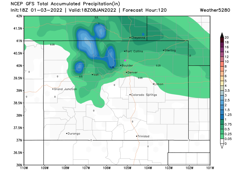
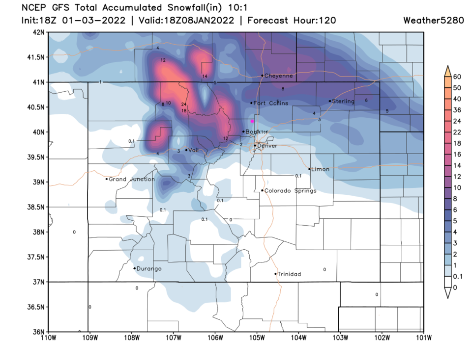
Over the next five days, the Longmont/Broomfield region will get about 0.25 inch of liquid (Figure 4). The GFS gives us about 2-3 inches.