This content was originally published by the Longmont Observer and is licensed under a Creative Commons license.
Forecast Discussion:
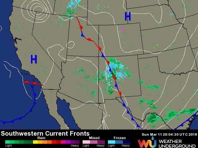
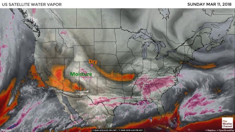
Yesterday's front has made it to the Four Corners area and a healthy amount of rain and snow has moved across Arizona and New Mexico (Figure 1). The water vapor satellite image (where moist air is grey/white and dry air is yellow to orange) shows a dry flow overhead in Longmont, and a clump of moisture to our southwest. IF that blob drifts northeast, virga (rainfall that evaporates before reaching the ground) is the most likely weather type.
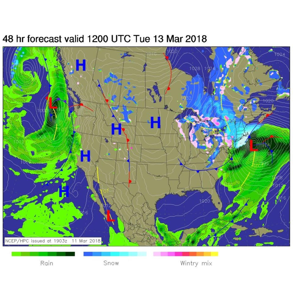
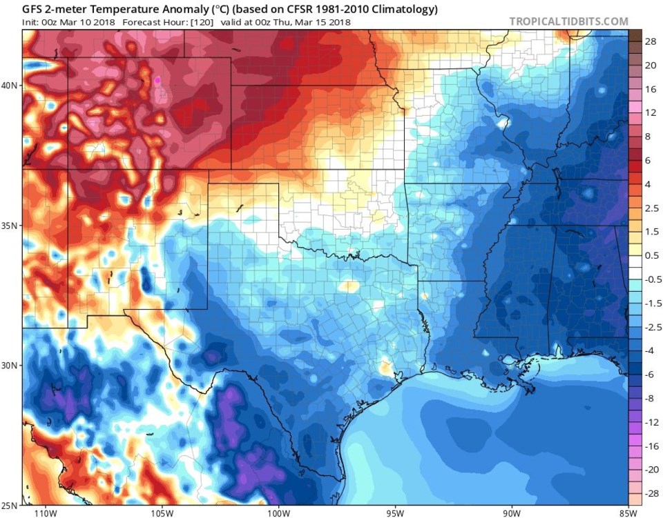
Figure 3 is the surface map for Tuesday morning -the stationary front is finally drifting eastward allowing warm air to hit for midweek and beyond. The ridge is overhead Wednesday morning. We'll have southwest winds, down slope flow, and compression under the ridge. All good reasons to see 70's F this week. Figure 5 is the departure from normal surface temperatures for Wednesday PM - Longmont is in the 12F above normal category (again!).
The longer range forecast:
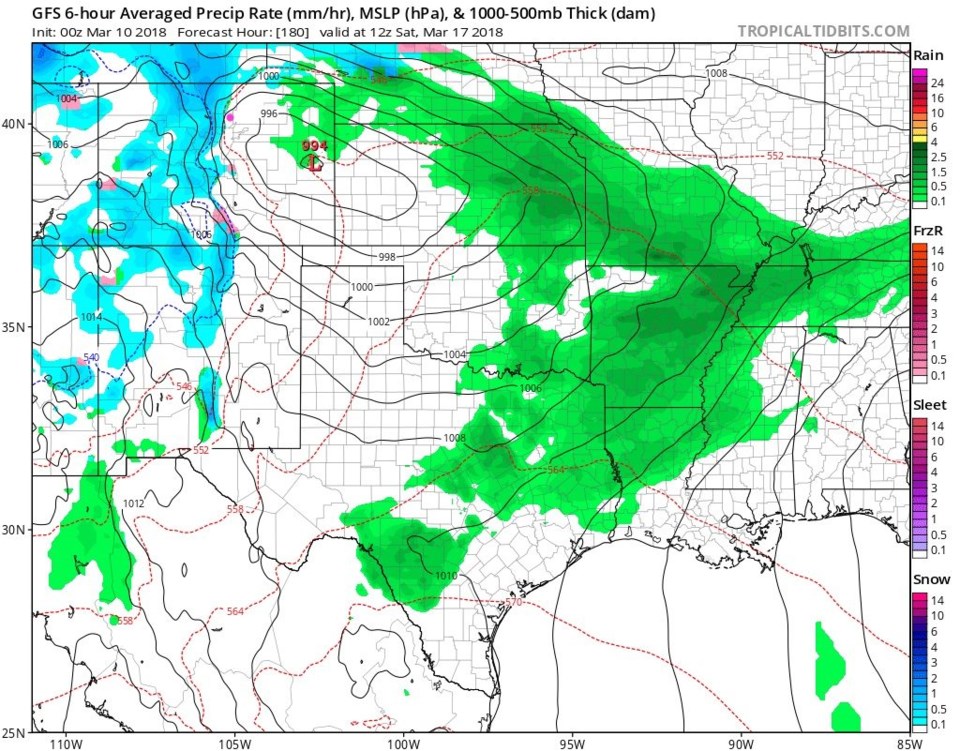
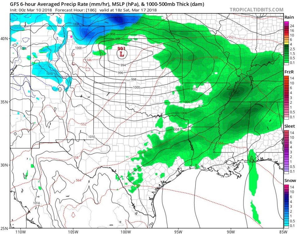
The trough, and next significant storm, is expected to impact our area Monday-ish next week. An earlier system is visible in the forecast maps now. A system will move through the state on Saturday. Like so many storms, the maximum precipitation to the west of Longmont will be underway Saturday morning. Down slope flow keeps us dry as a Plains low pressure system organizes. By Saturday midday - the Low is entering Kansas and the precipitation has hopped over us (with down slow flow keeping us dry and a bit warmer) hitting the northeast Colorado Plains. Can someone try to order a good rain or snow storm on Amazon Prime? We know it'll be delivered quickly if that were possible.