Skip to content
Join our Newsletter

Front Range Forecast: Cold Front Replaced by Summer Hot + Storms

In Brief:

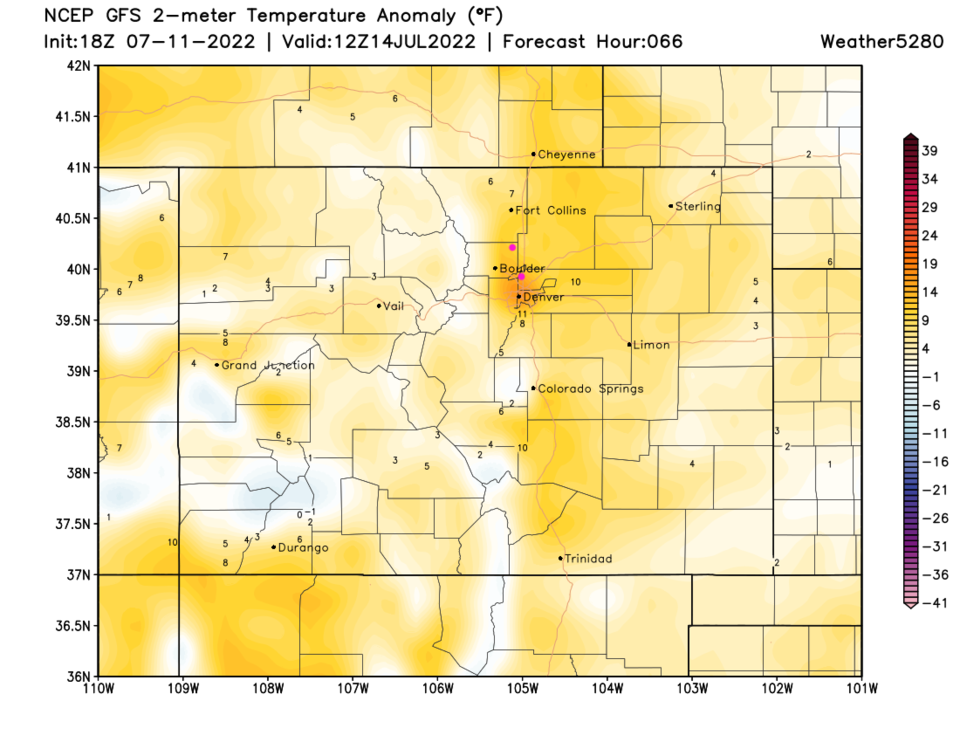
After a brisk cold front Monday morning (wow!) we warm to above average temperatures with some afternoon storm chances.

Forecast Discussion:

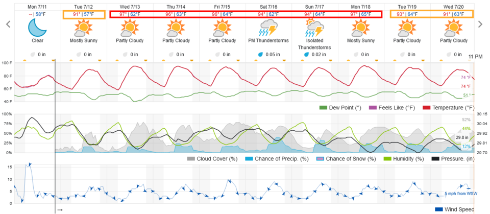
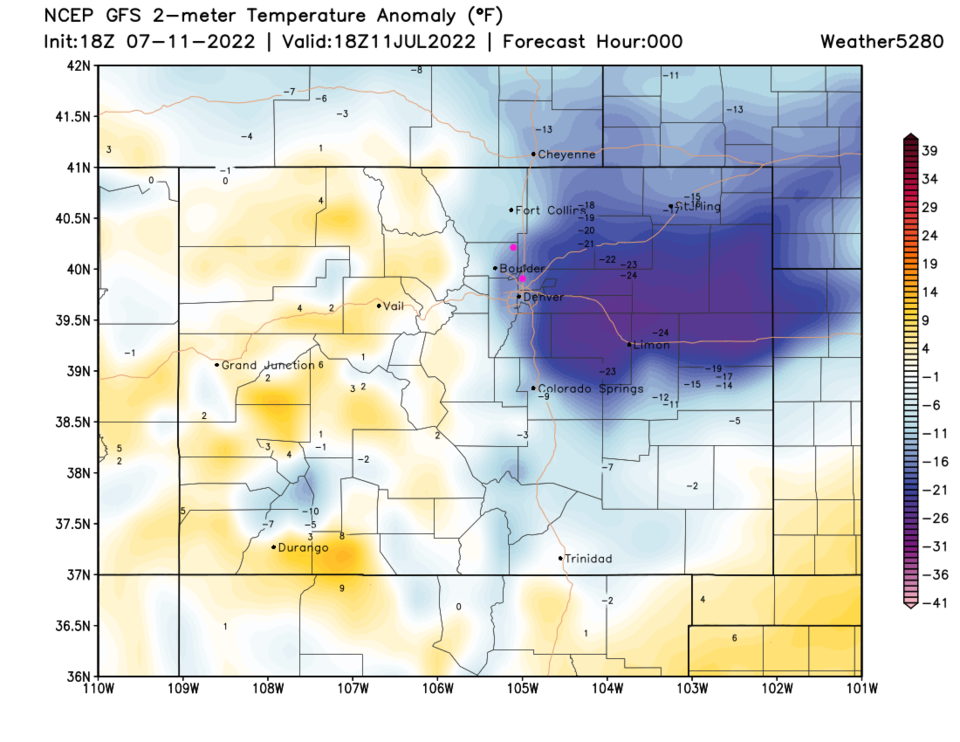
A stiff cold front blew through the area early Monday morning (it knocked over some trash cans on my street and made my Water World trip less than comfortable).  We return to seasonable temperatures Tuesday (Figure 1) and add about 7 degrees on average to the normal high temperature for the rest of the week.  The cold front is very visible on the surface temperature anomaly map for Monday (Figure 2). By Wednesday/Thursday, we are back to above average (Figure 3).

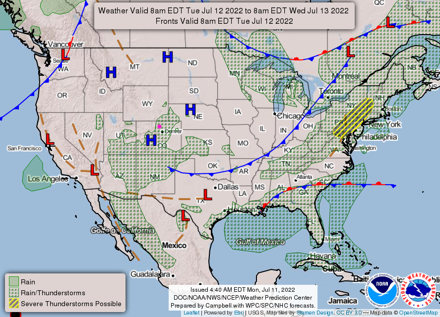
The cold front has moved on by Tuesday (Figure 4) and some storm chances have returned each afternoon after that (Figure 4 and Figure 1).


Figure1_07112022
Figure 1: the 10 day graphical forecast for Denver from weatherunderground.com
Figure2_07112022
Figure 2: the 2 meter above ground temperature anomaly (departure from normal) for noon Monday from weather5280.com and the GFS.
Figure3_07112022
Figure 3: the 2 meter above ground temperature anomaly (departure from normal) for Thursday morning from weather5280.com and the GFS.
Figure4_07112022
Figure 4: the forecast surface map for Tuesday from NOAA.

The Longer-Range Forecast:

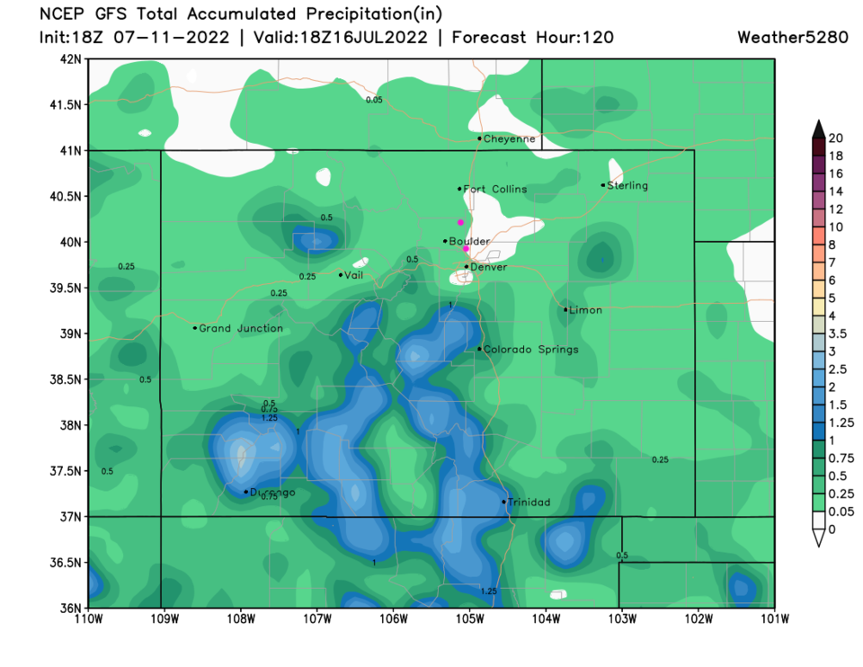
Nothing really changes in the long term. We remain a bit on the warm side with daily storm chances in the afternoons (Figure 1).  The rainfall amounts over the next 5 days will be pretty light overall except for the central and southern mountains (Figure 5).

Figure5_07112022
Figure 5: the 5 day precipitation forecast from the GFS and weather5280.com


About the Author: John Ensworth

John Ensworth used to work from Longmont as the PI for the NASA through the IGES (The Institute for Global Environmental Strategies). He now teaches technology, algebra, astronomy, meteorology, film school, and Lego robotics to middle/high school.
Read more


Comments


Current Weather

Mostly cloudy

Mostly cloudy

51°F

UV Index
0 Low
Pressure
30.11 Rising
Visibility
6 miles
Dewpoint
43 °F
Humidity
74%
Wind
SW 2.3 mph
Gust
3.9 mph
Wind Chill
51 °F

Hourly Forecast

Today
3 AM
51°F
Clear
Today
4 AM
51°F
Clear
Today
5 AM
50°F
Clear
Today
6 AM
49°F
Clear
Today
7 AM
52°F
Sunny
Today
8 AM
57°F
Sunny
Today
9 AM
64°F
Sunny
Today
10 AM
72°F
Sunny
Today
11 AM
77°F
Mostly sunny
Today
12 PM
82°F
Mostly sunny
Today
1 PM
84°F
Partly sunny
Today
2 PM
87°F
Partly sunny

7 Day Forecast

Partly sunny w/ showers

Sunday

73 °F

Brief morning showers; otherwise, clouds giving way to some sun


Mostly clear

Sunday Night

49 °F

Clear to partly cloudy


Partly sunny w/ t-storms

Monday

87 °F

Partly sunny and warmer; a thunderstorm around this afternoon


Partly cloudy

Monday Night

52 °F

Partly cloudy


Partly sunny w/ t-storms

Tuesday

74 °F

Not as warm with times of clouds and sun; a thunderstorm in the area in the afternoon; thunderstorms can bring localized damaging wind gusts


Mostly cloudy

Tuesday Night

51 °F

Increasing clouds


Mostly cloudy w/ t-storms

Wednesday

67 °F

Some sun, then turning cloudy with a couple of thundershowers in the afternoon


Clear

Wednesday Night

47 °F

Clear


Mostly sunny

Thursday

72 °F

Mostly sunny and pleasant


Mostly clear

Thursday Night

47 °F

Mainly clear


Sunrise and Sunset

Sunrise
6:40 AM
Sunset
7:11 PM

Based on AccuWeather data