Skip to content
Join our Newsletter

Front Range Forecast: Mild and quiet

In Brief:

Quiet near-normal temperatures dominate the next week.

Forecast Discussion:

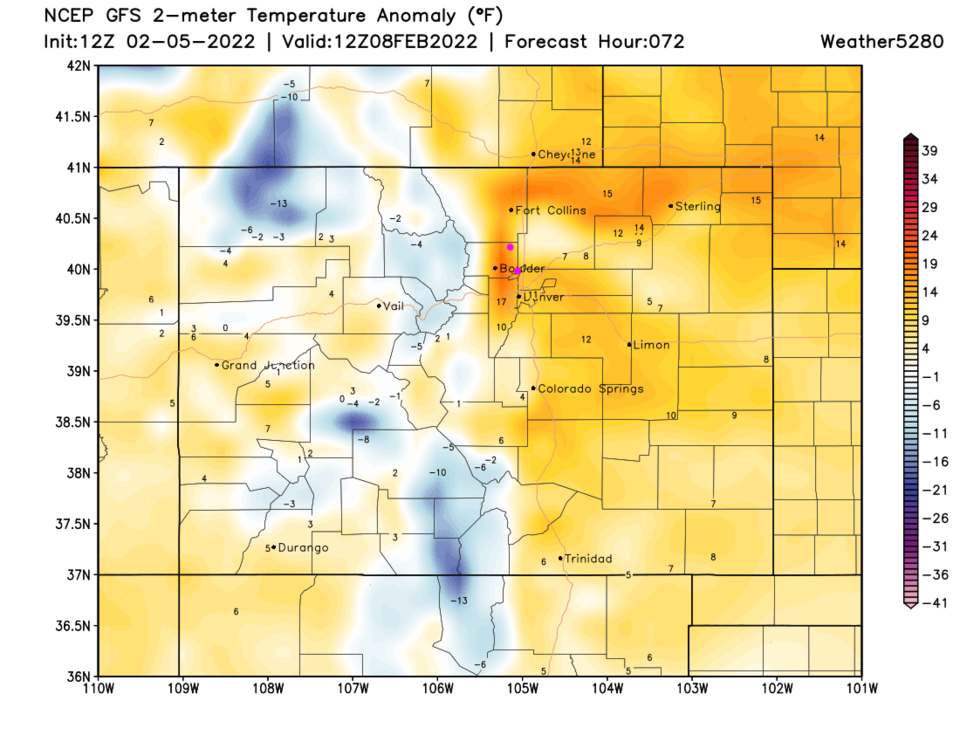
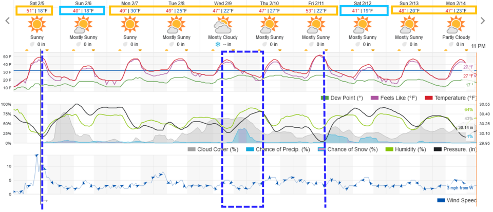
After all this excitement, the weather really calms down for the week to come. Temperatures are very close to normal with just a couple of cold fronts to briefly cool us for a bit. Watch the melt continue each day (Figure 1).

Figure1_02052022
Figure 1: the 10 day graphical forecast for Denver CO from weatherunderground.com

The Longer Range Forecast:

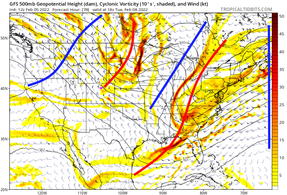
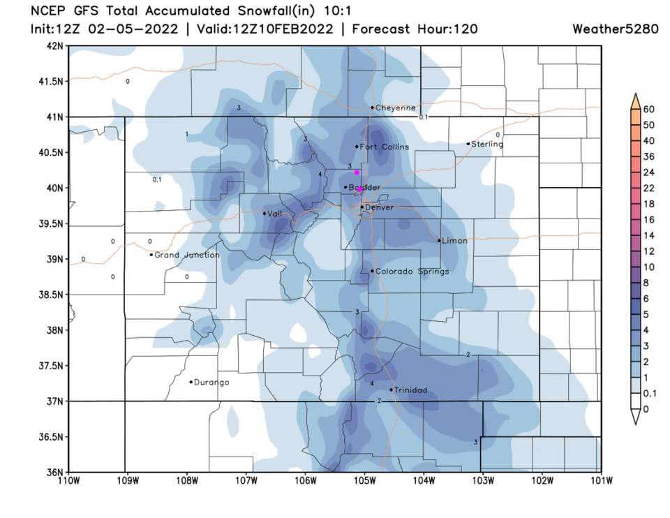
Before our next (small) chance of rain/snow - there will be another brief warm-up to about 15F above normal (Figure 2).  There are small precipitation chances east of the Rockies (Figure 1). That is caused by a quick moving small short wave trough to our north (Figure 3). The GFS is hinting at 1-3 inches in patchy spots (Figure 4).

Figure2_02052022
Figure2: the temperature anomaly (departure from normal) for Tuesday noon.
Figure3_02052022
Figure 3: the 500mb upper air map for noon Tuesday from the GFS and tropicaltidbits
Figure4_02052022
Figure 4: The 5 day snowfall total (10:1) from weather5280 and the GFS.


About the Author: John Ensworth

John Ensworth used to work from Longmont as the PI for the NASA through the IGES (The Institute for Global Environmental Strategies). He now teaches technology, algebra, astronomy, meteorology, film school, and Lego robotics to middle/high school.
Read more


Comments


Current Weather

Cloudy

Cloudy

56°F

UV Index
0 Low
Pressure
30.04 Rising
Visibility
8 miles
Dewpoint
52 °F
Humidity
85%
Wind
WNW 2.7 mph
Gust
6.2 mph
Wind Chill
56 °F

Hourly Forecast

Today
10 PM
57°F
Cloudy
Today
11 PM
56°F
Showers
Tomorrow
12 AM
56°F
Cloudy
Tomorrow
1 AM
56°F
Cloudy
Tomorrow
2 AM
56°F
Cloudy
Tomorrow
3 AM
56°F
Cloudy
Tomorrow
4 AM
56°F
Mostly cloudy
Tomorrow
5 AM
56°F
Rain
Tomorrow
6 AM
56°F
Rain
Tomorrow
7 AM
55°F
Rain
Tomorrow
8 AM
57°F
Partly sunny
Tomorrow
9 AM
60°F
Partly sunny w/ showers

7 Day Forecast

Thunderstorms

Saturday

75 °F

Mostly cloudy with a thunderstorm in spots this afternoon; thunderstorms can bring hail and damaging winds


Rain

Saturday Night

55 °F

Mostly cloudy; an evening shower in spots followed by occasional rain and drizzle late


Partly sunny

Sunday

77 °F

A morning shower in spots; otherwise, sun and some clouds


Clear

Sunday Night

49 °F

Clear


Partly sunny

Monday

84 °F

Warmer with sunshine and some clouds


Partly cloudy

Monday Night

51 °F

Partly cloudy


Intermittent clouds

Tuesday

76 °F

Pleasant with times of clouds and sun


Mostly cloudy w/ t-storms

Tuesday Night

50 °F

Cloudy in the evening with a couple of showers and a thunderstorm, then partly cloudy late


Mostly cloudy w/ t-storms

Wednesday

75 °F

Some sun, then turning cloudy with a couple of showers and a thunderstorm


Clear

Wednesday Night

47 °F

Clear


Sunrise and Sunset

Sunrise
6:39 AM
Sunset
7:13 PM

Based on AccuWeather data