Skip to content

Mon Update: Front Range Forecast: Snow totals

In Brief:

Cool spring-like weather with showers every few days.

Monday Update:

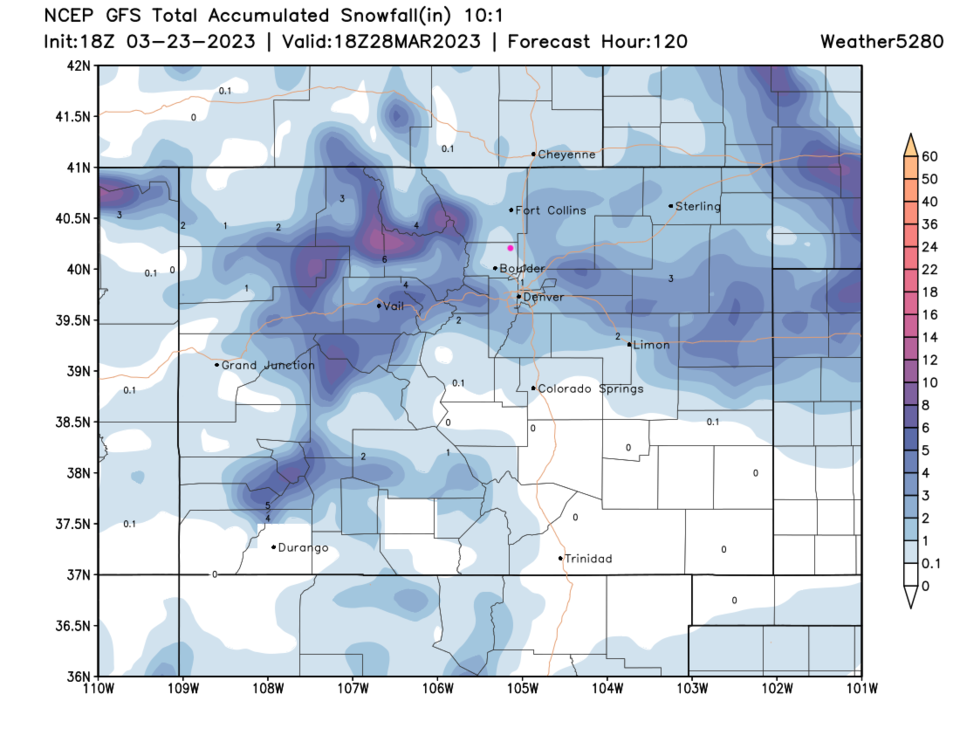
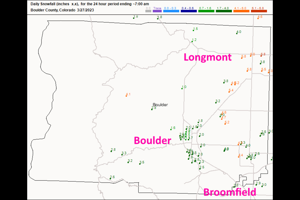
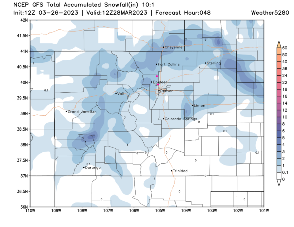
The storm is departing midday Monday. A line of converging air formed over I-25 from Longmont to Ft. Collins.  The storm WAY over produced snow compared to expectations (see the GFS below - Figure 1 update).  Figure 2 update shows widespread 6-7 inches of snow in town. Further north, there were 11 inch depths reported!  Pretty incredible. And great additional moisture.

As an update, Thursday's storm is shrinking in expected strength, but I'll keep an eye on it.

.

figure2u_03272023
Figure 2 update: the snow totals through 7am Monday from CoCoRaHS.com

End Monday update.

Sunday Update:

After our 1 inch snow Friday night, another storm approaches for the overnight Sunday/Monday. Ft. Collins and Boulder might see 2-3 (locally 4) inches of snow while places south of Ft. Collins look like they should only see a coating to an inch or two. 

figure1u_03262023
Figure 1 update: the 48 hour snowfall total at 10:1 ratio from the GFS and weatherunderground.com

End Sunday update.

Forecast Discussion:

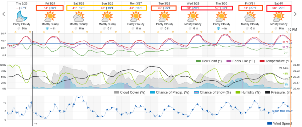
Temperatures have definitely improved recently. The weekend will be unusually cool (compared to the great weekends we've been having).

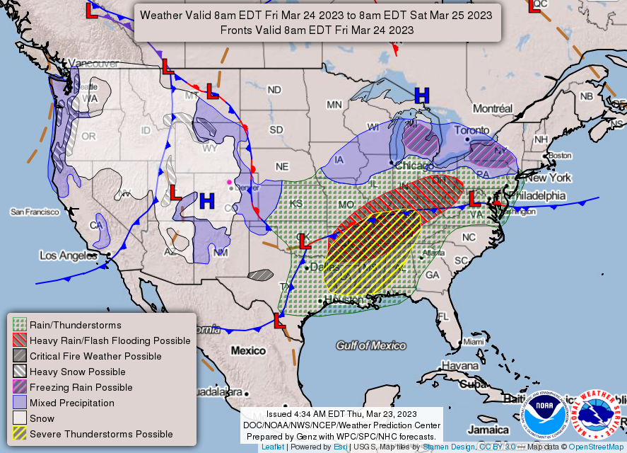
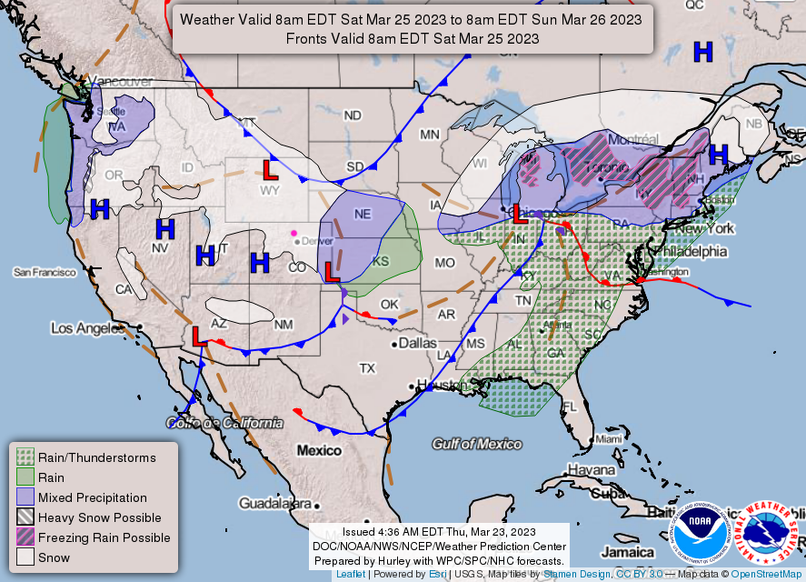
There is a pretty good shot of moisture coming in Friday PM through Saturday AM. There might be an inch or so of snow on grassy areas after some rain, but roads should remain only wet or slightly slushy (Figure 1). There is another shot of moisture Sunday night into Monday, but is looks less impactful.  The surface forecast maps from the National Weather Service (Figure 2 and 3) show snow/rain falling over Colorado (even it it might be a bit overdone). 

figure1_03232023
Figure 1: the 10 day graphical forecast for Denver from weatherunderground.com
figure2_03232023
Figure 2: the Friday NWS surface forecast map.
figure3_03232023
Figure 3: the Saturday NWS surface forecast map.

The Long Range Forecast:

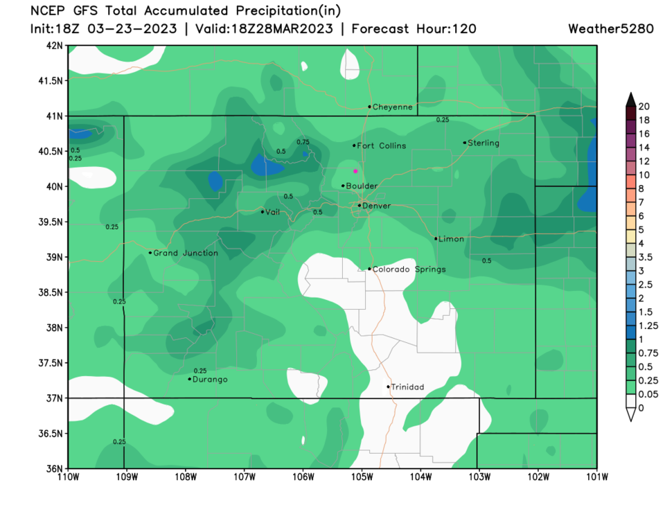
Looking out five days, these small systems might drop 1-2 inches along I-25 and a bit more in the mountains (Figure 4). It looks like rain + snow might total up to a liquid equivalent of 0.25 to 0.5 inch of moisture (Figure 5). Every bit helps!

figure4_03232023
Figure 4: the 5 day snowfall (10:1 ratio) forecast from the GFS and weather5280.com
figure5_03232023
Figure 4: the 5 day precipitation forecast from the GFS and weather5280.com


About the Author: John Ensworth

John Ensworth works from Longmont as the Principle Investigator for the NASA Science Mission Directorate Earth and space science education product review through the IGES (The Institute for Global Environmental Strategies – www.strategies.org).
Read more


Comments

Current Weather

Mostly cloudy

Mostly cloudy

58°F

UV Index
6 High
Pressure
29.91 Falling
Visibility
8 miles
Dewpoint
52 °F
Humidity
79%
Wind
NNE 2.3 mph
Gust
4.4 mph
Wind Chill
58 °F

12 Hour Forecast

Today
11 AM
67°F
Mostly cloudy
Today
12 PM
70°F
Mostly cloudy
Today
1 PM
72°F
Mostly cloudy
Today
2 PM
74°F
Mostly cloudy
Today
3 PM
72°F
Thunderstorms
Today
4 PM
70°F
Mostly cloudy
Today
5 PM
68°F
Thunderstorms
Today
6 PM
66°F
Cloudy
Today
7 PM
65°F
Mostly cloudy
Today
8 PM
64°F
Intermittent clouds
Today
9 PM
62°F
Intermittent clouds
Today
10 PM
59°F
Intermittent clouds

7 Day Forecast

Thunderstorms

Thursday

74 °F

Mostly cloudy; a brief shower or two this morning followed by a couple of thunderstorms this afternoon


Mostly cloudy w/ t-storms

Thursday Night

50 °F

A thunderstorm in spots this evening; otherwise, partly to mostly cloudy


Partly sunny w/ t-storms

Friday

73 °F

Intervals of clouds and sun with a thunderstorm in spots in the afternoon


Thunderstorms

Friday Night

50 °F

A thunderstorm in spots in the evening; otherwise, mostly cloudy


Thunderstorms

Saturday

67 °F

Cloudy with a couple of showers and a thunderstorm


Mostly cloudy

Saturday Night

51 °F

Rather cloudy


Cloudy

Sunday

68 °F

Dull and dreary with a stray thunderstorm in the afternoon


Thunderstorms

Sunday Night

52 °F

A couple of thunderstorms in the evening; otherwise, considerable cloudiness


Cloudy

Monday

73 °F

Considerable cloudiness with a stray thunderstorm in the afternoon


Mostly cloudy

Monday Night

51 °F

Rather cloudy


Sunrise and Sunset

Sunrise
5:33 AM
Sunset
8:24 PM

Based on AccuWeather data