Skip to content
Join our Newsletter

Fri Update: Front Range Forecast: Warm and dry continues

In Brief:

We remain dry with above normal temperatures for many days.

Friday Update:

Astonishingly long stretch of quiet weather and above normal temperatures.  Hoping for more snow in Thanksgiving week!


figure2u_11102023
Figure 2 update: the 10 day graphical forecast for Longmont from weatherundeground.com

End Friday update.

Sunday update:

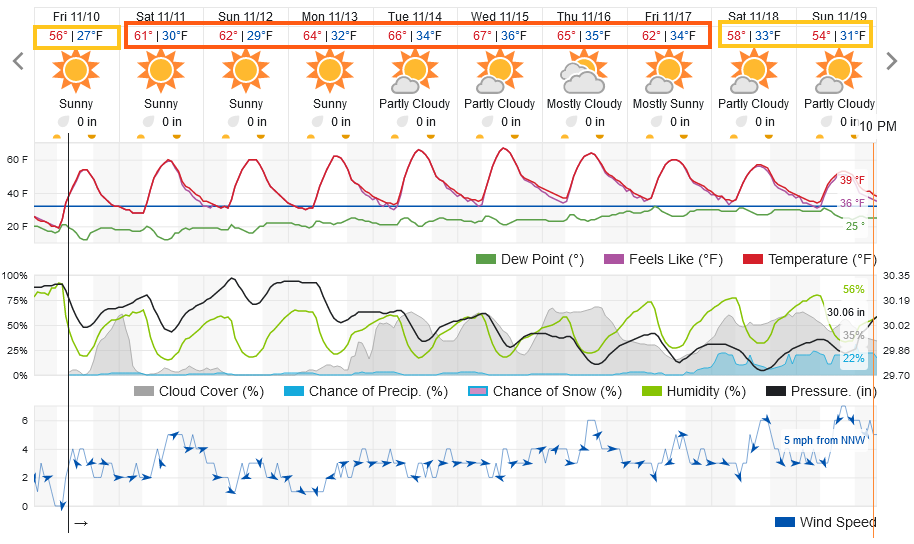
The models are coming more into agreement for the Wednesday/Thursday cool down and chance of precipitation (Figure 1 update). The cold front arrives around 2pm on Tuesday.  This doesn't look, at this time, to be a very wet or very cold storm. Some snowfall is possible at night.  More later!

figure1u_11052023
Figure 1 update: the 10 day graphical forecast for Longmont from weatherunderground.com

End Sunday update.

Forecast Discussion:

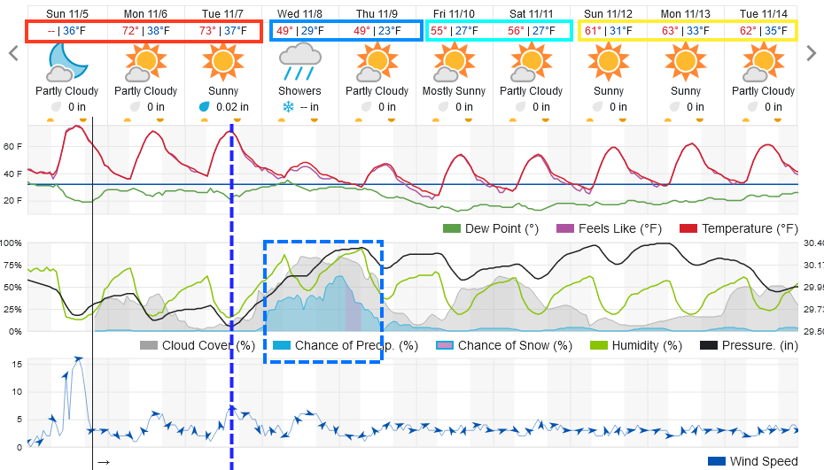
We remain about 15-20F above normal and completely dry through Tuesday.  Enjoy a comfortable weekend!

figure1_11032023
Figure 1: the 10 day graphical forecast for Longmont from weatherunderground.com

The Longer Range Forecast:

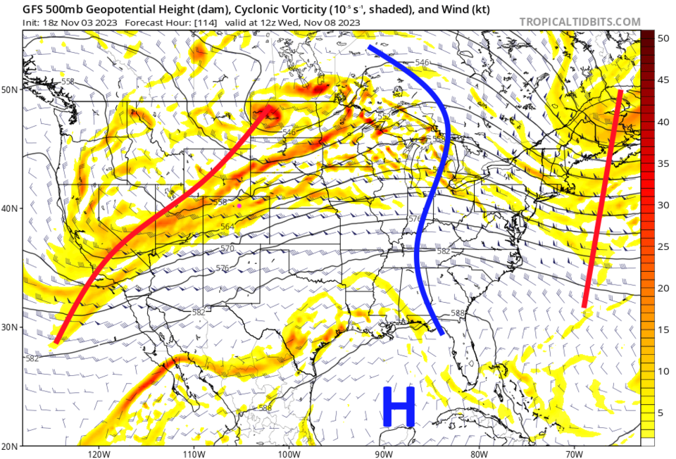
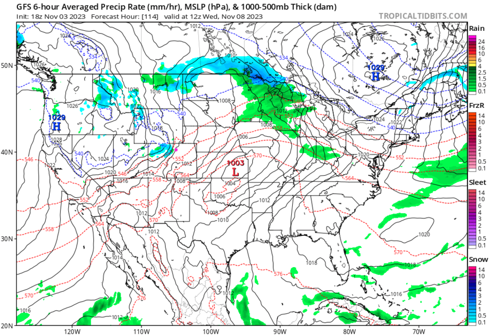
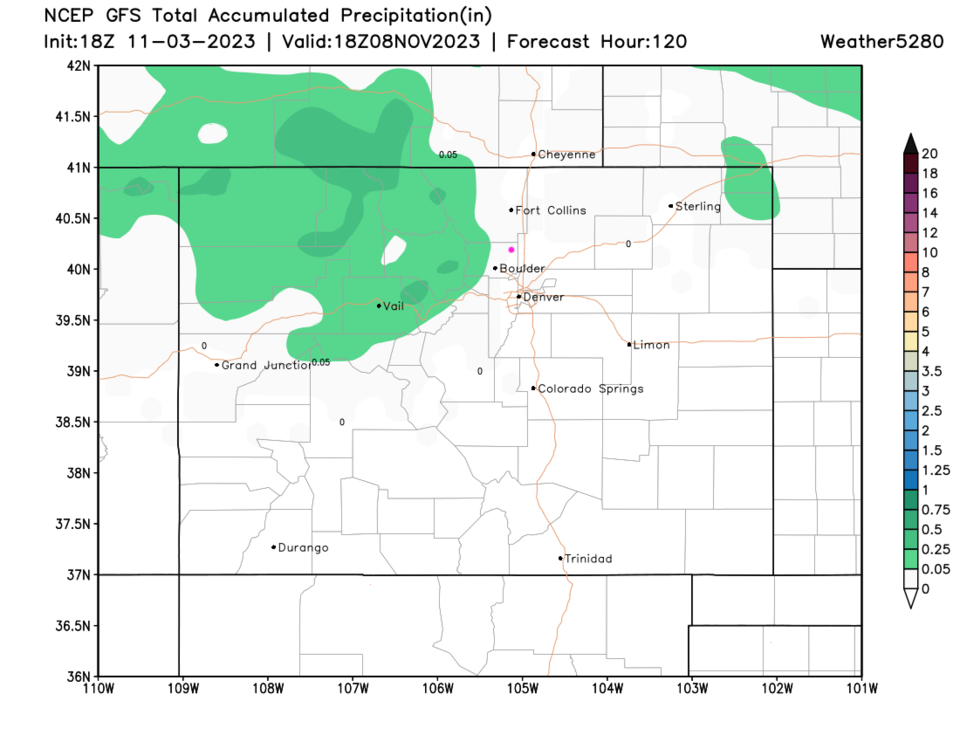
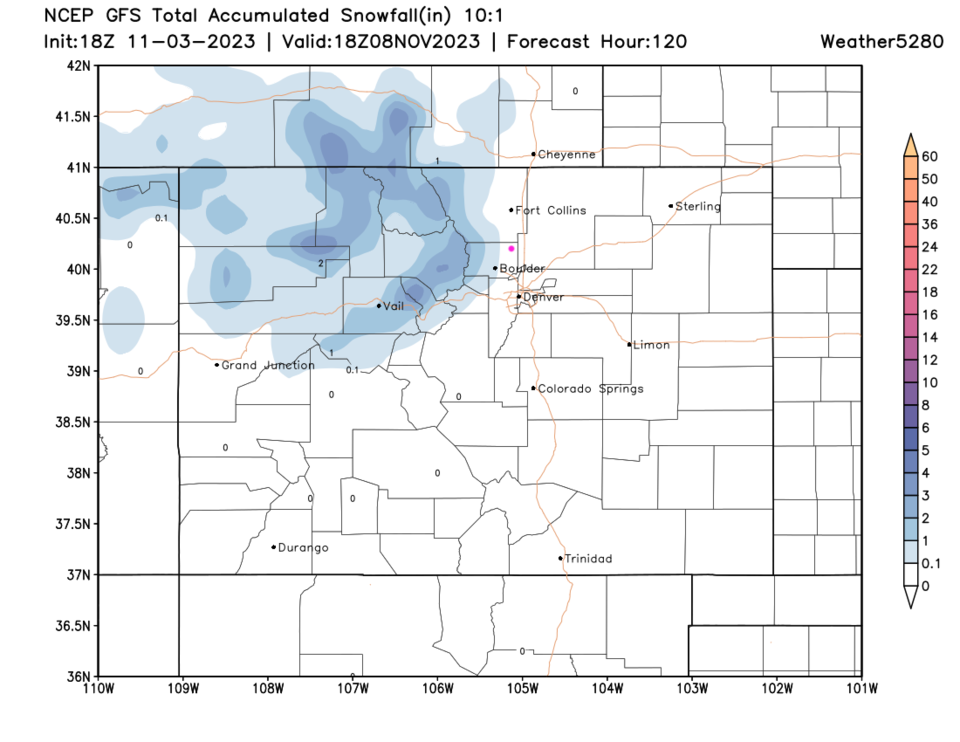
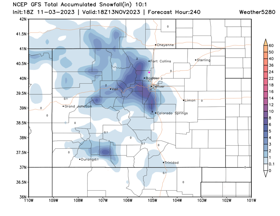
A trough finally approaches the state mid-week (Figure 2). The GFS has snow/rain chances looking very spotty at this time (Figure 3). Over the next 5 days, the precipitation remains in the mountains, and very light (Figure 4). That falls as light snow amounts (Figure 5). There is a hint of more mountain snows over the next 10 days, but overall, things are very quiet.  Enjoy a warm late-fall.

figure2_11032023
Caption
figure3_11032023
Figure 3: the surface precipitation forecast around Wednesday morning from the GFS and tropicaltidbits.com
figure4_11032023
Figure 4: the 5 day precipitation forecast from the GFS and weather5280.com
figure5_11032023
Figure 5: the 5 day snowfall forecast (10:1) from the GFS and weather5280.com
figure6_11032023
Figure 6: the 10 day snowfall forecast (10:1) from the GFS and weather5280.com


About the Author: John Ensworth

John Ensworth used to work from Longmont as the PI for the NASA through the IGES (The Institute for Global Environmental Strategies). He now teaches technology, algebra, astronomy, meteorology, film school, and Lego robotics to middle/high school.
Read more


Comments


Current Weather

Cloudy

Cloudy

69°F

UV Index
1 Low
Pressure
30.21 Steady
Visibility
8 miles
Dewpoint
48 °F
Humidity
46%
Wind
E 2.9 mph
Gust
6.5 mph
Wind Chill
69 °F

Hourly Forecast

Today
5 PM
70°F
Cloudy
Today
6 PM
68°F
Mostly cloudy w/ t-storms
Today
7 PM
65°F
Intermittent clouds
Today
8 PM
61°F
Intermittent clouds
Today
9 PM
60°F
Intermittent clouds
Today
10 PM
58°F
Intermittent clouds
Today
11 PM
57°F
Intermittent clouds
Tomorrow
12 AM
56°F
Mostly cloudy w/ t-storms
Tomorrow
1 AM
55°F
Intermittent clouds
Tomorrow
2 AM
54°F
Cloudy
Tomorrow
3 AM
53°F
Cloudy
Tomorrow
4 AM
53°F
Cloudy

7 Day Forecast

Partly sunny w/ t-storms

Tuesday

78 °F

Not as warm with times of clouds and sun; a thunderstorm or two this afternoon; thunderstorms can bring gusty winds, hail and localized flooding


Mostly cloudy w/ t-storms

Tuesday Night

50 °F

A thunderstorm this evening; otherwise, increasing clouds


Mostly cloudy w/ t-storms

Wednesday

73 °F

Some sun, then turning cloudy with a couple of thundershowers in the afternoon


Partly cloudy w/ t-storms

Wednesday Night

50 °F

A couple of showers and a thunderstorm in the evening; otherwise, clearing


Mostly sunny

Thursday

74 °F

Mostly sunny and pleasant


Clear

Thursday Night

45 °F

Clear


Sunny

Friday

81 °F

Plenty of sunshine


Partly cloudy

Friday Night

47 °F

Partly cloudy


Mostly sunny

Saturday

85 °F

Mostly sunny


Clear

Saturday Night

53 °F

Clear


Sunrise and Sunset

Sunrise
6:42 AM
Sunset
7:08 PM

Based on AccuWeather data