In Brief:
Warm now, possible weekend first snow.
Wednesday update:
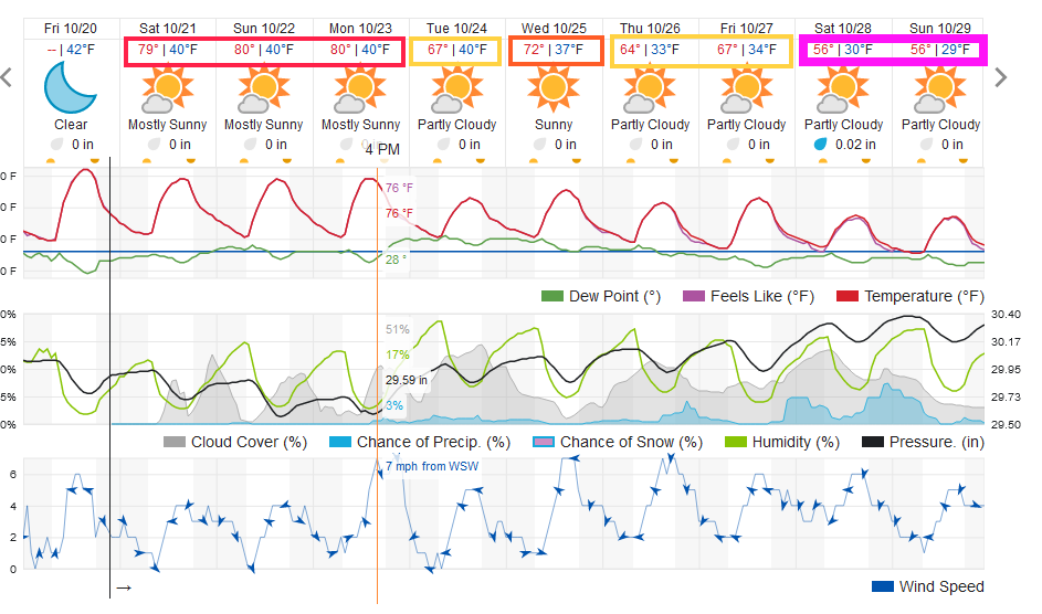
The earlier mentioned Thursday-ish snow storm will be restricted to the northern mountains. Our (probably real this time) first chance of snow is forecast to arrive Saturday (Figure 1 update). I'm on vacation this week, but will be watching this closely!

End Wednesday update.
The Forecast Discussion:
We still have a few days of warmth and dry air. We set a new hight temperature record for Friday at DIA! The near 80's continue through Monday (Figure 1).
The Longer Range Forecast:
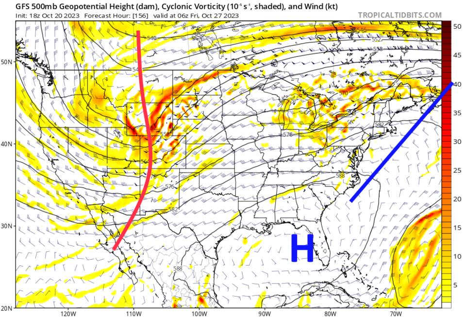
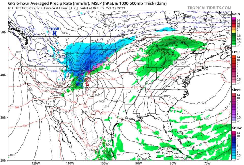
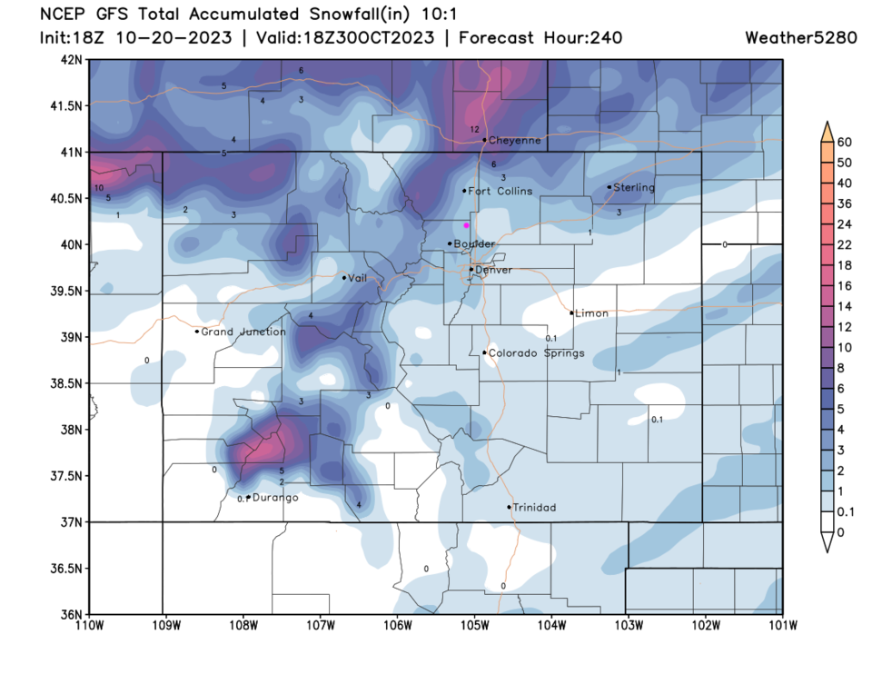
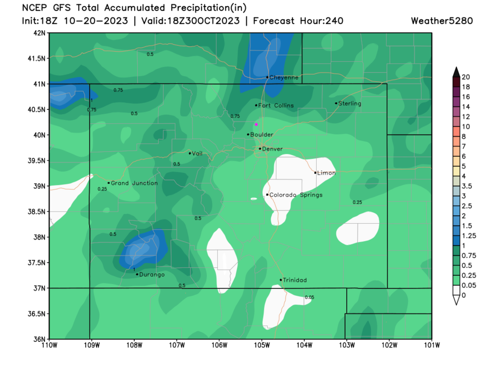
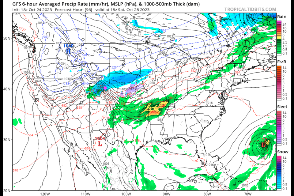
The graphical forecast does not show significant rain or snow (Figure 1), but the GFS is hinting at a good storm late week. A trough crosses the state Thursday/Friday (Figure 2). It gives us a good (first) snow storm (Figure 3). That gives Longmont about 1-2 inches of snow (Figure 4). Overall, the GFS givves most of us about 1/2 inch of water or less (Figure 5). Keep praying for more moisture!