In Brief:
We warm to summer norms with afternoon thunderstorms wandering off the foothills.
Tuesday Update:
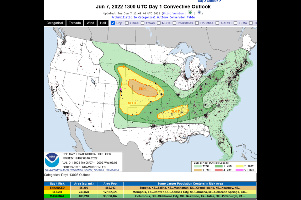
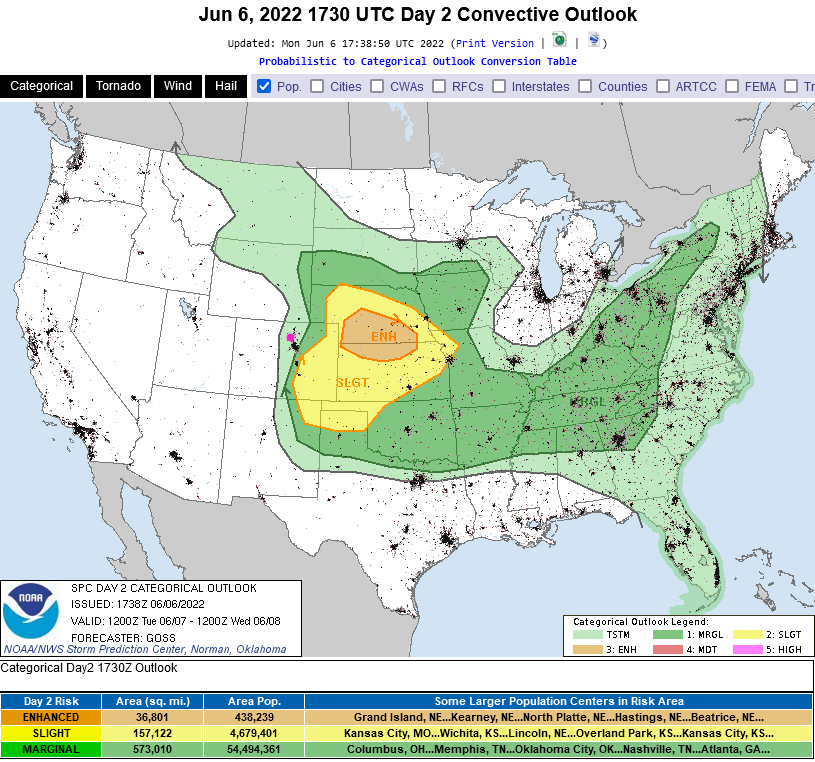
The NWS points out that today is a difficult forecast. We have a stable atmosphere in place that may not destabilize before a different atmospheric effect moves in to suppress thunderstorm development later today. But *if* it does warm up enough, we do have a chance for severe weather. Figure 1 shows a Marginal Risk (1 out of 5) in the foothills- this is mainly for damaging hail. The Slight Risk in yellow (2 out of 5) includes damaging straight line winds and a chance of a tornado. Still, the chance of precipitation is only about 20%. Most people won't even see rain, let alone strong thunderstorm weather. Keep your eyes to the western sky this afternoon but don't cancel your picnic.
End Tuesday update.
Forecast Discussion:
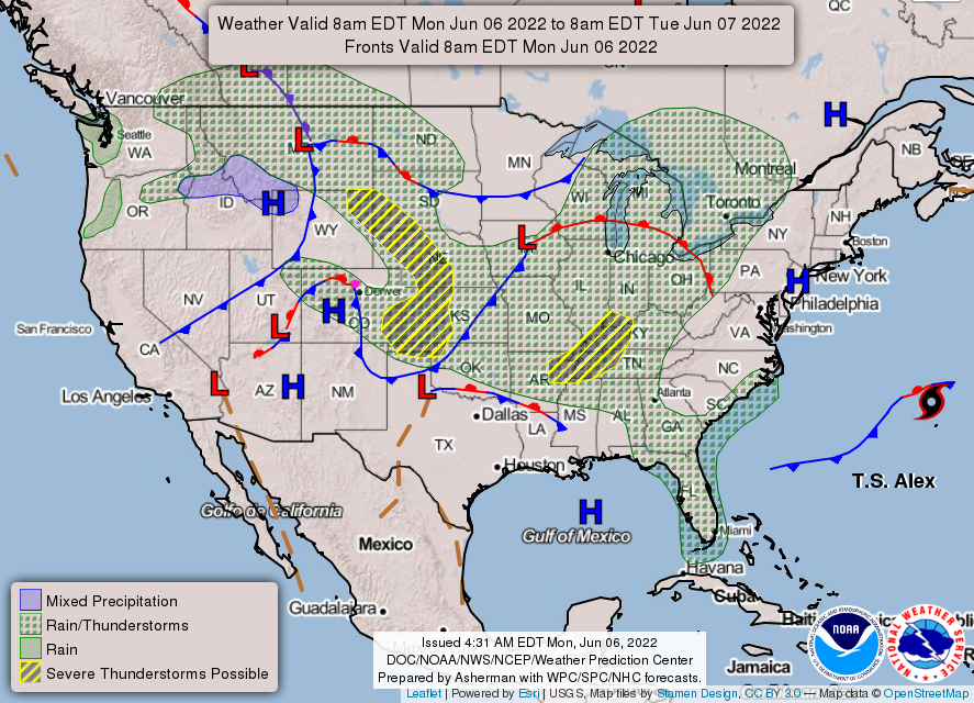
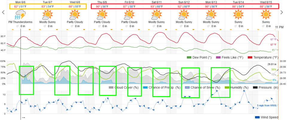
We seem to be leaving the pattern where we expect most of our moisture to come from cold front passages (there still will be those, but afternoon storms are going to contribute more and more to our needed water). For Monday into Tuesday, a weak cold front is delivering moisture to thunderstorms that fire in the mountains and slide down to the east (Figure 1). With this shallow cool air in place, we hover around the lower 80s as highs and have nearly daily afternoon thunderstorm chances (Figure 2).
Severe weather chances one day out (Tuesday) begin just 10s of miles east of I-25. Tornado chances will exist in the Slight (yellow) and Enhanced Risk (orange) zones (Figure 3) further east. This may sneak back a bit to the west when Tuesday's data comes in. There might be a risk of hail and high winds along I-25. Keep your eyes on your weather apps.
The Longer-Range Forecast:
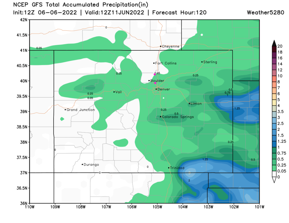
From Thursday on, we hover around 90F for a high for at least a week with daily pulses of afternoon thunderstorm chances (green boxes Figure 2). Overall, precipitation totals over the next 5 days should remain pretty light unless you get a fortunate storm overhead (Figure 4). Break out the ice tea and lemonade!