In Brief:
Temperatures will top 100 for a day or two, forest fire smoke returns, then cooler weather with a few thunderstorms will return.
Update Wednesday:
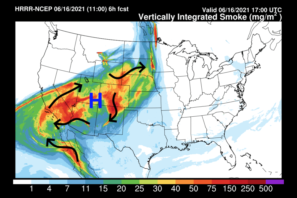
Due to the heat and drought out west, forest fires have resumed. The high pressure system (blue H in Figure 2 update) is circulating the air in it around clockwise allowing the smoke levels to build (black arrows in Figure 2 update). The smoke may shave a degree or two off the high temperature today; 99-100F is still possible which should break another high temperature record.
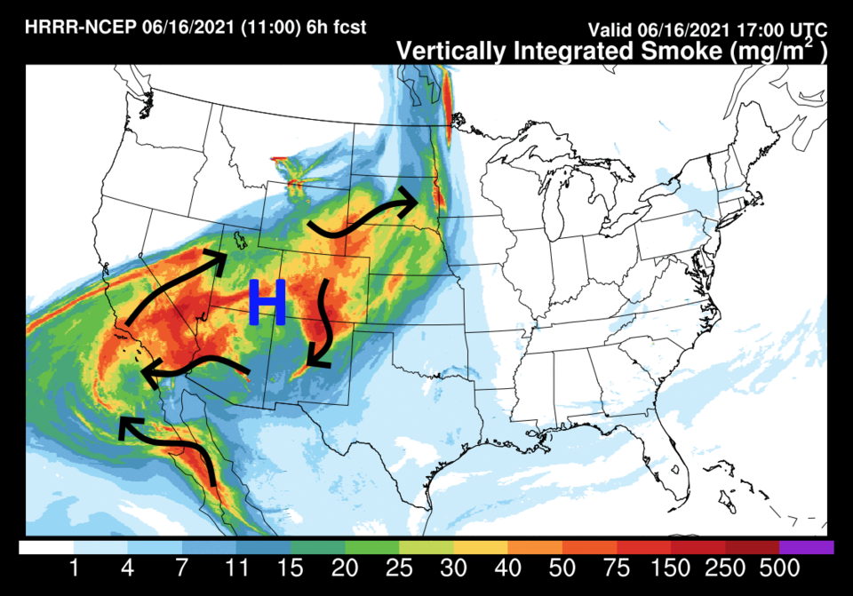 Figure 2 update: the HRRR smoke forecast with wind flow arrows from NOAA.
End Wednesday update.
Update Tuesday:
A quick check on today's heat. Figure 1 update shows Longmont at 100F this afternoon with a notable 102 SE of Colorado Springs. Ouch.
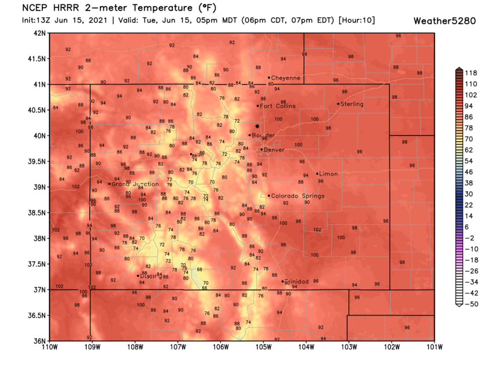 Figure 1 update: the actual temperatures and departure from normal (coloration) map for 5pm Tuesday from the HRRR and weather5280.com
End Tuesday update.
Forecast Discussion:
A giant high pressure system, that is the discussion for today. Looking at Figure 1, the high pressure center over the Four Corners area is creating atmospheric heights (the contours drawn in Figure 1 and 3) about as high as we ever see at any time of the year. That means record temperatures for the I-25 corridor. Looking at Figure 2, we see a possible 100+F Tuesday, 97F Wednesday and 98F Thursday, before a cool down moves in. The actual record temperatures, for Denver, on those dates are: 97F on June 15, 1993, 96F on June 16, 2020 and 98F on June 17, 2012. All three records are in danger. Stay cool!
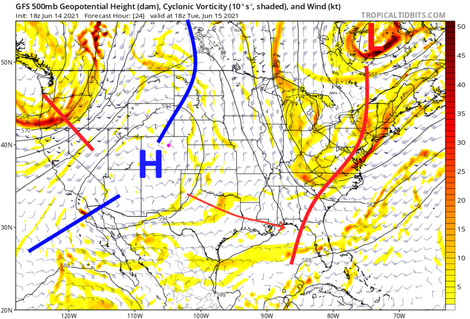 Figure 1: the 500mb upper air forecast map for Tuesday noon from the GFS and tropicaltidbits.com
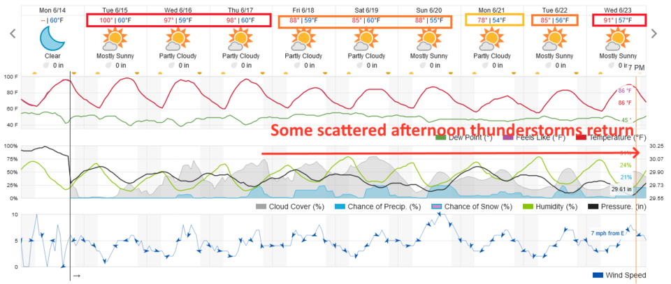 Figure 2: the 10 day graphical forecast from weatherunderground.com for Longmont, CO.
The Longer-Range Forecast:
The high center and ridge retreat to the west allowing us to cool a bit Friday into the weekend (Figure 3). With a bit of cool air aloft and moisture below, we might see a stray afternoon thunderstorm return now and then (Figure 2 as well). Rainfall amounts will be spotty over the next five days. It 'is' possible we could top a quarter-inch of rain from a thunderstorm hit or two. Cross your fingers!
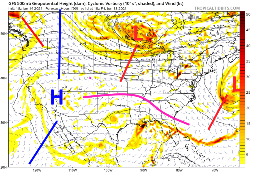 Figure 3: the 500mb upper air forecast map for Friday noon from the GFS and tropicaltidbits.com
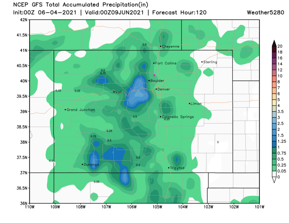 Figure 4: the 10 day precipitation total from the GFS and weather5280.com


