In Brief:
Smoke and near record heat continue until moisture and north winds cool us to just-above-normal Wednesday when some smoky storm chances return.Forecast Discussion:
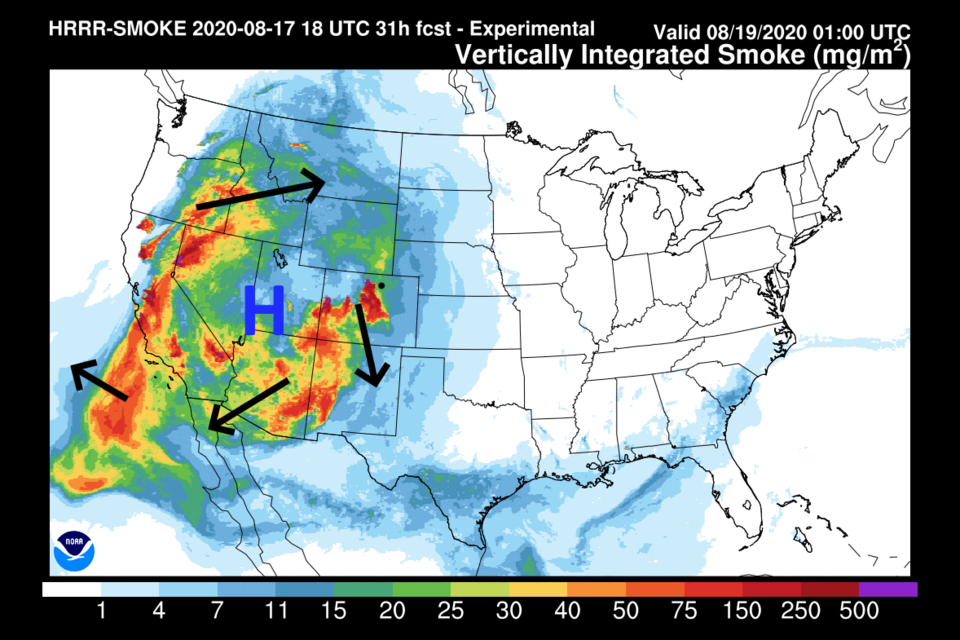
More heat. More smoke. The high-pressure center in the West is dominating the weather for most of the country. It is cycling smoke in a clockwise gyre, pulling around the afternoon pulses of smoke from the afternoon fire flare-ups (Figure 1 and Figure 2). Even with north winds over Colorado (black arrow in Figure 3), the high is so large that we are still pushing close to 100F (Figure 8). The nation west of the Kansas/Colorado border is experiencing much above normal temperatures (red coloration Figure 4). Further east, the nation is actually below normal.
By Wednesday, enough moisture gets pulled around the high, that storm chances finally return and temperatures drop just a bit (Figure 5 and Figure 8).
The Longer Range Forecast:
By Friday, the pattern is almost identical to what we have now with north winds still flowing across the state (Figure 6) and the high center wobbling towards us. Over the next 5 days, we might get a splash of rain with lucky spots in the central mountains getting more than 1 inch (Figure 7). Except for Friday, when the high drifts back over Colorado, again, suppressing thunderstorms and pushing temperatures to near 100F, afternoon thunderstorms become a small possibility everyday (Figure 8).
By Sunday the high has drifted back to Colorado, yet again, taking us over 95F (give it a break high-pressure system!! Figure 9). The above-normal heat over the state is remarkable (Figure 10).
In the DISTANT future - Friday next week - there is a chance that a big trough will finally displace the high (Figure 11) bringing cool air into the West (Figure 12). Fingers crossed.


