In Brief:
A summer ridge is in place brining the hottest weather we see in Colorado and no rain for a while.
Update 7/11 3pm:
The heat rolls on, but a surface low and a weak cool front will be drawing in some fairly good moisture (Figure 1 update in the gallery above). There is plenty of heat - and that spells severe weather! Storms will be somewhat widely separated but may produce severe weather - hail and high winds - almost back to I-25 on Sunday (Figure 2 update). Stay cool and safe out there.
Tuesday does look interesting with our passing short wave. We may cool to the 80'sF and see severe weather again. More later!
End 71/1 3pm update.
Forecast Discussion:
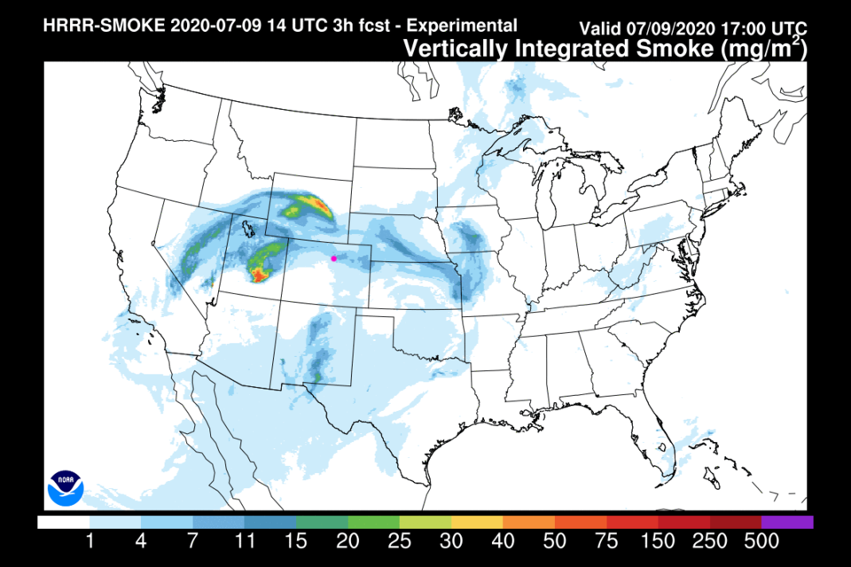
There is a new fire in Utah. Winds from the west are bringing smoke and particulates our way (Figure 1 in the gallery above). The NWS has issued air quality alerts because of this. You can see the big blue H for the surface high in Figure 2 and the big upper level ridge with its blue H in Figure 3. That spells heat. In the water vapor satellite image (Figure 4), the red and pink colors are bone dry air. The storms in Kansas/Oklahoma are powered by northwest flow way over there.
Little will change in the near term. We should see 102F to maybe 104F Friday. We are in record heat territory. Hotter locations will occur out on the Plains. Wowzie. We'll have to check in on the drought index map soon.
The Longer Range Forecast:
We keep hovering around 100F through Tuesday next week (Figure 5). There is a trough that will begin to nudge the ridge eastward Tuesday/Wednesday next week. That will cool us to the mid 90'sF (oh boy, whoopee - Figure 6). By next Friday, the ridge will stretch from coast to coast but the center will have moved to Tennessee. We will have strong southwest flow that will create down slope flow (= heating the air). Next Friday will be another near record hot day (Figure 7). We do remain dry for the next 5 days (Figure 8).
Note, I'm still getting a bit of vacation//relaxation time in this Independence Day week. I'm publishing every 3 days temporarily.
The Video Forecast for this Week.


