In Brief:
The high pressure center aloft to our east will slowly position itself in a way that will pump copious amounts of atmospheric moisture into Colorado - Monsoon!
Forecast Discussion:
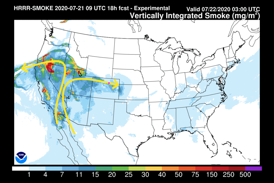
We'll start this time with the cause of the haze and air quality alerts. Figure 1 shows the mid-level wind flow that is spreading smoke from Western fires around (Figure 1 in the gallery above). This won't change too much in the short term - just stay inside if you have respiratory problems.
The real story is the "fire hose" of moisture that will begin to pump into our state over the next few days and beyond. The upper level map from Wednesday shows two pathways for moisture from the Pacific (into western Colorado counties - Figure 2) and from the Gulf of Mexico (into the central mountains - green arrows). The ridge over the state is responsible for the last few days of upper 90'sF weather (blue line).
There is also an "easterly wave" in the Gulf that will send a surge of moisture our way over the weekend even if it doesn't become a (briefly) named storm before landfall. Figure 3 is this same weather situation but with the water vapor satellite image showing very moist air streaming into the west. This is known as the North American monsoon.
At the start of this forecast, we will still have 90'F highs and only afternoon storm chances (Figure 5).
The Longer Range Forecast:
By Friday, that easterly wave/tropical circulation (unnamed as I write this) is approaching the Texas coast. (If nothing else forms first and it does get a name, it will be Hanna). That moisture will get pulled into Colorado by Sunday/Monday. This would lead to a cooler and very humid/stormy period Sunday through Tuesday (Figure 5). The high center sitting over Kansas City is well placed to send moisture into the Four Corners area (Figure 6). Green shading in Figure 7 is above average amounts of atmospheric moisture. The green arrows show this same transport avenue.
Something to keep an eye on is the eventual fate of the (currently Tropical Storm) Gonzalo. It should become a hurricane for a while then is expected to get battered by strong dry winds rocketing across the Atlantic from Africa. The very long range GFS ensemble paths show it coming ashore (as a storm or just moisture) very similar to the blob of unnamed moisture moving in this weekend. If the ridge is in a similar position, some of that moisture would wind up in Colorado as well later next week. Cooler and wet relief is on its way.


